
21 September 2013 at 6:17 am
#8862
News from NASA:
Includes:
Quote:
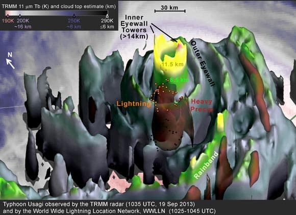
The radar on the Tropical Rainfall Measuring Mission (TRMM) satellite captured an image of Supertyphoon Usagi near the end of a 24-hour period in which Usagi intensified by 65 knots. This is more than twice the commonly used 30-knot threshold for defining rapid intensification.
The TRMM data was used to create a 3-D image. The data was collected at 1035 UTC/6:35 a.m. EDT on Thursday, September 19, 2013, when Usagi was at category 3 on the Saffir-Simpson hurricane intensity scale. A few hours later, Usagi completed its lightning-fast intensification to category 5, the highest category in the scale.
but few tropical cyclones have such symmetric eyewalls as does Supertyphoon Usagi in the TRMM 3-D image.
NASA Sees Super-rapid Intensification of Supertyphoon Usagi