
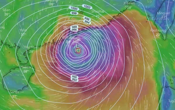
Forecasts still consistent; the best model from ECMWF v similar; here for 10am Sunday. Pressure of 931mbar is lower than for HK’s strongest storm on record, Typhoon Wanda of 1962
“Wildcard” will surely be interaction with Luzon; will it pass just to north, or slam into the island with its mountains????
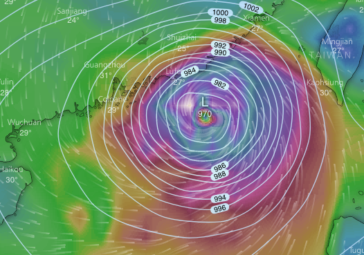
GFS model; much the same track, but pressure 970mbar, significantly higher than from ECMWF so less intense storm [still not to be trifled with]
Joint Typhoon Warning Center mentions 24 nautical mile [44km] wide eye; mentions landfall south of Hong Kong [well, see about that – will it wind up nearer Hainan, say?]
Eye easily seen here; a startling looking storm; ranking category 5 on hurricane scale, super typhoon

And here, some tracks from a few models [spaghetti]; southern one is COTC, a US navy model that’s generally not too accurate
Looking for info on this model, I found this handy article – notes that not all models are created equal by any means

Article just linked to advises looking at ensembles – products of slightly different “runs” – for good models like ECMWF. So here’s one; and it’s not bang up to date, just helps show what forecasts we see are based on [which here should include ideas of how storm will interact with Luzon]
