
- This topic has 3 replies, 2 voices, and was last updated 15 years, 10 months ago by
 DocMartin Williams.
- AuthorPosts
- 24 June 2008 at 10:20 am #7130
Severe Tropical Storm Fengshen – which had hit Philippines as a typhoon, killing several hundred people (mainly in ferry that sank) – was forecast to head towards Taiwan. But now, looks to be coming roughly straight for Hong Kong. HK Observatory has issued Number Three signal. Latest forecast includes:
Quote:At 6 p.m., Severe Tropical Storm Fengshen was estimated to be about 170 kilometres south-southeast of Hong Kong (near 21.0 degrees north 115.0 degrees east) and is forecast to move north or north-northwest at about 16 kilometres per hour in the general direction of the Pearl River Estuary.– at this speed, should be closest around 5am tomorrow morning, so could be a wet and wild start to the day; and, indeed, a wet and wild day overall. Plenty more rain likely, for waterfall fans!
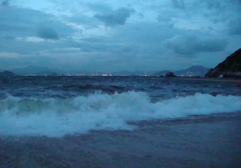
24 June 2008 at 1:52 pm #8158A couple of shots here from Cheung Chau a little after 7pm this eve; wind only just blowing, some surf rolling in as result of winds at sea – but far worse set to come, with Number 8 expected around 11pm – so in an hour or so, as I post this.
It’s windiy here on Cheung Chau; but as yet, not raining. HK Observatory weather radr shows intense rain just a little to south of HK; so soon, liable to become a real dark n stormy night.’

 25 June 2008 at 3:36 am #8159
For past 4 days I have been following the forecast of the track for FengShen and they have been consistant, they always reported it has been moving NW but it is going to recurve NE right now. Sunday they were showing the track east of Taiwan, then over Taiwan , the through the straits , eastern Guangdong, until yesterday afternoon. By then it seems they accepted this was not going to recurve – just keep going Nw – or NNW towards HK. This was not just HKO – all four agencies – China, Japan, US & HK all had similar forecasts. And all wrong . So there is still plenty to learn about what steers tropical revolving storms ? My own superficial observation has been that what ever steers them tends to be consistant for a period of months, each years storms tend to follow the same track. In recent years roughly 4 storms a year have crossed northern Taiwan and landed on the Zhejiang coast. ( I notice as I rely on some factories there) In 1999 3 storms in 2 weeks passed over HK, we were living on a boat and my 9 yo boy looked up from breakfast and asked if this was another ‘Eye’ – something expected once in a lifetime became briefly commonplace. But I think I saw it again today – I woke about 5:45 and there was a very strange orange glow to the clouds and no wind or rain – in Sheungwan. I think the colour was the sunrise through thinner cloud because within 15 minutes it was much darker and a purple hue, 20 gusting 30kts and heavy rain.
25 June 2008 at 8:02 am #8160Here on Cheung Chau, I was woken around 6, by noise of wind n rain – no glow in the sky at all, just dark and very windy.
I’ve seen some very impressive forecasts of tropical storm tracks; but here, indeed proved well wide of the mark – I’d also seen re Fengshen forecast to head up eastern Philippines, and onwards to north.
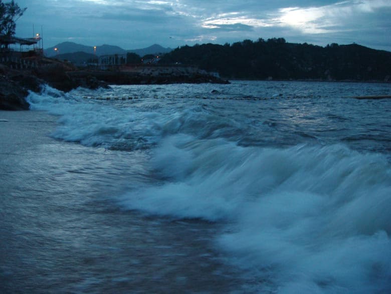
I also have an impression that successive storms can follow similar paths; will be interesting to see if happens again this time Here’s shot from our place, around 6am
 Here, from southern Cheung Chau, mid morning.
[video:http://www.youtube.com/watch?v=WHxptqmiNek%5D
Here’s some video, showing Cheung Chau beach as Fengshen approached on 24th; then wind n rain soon after dawn on 25th, soon after the centre of the storm passed roughly over Cheung Chau, and surf in inlet along southern Cheung Chau mid-morning on 25th. - AuthorPosts
 Here’s shot from our place, around 6am
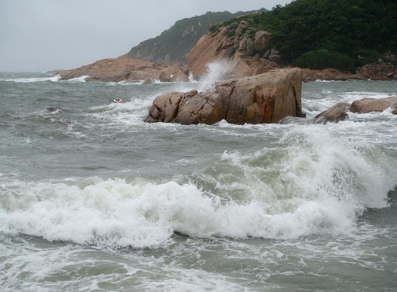 Here, from southern Cheung Chau, mid morning.
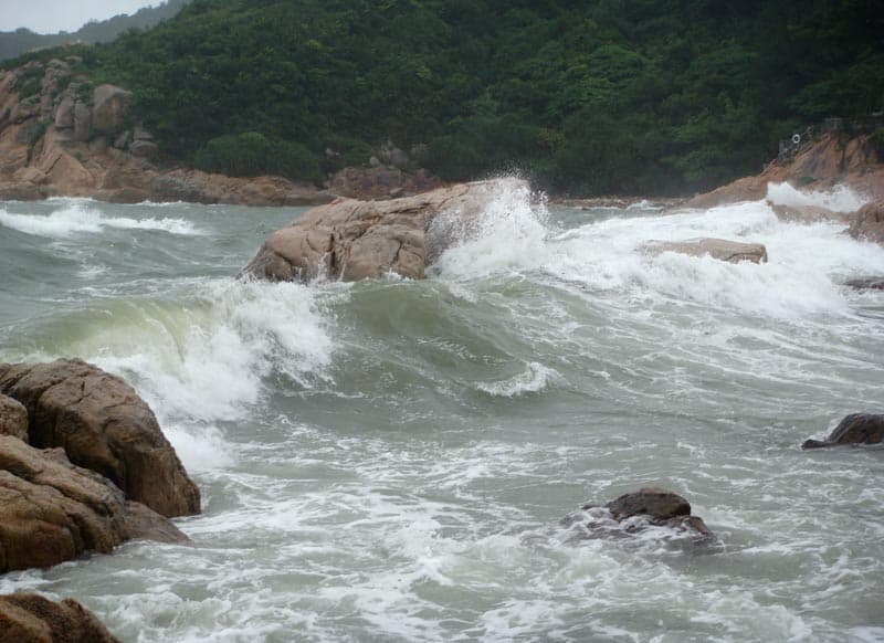
- You must be logged in to reply to this topic.