
- This topic has 1 reply, 1 voice, and was last updated 7 years, 6 months ago by
 DocMartin Williams.
- AuthorPosts
- 16 October 2016 at 3:23 am #7473
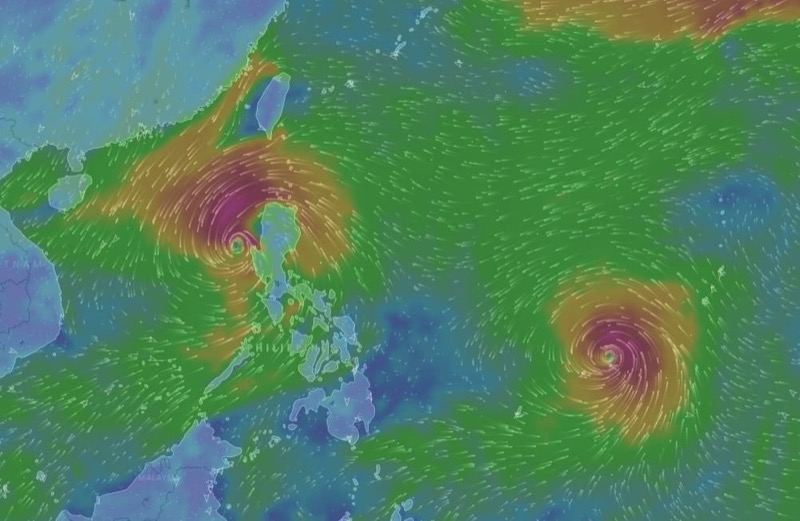
Got typhoon double trouble for the South China Sea this week.
Update 18 October, morning. Still T3 signal in effect, as Sarika making landfall over Hainan.
Typhoon Haima is still to east of Luzon. Forecast tracks have broadly shifted landfall on China coast westwards a little, nearer to Hong Kong. ECMWF – the best computer model for storms – seems to have become settled on landfall over east Hong Kong. Still likely to change, but could be impacts for Hong Kong.
Below are two images, indicating potential landfalls. If well to east of HK; not much to happen here. While if over Sai Kung area, as ECMWF, would be direct hit.
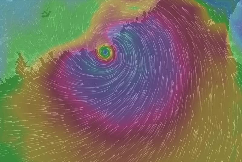
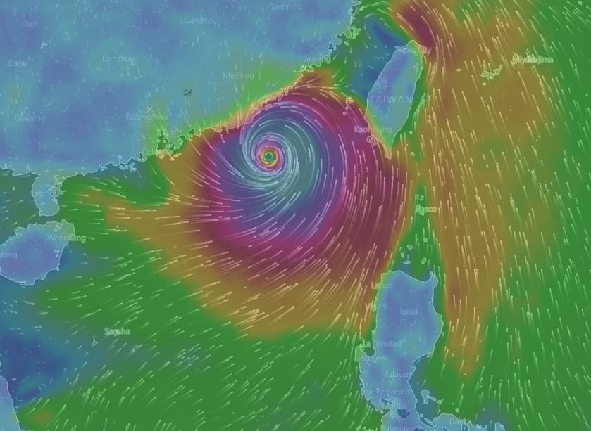
GFS, via windyty, for 8pm 21 Oct:

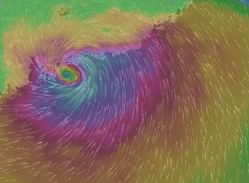
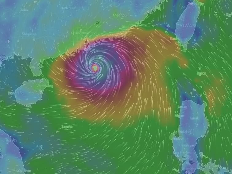
By ECMWF, for 3pm 21 Oct:

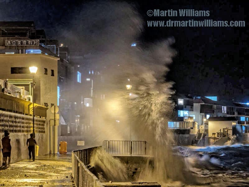
While here’s a shot from Cheung Chau last night, waves from Typhoon Sarika pounding east coast:

[video:https://www.youtube.com/watch?v=fizZe3WlhFg%5D
Update 17 Oct: T3 signal now up as Sarika passes to south of Hong Kong; strong winds, nearing gale force for Wagland Island. Likely to get rather stronger, and with squally showers.
Even as Sarika passes, Haima looms to east of Philippines: still looking set to become super typhoon, pass north Luzon; and then may head north towards Taiwan and beyond, but seems more likely to be landfall in southeast China, possibly very near Hong Kong.
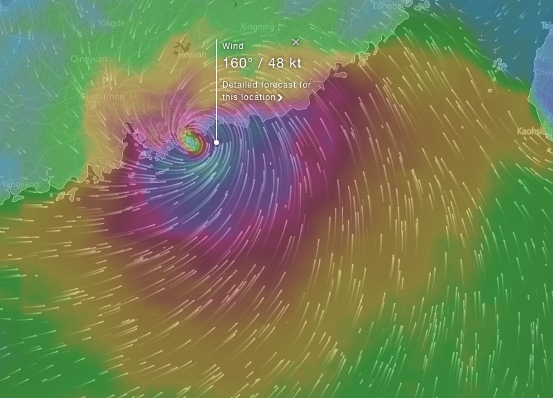
ECMWF is best computer model; here’s a forecast for 21 October, via windyty:

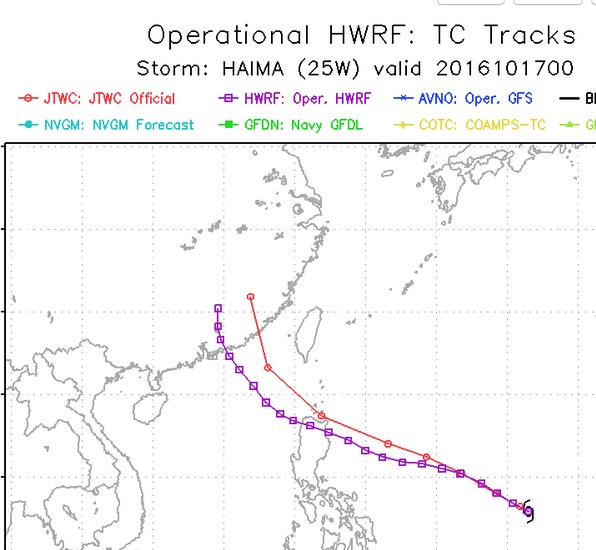
And here are tracks on HWRF [Hurricane Weather Research and Forecasting Systems] website:

Original post:

Typhoon Sarika has just passed over Luzon; forecast to head around west-northwest towards Hainan. Likely to bring windy weather with rain to Hong Kong, chiefly on 18 October.
Hot on its heels comes Haima, which is forecast to become typhoon, severe typhoon and super typhoon [strongest; around Cat 4 hurricane strength], and to head towards north Luzon.
Seems pretty good agreement in forecasts to n Luzon. May well then carry on to South China Sea.
A curve towards north is then likely, and much will depend on just where this curve starts – may take it to coast around eastern Guangdong/Fujien: no big deal for HK, but hitting area already impacted by typhoons this season:

Or, as in current ECMWF forecast model, as below, could be very close to Hong Kong:

So, direct hit possible, though late in season; and Li’s Field has been effective for years… [joke idea that Li Ka-shing puts out typhoon deflecting shield so HK can keep working!]
These images from windyty: https://www.windytv.com/?22.283,114.150,6
17 October 2016 at 1:51 am #8918Just seen post in Weather Underground forum, showing Typhoon Dot had a track much as one of the forecasts for Haima – across n Luzon, then on to eventually curve north and hit Hong Kong [landfall just to east it appears]
Track here:
http://agora.ex.nii.ac.jp/digital-typhoon/summary/wnp/l/196424.html.en
And here’s a photo from height of the storm, with wave smacking over Kennedy Town waterfront:
http://www.hko.gov.hk/education/cyber_met_exh_hall/display02_dot.htm
- AuthorPosts
- You must be logged in to reply to this topic.