While it can be fun to hike up and over hills, there are times when it seems best to start from a place that’s well above sea level – particularly when the summer heat has arrived. One of the best such starting points for a hill walk is Ngong Ping, an upland basin on Lantau.
You can head to Ngong Ping by taking one of the most scenic bus rides in Hong Kong – from either Mui Wo or Tung Chung, with views of hillsides, shorelines, and Lantau Peak soaring above Shek Pik Reservoir. The buses stop beside Ngong Ping Village, a supposed tourist attraction that’s best avoided if you’re aiming for an authentic Lantau experience.
Less than five minutes’ walk beyond the bus stop, you reach a plaza below the Big Buddha. From here, there’s a footpath through the former Tea Gardens.
A tea plantation was established here in 1947, by British lawyer and philanthropist Brook Bernacchi. It produced Hong Kong’s only locally grown tea, sold as Lotus Brand. Sadly, the tea gardens business is now defunct, and you pass a cluster of abandoned buildings amidst woodland that has mostly reclaimed the plantation.
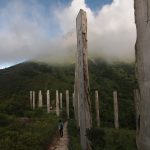
Reaching the edge of the wood, you might turn right to the Wisdom Path, and wonder if it really was wise to import the trunks of 38 trees from Africa, to carve Buddhist scripture on them, and array them, starkly upright, on a patch of cleared ground. Just above, a hilltop affords marvellous views across Shek Pik Reservoir to the hills of southwest Lantau.
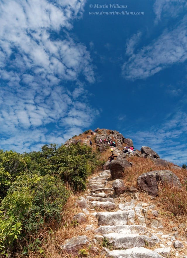
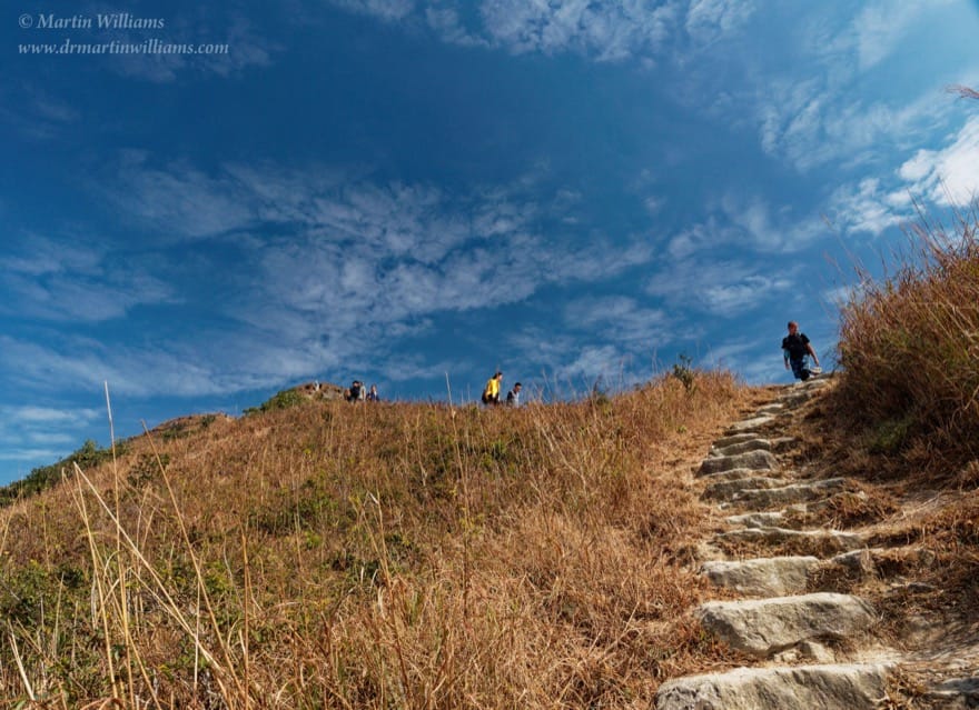
If it’s a clear day, Lantau Peak is a more impressive viewpoint, but getting to the top requires far more effort. The main route follows section 3 of the Lantau Trail, which you can start beside Wisdom Path. It’s easy going at first, with occasional flights of stone steps as it curls up and around the hillside. But soon, there’s a more intense workout, as uneven flights of steps lead up the steep west face of Lantau Peak.
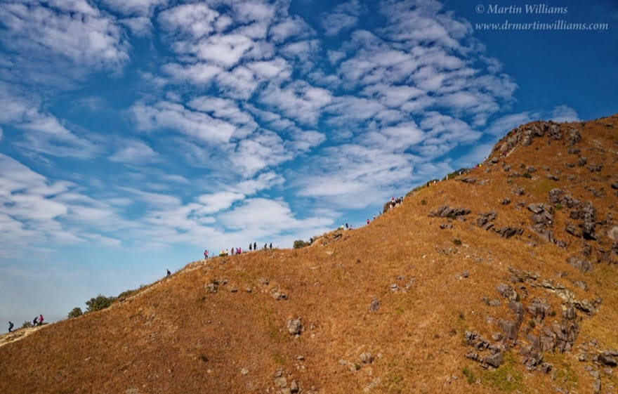
Happily, there’s regenerating woodland here, affording some shade from the sun. In places, you might look back through gaps in the trees, to see Ngong Ping gradually receding below. At last, there’s the final stretch up this slope, and the path emerges from trees to reach a ridge leading roughly southwest from the summit of Lantau Peak.
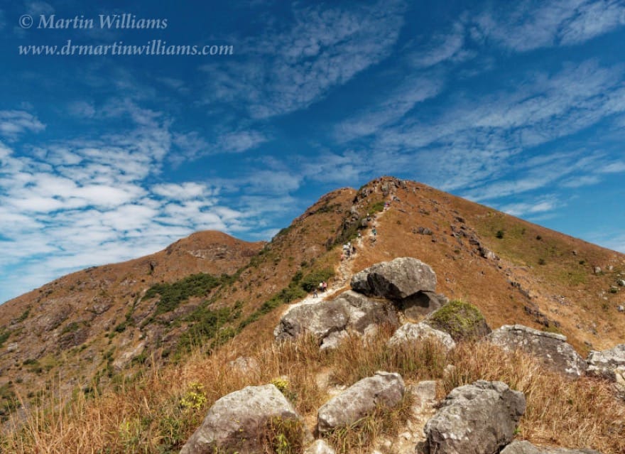
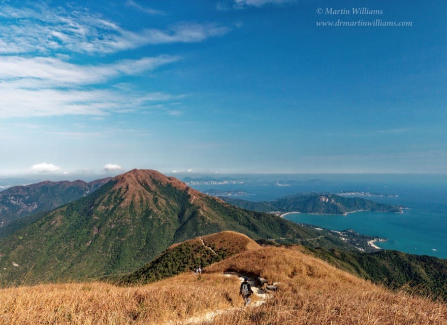
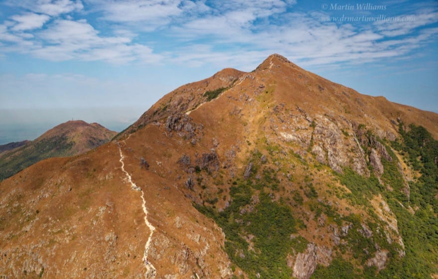
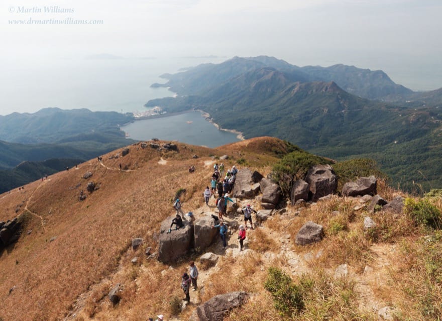
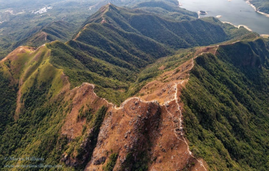
The trail heads up the ridge to the left, but first perhaps turn right, to a crag known as Bird Rock. This is a grand place to catch your breath, and admire the wild Lantau uplands. The nearby slopes are grassy, dotted with boulders, and you can look down to the famous – or infamous – West Dog’s Tooth and Middle Dog’s Tooth ridges, which meet at a sharp spur on the flank of Lantau Peak. These are favourites with people seeking a more adventurous way to the top, yet have also been the scene of accidents, including at least one hiker suffering a fatal fall.
After a pause at Bird Rock, onwards; the summit awaits! There are more boulder steps, but the going is easier than climbing the steep slope. The summit itself isn’t spectacular, just a hilltop with a jumble of large rocks, and a low stone hut where you might shelter if the weather turns nasty. But you’ve reached an altitude of 934 metres, just 23 metres below Hong Kong’s highest point, atop Tai Mo Shan.
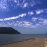
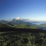
When the air is clear, you can look west across the Pearl River Mouth to Zhuhai and Macau, north to Shenzhen, and east to Hong Kong Island. From here, the buildings appear small; rugged hills rather than urban areas dominate the views, notably the imposing form of Sunset Peak that blocks Kowloon from sight. Southwards, islets including the Sokos dot the South China Sea.
The Lantau Trail now drops down to the east. There are more flights of rock steps, interspersed with gentler stretches with soil and small stones underfoot. This seems a wild landscape, with grassy hillsides enabling expansive views that are increasingly dominated by Sunset Peak as you descend. After crossing a relatively level area, the trail winds down through a belt of trees, and arrives at Pak Kung Au, a pass between Lantau and Sunset peaks.
If you’d prefer an easier hike, Ngong Ping offers several possibilities.
One Tree Trail and Three Country Trails
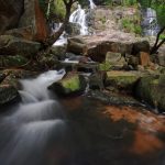
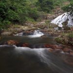
One is the 5.5 km Shek Pik Country Trail, which starts by the Wisdom Path, wends its way down the southern slope of Lantau Peak, and ends at South Lantau Road. It’s a pleasant, woodland trail and, before reaching the road, crosses a stream with attractive cascades, making it a welcome place to rest and cool down during summer hikes.
For other options, head north from the Wisdom Path, along Ngong Ping Tree Trail. This gentle path passes trees that are still scrawny youngsters, requiring decades to reach sizes akin to the trees of primary forests clothing much of Hong Kong before man arrived. Signs in front of them give species names, along with snippets of information.
It should take only around ten minutes to reach the tree trail’s end, at a narrow concrete road. Turn right, and you can soon exit Ngong Ping by a path to Tung Chung.
Rather than dashing off, look for a rough path up the hillside in front of you. A short, easy climb brings you to another junction, with the Nei Lak Shan Country Trail. This makes a circuit of Nei Lak Shan, almost hugging the 500-metre contour, and offering contrasting views to east and west.
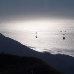
Along the east slope of the hill, the country trail overlooks Tung Chung and the airport, and in places tunnels through dense woods. It curls round the northern slope, passing below a stretch of the Ngong Ping cable car, and meets a path down to the cable car station. Along the west slope, the country trail affords fine views including nearby Po Lin Monastery.
Walk roughly 5km along the trail, and you’ll come full circle, all set for the walk towards Tung Chung.
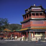
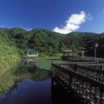
The path angles down a slope with more woodland, but no steps – not yet, anyway. It arrives at Tei Tong Tsai, where there’s a loose grouping of a couple of Buddhist temples plus a monastery, which seem far better suited to a life of contemplation than the modern-day tourist magnet of Po Lin.
Beyond here, the path becomes steeper, with flights of concrete steps, as it continues on to the hamlet of Shek Mun Kap, 2km from Tung Chung town centre.
There’s an alternative to this trail, too. Just after Tei Tong Tsai, look for a signpost on the right, indicating the Tei Tong Tsai Country Trail. Rather than dropping to the valley below, this heads up through trees, then winds gently along the hillside towards the pass at Pak Kung Au. Even when nearby routes can be thronging with people out to escape the city’s confines, you might encounter few hikers along this trail, and can enjoy the sort of tranquillity that led to so many monasteries being established on Lantau, it was dubbed the Island of Prayer.
Travel tips
Ngong Ping is served by bus 23 from Tung Chung and bus 2 from Mui Wo. While it might be tempting to finish a hike here, note that many people are heading for the hills nowadays, and there might be longer queues for less frequent transport here than at places such as Pak Kung Au and Shek Mun Kap.