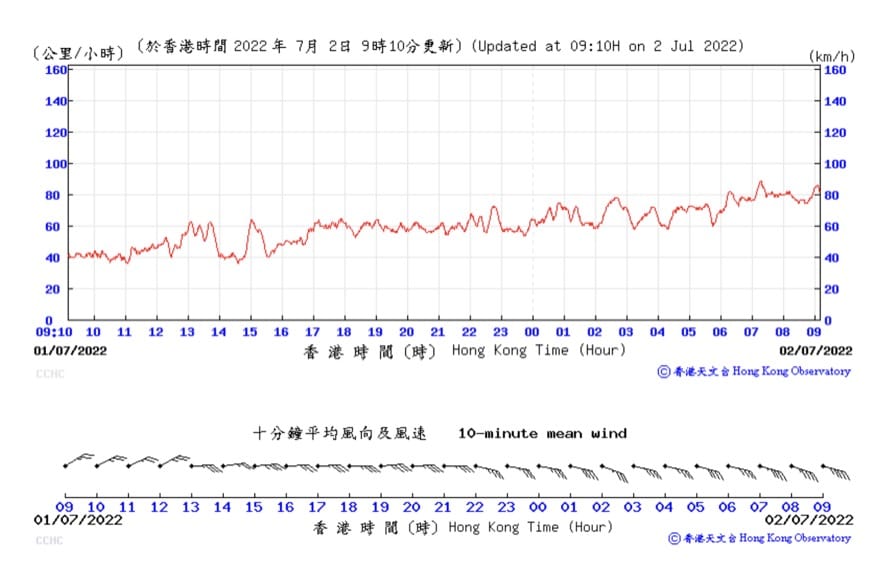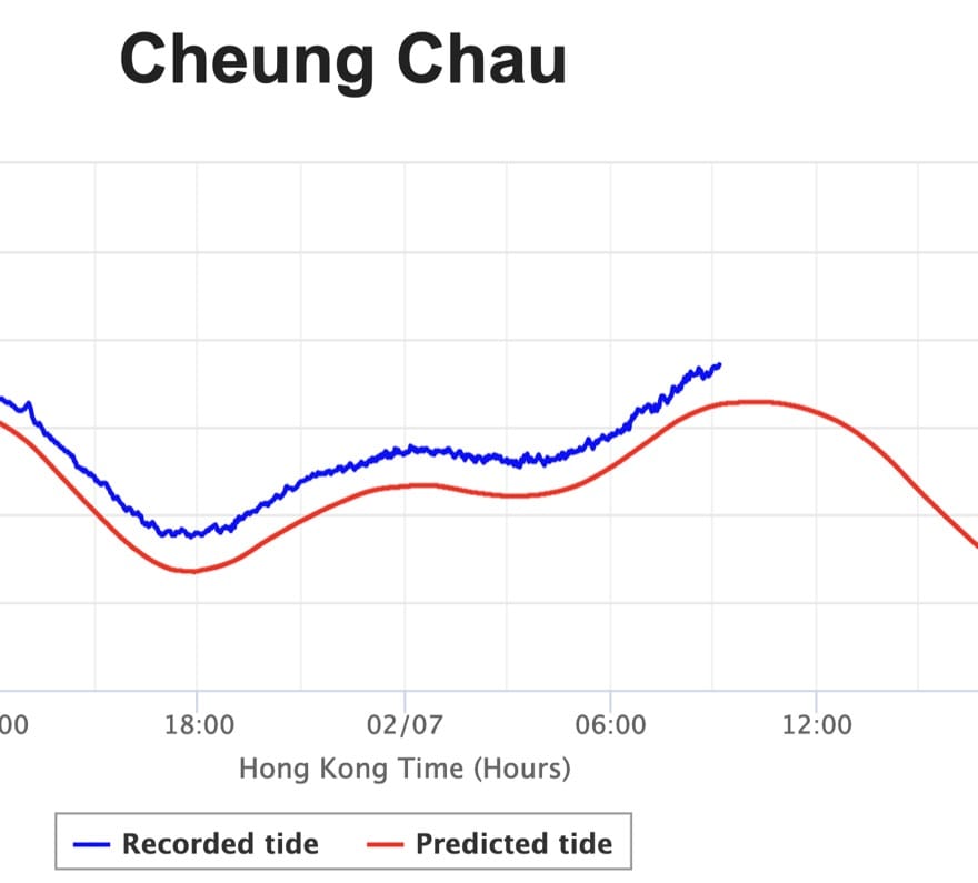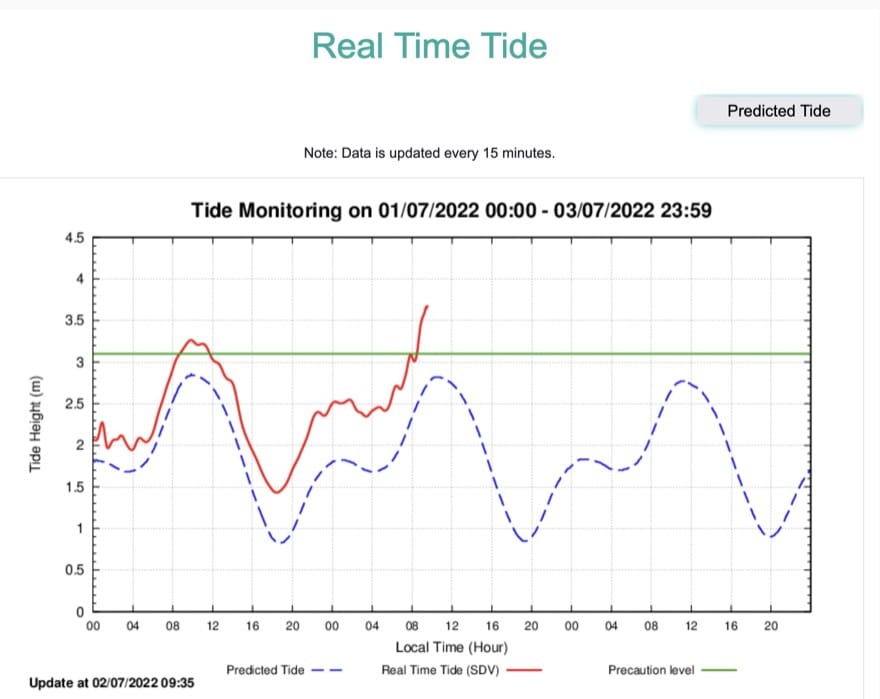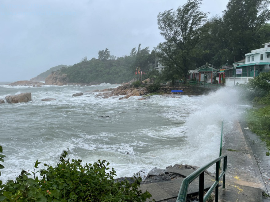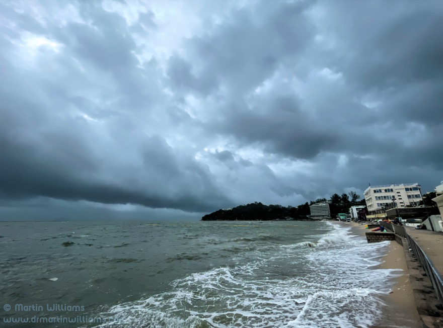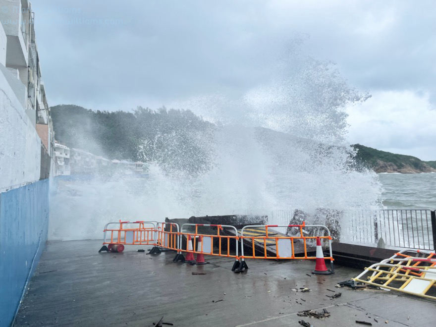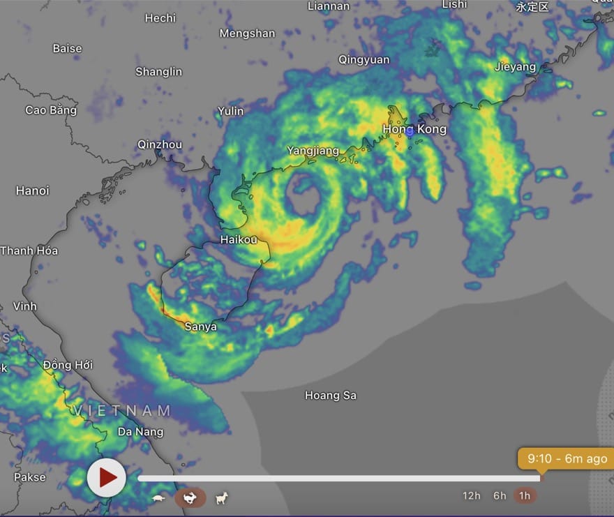
Chaba has recently intensified to typhoon strength. Has a large eye on radar images, with rainbands across wide area – inc passing over Hong Kong (though rain here not so intense just now).
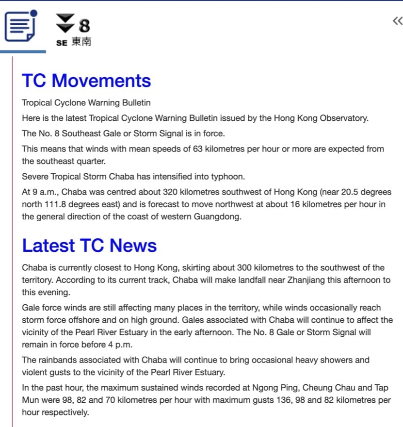
The track is not as much to northwest as had been forecast, so rather closer to Hong Kong than anticipated yesterday. Hence, T8 signal will be in effect for much of today.