
 Hong Kong is a marvellous place for hiking, thanks to its splendid setting.
Hong Kong is a marvellous place for hiking, thanks to its splendid setting.
]If you know Hong Kong only as a metropolis of concrete canyons and neon signs, the notion of hiking here might seem as ludicrous as clubbing at the North Pole or skiing in the Sahara. And yet, Hong Kong is a marvellous place for hiking.
Hong Kong’s setting is the key to this: the city lies in a territory that’s around three-quarters countryside, with rugged hills, islands and islets. Chunks of land are protected in country parks and special areas, and there are superbly maintained trails, ranging from gentle family walks to tough, long-distance hiking trails.
Add various guidebooks and maps and the excellent public transport system, and your only problem might be: where should I start?
Hong Kong hiking
The variety of trails and landscapes leads to a host of options for hiking in Hong Kong. Good routes are possible almost anywhere outside the main city and towns – I’ve only struggled to find something interesting in the northwest New Territories. Perhaps surprisingly, Hong Kong Island boasts some of the best trails, which are especially good for anyone wanting to give hiking a try.
Note, however, that you should ensure the weather is okay for tramping about. When it’s not raining, that’s usually the case from late autumn to early spring. But in summer, hiking is tough in Hong Kong, and if you do head out you should take it easy, and drink fluid by the litre, perhaps mixing sports drink and water so your salt levels don’t plummet. Also in summer, be leery of deluges, which can cause flash floods that can make streams and gullies dangerous.
Hong Kong Island: the Peak, Mount Butler, and Dragon’s Back
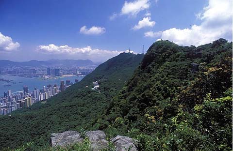
The Upper Peak Tram Station is a fine starting point for introductory routes. For anyone who hasn’t walked it yet, I reckon the circuit of the Peak along Lugard and Harlech roads is a must, starting with magnificent views of the city, then revealing the flip side of the island, as greenery and reservoirs dominate. Level all the way, it barely qualifies as a hike—but you can go a little wilder, by taking a small path from behind a tiny park where Lugard Road gives way to Harlech. After tunnelling through trees, this climbs High West, a surprisingly raw summit that looks across to islands including Lantau.
Opposite the station car park, you can drop down Pokfulam Reservoir Road, which is effectively closed to traffic. It promptly plunges into dense woodland, emerges onto scrubby hillside facing High West, and meets a handful of trails. One is the Hong Kong Trail – follow it eastwards, and you keep to the hillside, and arrive at a bluff with Aberdeen set out below. Down from here, you could turn off to Aberdeen, leaving the Hong Kong Trail to continue through the heart of the island.
For a harder, more spectacular hike, aim first for Parkview. Don’t dally by the monster, but start up the steps where the Wilson and Hong Kong trails run together. Unless you’re superfit, your heart will soon be pounding away as you keep on, up to the top of Jardine’s Lookout.
One benefit of the climb is soon apparent: Parkview is receding but, sadly, not crumbling just yet. More importantly, there’s a grand landscape of rolling hills laid out before you. Walk a very short path, and – Bam! – there’s a birds-eye view of Victoria Harbour and surrounding city.
Continue along the Hong Kong Trail, and you’ll soon reach the top of Mount Butler. This is another of those classic HK viewpoints, which are at once close by the city, and yet apart from it. Again, there are harbour and city on one side, hills on the other, with the lovely Tai Tam reservoirs low in a valley.
The Hong Kong Trail fairly tumbles off Mount Butler, then meanders down past the reservoirs. For me, that’s usually quite enough hiking for the day, thank you very much, and I like to catch a bus to Stanley for a meal with a beer or two. I’ve walked the next section of the HK Trail, but if you ask me it’s boring.
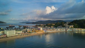
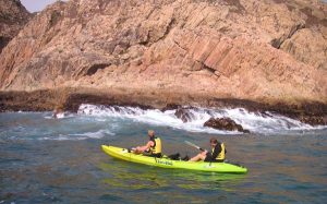
The following section – along Dragon’s Back – is, though, one of the top ridge walks in Hong Kong. You can walk it from north to south, passing first through woodland, then up to the spine of the dragon, where the vegetation is low and there are panoramic views of southern Hong Kong Island, the Clearwater Bay Peninsula, and islands to the south and east. Dropping down to Shek O Road, perhaps catch a bus to Shek O, to stroll along the headland and onto the islet across the footbridge – where in easterly winds you can enjoy surf pounding the rocky shoreline, and unwind after all your exertions in one of the restaurants.
“Exertions? What exertions?” hardcore hikers may be asking at this point. “You call Dragon’s Back a hike?” Now, I’ve taken a few people who’ve shuffled off Dragon’s Back red-faced and short of breath. But none were hardened hikers, to whom these Hong Kong Island hikes may be little more than modest strolls. And unless it’s summer, Hong Kong Island is not the place for challenging routes other than, say, trekking non-stop from the Peak to Shek O.
For more testing trails, you must head for the New Territories, or Lantau Island. And if you’ve a yen for wild summits overlooking city and country, head first for Lion Rock.
The New Territories: Lion Rock, Ma On Shan, and Tai Long Wan
You can approach Lion Rock by following the Maclehose Trail from close to the Kowloon Reservoirs. This trail has a fondness for switchbacking between hilltops and, sure enough, it isn’t long before it takes you up onto Beacon Hill, then along a ridge. But Lion Rock is too steep for even the Maclehose Trail, and you have to take a side path to climb it. A sign pointing the way says the top is just 400 metres away – but doesn’t mention that these could be the longest 400 metres you’ll ever encounter.
Once at the top, you’ll find yourself perched atop a huge crag that drops sheer away from you to the south. There’s Kowloon below, and beyond the harbour are hills including the Peak and Mount Butler on Hong Kong Island. To the north is Sha Tin; to the west lies Tai Mo Shan; and Ma On Shan could be just visible to the east.
Ma On Shan is an even better hill to climb than Lion Rock. It’s tougher, too, but I reckon this helps make the summit a more satisfying place to reach. I’ve hiked it from the east, again following the Maclehose Trail to get close before taking a side track to the top. Although nowadays not so impressive when viewed from across Tolo Harbour, thanks to the new town at its foot, Ma On Shan looks dramatic and imposing when approached this way. The east slopes are steep, and capped by a great fist of volcanic rock that seems like a natural fortress.
Hiking the side track, you find that this fortress is not so daunting from close to, and a little scrambling is all you need to reach the summit. On a clear day, you can see across great swathes of Hong Kong from here—face south and then turn clockwise, and you’ll see Dragon’s Back and the north shore of Hong Kong Island, a panorama sweeping north past Tai Mo Shan, hills in Shenzhen and, westwards, hills in the Sai Kung Peninsula.
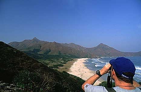
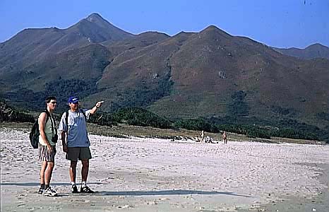
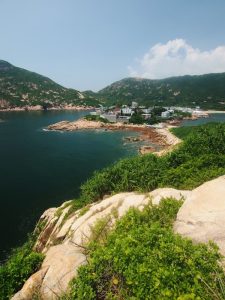
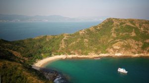
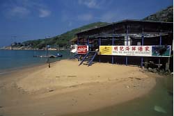
Though its hills are lower and never as dramatic as Ma On Shan, the Sai Kung Peninsula also offers excellent hiking. One of the best short routes in Hong Kong is here: the walk from Chek Keng up and over to the beautiful Tai Long Wan, with its white, sandy beaches backed by abandoned fields and ringed by hills.
Two somewhat ramshackle restaurants overlooking one of the beaches are favourites with hikers; from close by one of them, a short trail leads to the best beach, Tai Wan.
On hot days, it’s perhaps sufficient to walk to Tai Long Wan, relax there, and return to Chek Keng. But in more comfortable weather, you could head south, and cross over a blunt peninsula to Sai Wan in the next bay, then head up to the service road above High Island Reservoir. From here, turn onto the Luk Wu Hiking Trail, which leads through a landscape reminiscent of British moorland before dropping down to a road near Pak Tam Chung.
Lantau Island
Away to the west, the southwestern corner of Lantau also boasts superb scenery, yet seems almost overlooked by hikers. A road along a water catchment offers an easy way into the area, but it’s all uphill – and downhill – hiking from the end of this. A track leads up to meet the Lantau Trail, where you can turn left to soon find Hong Kong’s chief folly, the garden landscaped in traditional Chinese style at Ng Yuen. It’s now closed to the public, but you can stand on the dam to look at the carp pond with its zigzag bridge and pavilion, as well as the various buildings, all built well away from any highways. On from here there’s another oddity – a flying dragon sculpture on a boulder above a small temple.
Then comes a surprisingly impressive ridge walk through one of Hong Kong’s wildest landscapes, with astonishing views when the air is clear – look hard enough, and you can just see the city clinging to the sides of Hong Kong Island, seemingly far, far away. The city isn’t far away of course; once you’ve tackled two or three sudden flights of steps, you can catch a bus towards home. But now you’ve hiked this trail or another like it, you know the city is not all there is to Hong Kong – and you can escape it whenever you wish.
See also my book, The 25 Best Day Walks in Hong Kong.


Thanks!
This is an awesome article. Thanks!
HIKING IN HONG KONG
I am presently planning a few walks in Hong Kong and Lantau during a forthcoming visit.
This is an enjoyable article with very welcome pointers as to where I should start researching.
Thank you, author.
AJW
Hiking in Hong-Kong. AJW
Great article. Will be in HK on the weekend of 14/2. Wouldn’t mind company for a few hikes sat & sun.
Regards,
Thomas
hiking groups
Hi Thomas:
Thanks!
Thread on hiking groups may help:
https://www.hkoutdoors.com/places-and-trails/scheduled-hikes-or-hiking-groups.html
– I’m yet to add HK Leisurely Hikes, a facebook group
Martin
Lantau trail
Contemplating doing the Lantau trail over a weekend. Is there anywhere to stay in Tai O?
Thanks
John
Not sure re accomm in Tai O
I don’t know of places to stay in Tai O.
Elsewhere on site, mentioned Fung Wong Holiday Bungalows in Shui Hau; might be worth considering
The peak to Shek O
My husband and I are coming to Hong Kong in March and we’d love to hike from the Peak to Shek O in one go. Do you know how long that is, how long it takes and whether we can do it in trail running shoes? (Trying to avoid packing heavy hiking boots.)
Thanks!
Lori from Chicago
Peak to Shek O n Hong Kong Trail
You could follow the Hong Kong Trail; 50km tho not sure re time needed. Plus a few km more, for Big Wave Bay to Shek O.
Trail running shoes should be fine.
Martin
The peak to Shek O
Greenpower has been organising fund-raising hiking competition on the Hong Kong Trail for well over 10 years. the winners can do it just around 4 hours. but those r the guys who cud do a full marathon in under 2.5hr. for me who cud only manage half-marathon at about the same time the winners finish full marathon, my best record for the 50km HK Trail was 8 hr 23 min, in which i only rested for about 20 min for lunch, and 2 other quick stops at checkpoints, and i ran on several flat stretches(stage2 & 7). so, if u've done any competitive sports, u can make ur own comparison based on the above info.
however, there r many detours from the HK trail. eg u can take Black's Link instead of stage 4, & go via Tai Tam Reservoir Rd instead of Stages 5 & 6. in so doing, it'll save u some 3 hours to reach Big Wave Bay. moreover, we don't hv 12 hours of sunlight in HK in early March. therefore, it may be better for u to trek in reverse direction, 'coz stage 8 Dragon's Back is really spectacular but can't be seen after sunset, whereas stage 1 at the Peak will allow u to admire our magnificent night scene.
u r invited to visit my HK Hiking Blog to see whether there r other destinations appealing to u, i'll be pleased to provide u with details.
Peak to Shek O
Thanks so much for your reply. I’m reading it right now at 5 a.m. Saturday after landing in Hong Kong earlier today from Chicago.
The weather report earlier in the week called for rain all weekend, but it looks like things might be taking a turn for the better. I can’t wait to get out there and do some hiking.
I think you’re right about 50K in one day being a bit ambitious…especially on a few hours of sleep. Will probably do Dragon’s Back and then save the Peak portion for Sunday.
Thanks again!!!
Lori
biking hong kong
hello ,someone can help me to find map biking in hong kong,thanks
Putting some numbers on time required for the HK trail
You could follow the Hong Kong Trail; 50km tho not sure re time needed. Plus a few km more, for Big Wave Bay to Shek O. I just did a big chunk of the trail, from the Peak shopping centre to To Tei Wan village (on the west coast of the D'Aguilar peninsula) in 5hrs 30mins. I took a few shortcuts: *instead of going all the way around Lugard road for stage 1, just go straight down Pokfulam reservoir road *instead of going up to the Wanchai gap and back down, just cut across the Aberdeen reservoir. *instead of trekking up to Jardine's Lookout and Mount Butler, just take the Tai Tam reservoir road. That was a FAST hike, close to a run at times, with almost no stops. My longest stop was about 15 minutes at the Shell service station at Hong Kong parkview to use their toilet and stock up on much needed choc bars and water. Although the building of Parkview was an outrage, it is actually a rather useful pitstop on a long hike. Watch out for aggressive guard dogs at To Tei Wan village. The Agriculture, Fisheries and Conservation dept website gives 41.5 km and 12hrs 15mins for the Peak to To Tei Wan without the shortcuts.
I reckon my shortcuts amounted to skipping most of stage 1, and stages 3 and 5, which makes the dept's official time 7 hours to cover 24 km. I think I probably did about 25km. So the complete time for the FULL trail with no shortcuts would be Official pace: 15 hours Fast winter pace: (50/25)*5.5 = 11 hours approx Bear in mind this was late December when Hong Kong was at its coolest. I still got through about 4 litres of water. At a warmer time of year you'd need more time and more water. 😉
I really recommend doing as much of the trail as possible in one day. The feeling you get for the island is quite different when you hike across it from if you just do individual trails in country parks. Now I really have a feeling for the lay of the land. Hope this helps put some numbers on the requirements of the trail. Joe
HK Trail (Peak to Big Wave Bay) and Lantau Trail
More timings on hk trail – I did this trail mid Jan 2011. Did the full 50k. Started at 7am and finished at 5:30pm, with 20 min stop for lunch. I have knee problems so not able to jog/run at all, and I take a lot longer going up steep accents than normal. Saying that, I pushed myself to fast walking on the flat parts. Trainers / walking shoes fine – no need for hiking boots.
Great suggestion from previous commenter to do this hike from Big Wave Bay and end at the Peak – agree that ending up seeing Central by evening would be great. Also a LOT easier to sort out transport from the Peak to get home rather than from Big Wave Bay (3 buses for me!)
Make sure to bring plenty of water. I went through about 5 litres.
On another subject, does anyone have any timings for completing the whole of the Lantau Trail? Again I won’t be jogging/running any of it, and my last hike there took 5 hours to complete from Mui Wo to The Big Budda. Interested what the whole lot would approx. Take.
Thanks.
Hong Kong for shopping?
I never did shopping in HK before, I come here for hiking, swimming and the marvelous city-nature integration. I think it’s the best in the world.
However I prefer weekdays for hiking, since it’s less crowded and peaceful. But also on the weekends its not toooo bad, since the real men are going to the gym (which is the right place for focused workout I suppose).
Wonderful resource
Thanks for taking the time to explain how to connect to the killer peak… I had taken that route in the spring of this year – however I didn’t document our luck in finding it.
I have used your resource as an assistant when explaining the “connection” to the ridge walk.
Thanks again, happy trails.
Ben.