Step off the ferry to Cheung Chau, and you might think, Woah – this place looks as crowded as Mong Kok! But if you’ve come in hopes of finding some peace and quiet, don’t just turn tail and hop on the next boat. You only have to walk a little before any crowds thin out, and there are pleasant stretches of trail and lovely areas where you should find few people, or no one.
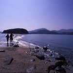
First, perhaps, turn right, then promptly left along the road to the main beach, Tung Wan. This passes stores selling knickknacks for tourists, an old banyan with small shrines, a pub, stores with food and drink. Thread your way between visitors, some of whom may be snapping selfies with novelty foods, and the beach is in front of you, at Tung Wan.
Here, you can get an idea of the island’s basic layout. On the left, beyond the northern end of the beach, Cheung Chau is hilly, with a headland sheltering the bay. It’s hilly to the south, too; while the central part with pier and beach is a low strip of land – geologically, a tombolo – linking the hilly areas, and packed with much of the housing.
That’s enough geography for now, so it’s time to set off exploring, heading south first.
Mini Great Wall: elephant, human head and other rocks
The beachside path leads to below Cheung Chau’s tallest building, the Warwick Hotel. There’s an ancient rock carving, protected from the elements by transparent plastic, and none too exciting to look at unless you’re fascinated by prehistory.
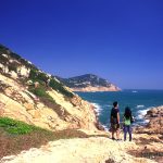
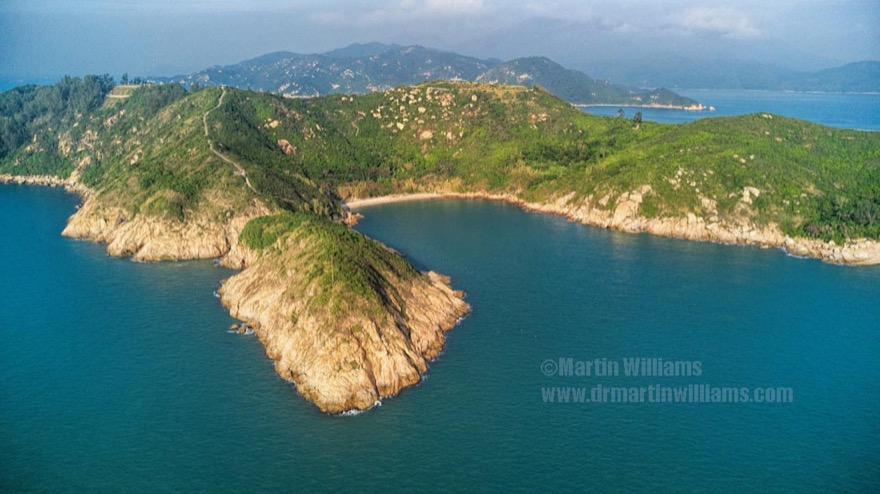
Then, after a windsurfing centre, the path leads by a smaller beach at Kwun Yam Wan, and turns up a wooded slope. Left at a junction, and shortly left again, and a path climbs the slope south of the bay. There are some grand views over Cheung Chau, with Lantau’s hills beyond.
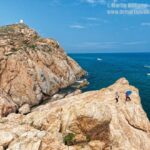
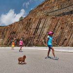
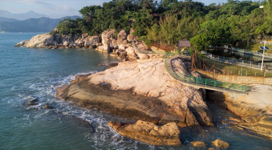
From a lookout pavilion, steps drop down towards the Mini Great Wall, which is actually a footpath made from marble-like blocks. You need imagination to “see” it appearing like the Great Wall winding over hills but, as you soon find, this is a path for imagination.
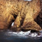
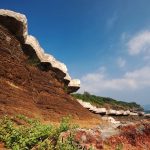
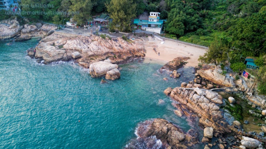
There’s a short flight of steps down to Vase Rock – which doesn’t remind me of a vase, but is a fine looking, natural granite sculpture atop a coastal crag. There are more naturally sculpted rocks along the path, often given names that might seem appropriate, or just wildly fanciful – and which are handily noted on small information boards.
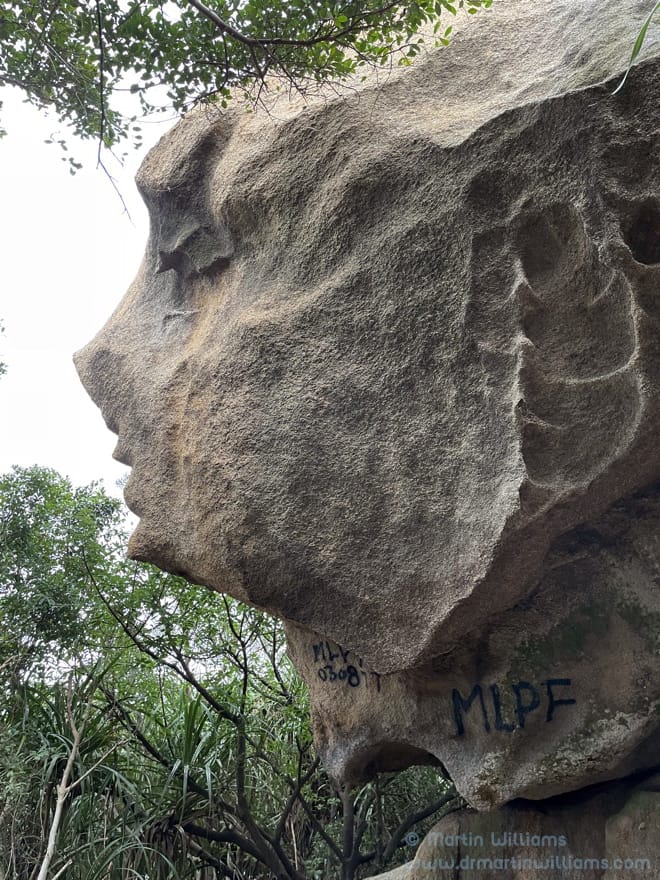
Elephant Rock does look rather like an elephant, from the right angle. And the largest and most distinctive of the rocks – which geologists would tell you is a large tor – does indeed look like a human head, with a relatively slender neck. The resemblance is best seen if you walk down to this rock, then crouch and shuffle to reach its northern side, from where you can look up, and maybe even make out the indentation for an ear, and the silhouette of a nose.
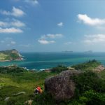
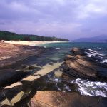
Southwards, the “great wall” ends atop a headland with views of Cheung Chau’s wild southeast coast, with Lamma and Hong Kong Island to the east, and the island of Wai Ling Ding, in Zhuhai, to the south.
Most people who reach this point simply retrace their steps towards the beaches. But there’s more exploring to be done, up steps from near the Human Head Rock.
At the top of the slope, there’s a junction where you can turn left, on a trail well above the coast. It passes through bamboo, and there’s a tiny glade amidst casuarinas.
Onwards and Westwards
This slender path led to a ruined house with open doorways, where you could roam inside to find kitchen, bathroom and more rooms. The building was on two levels, both with balconies that surely afforded splendid views over the South China Sea – and was perhaps a holiday home for missionaries working in mainland China. Today, there is work underway here, and the ruins might be demolished soon, replaced by perhaps another house.
If bush-bashing appeals there’s a slender track down from the tiny glade, through vegetation to the “Lover’s Cave”, which is really a place with boulders concreted over to form what was probably a wartime lookout post.
Onwards. Hang a left after a walled housing compound, and soon there are more coastal views. Left again, around past a headland, and watch for a path winding down to a small bay, Nam Tan Wan. A path above the mini beach here leads to a Tin Hau temple. This is a pleaant place to linger, enjoying sea views. Then, the path climbs a little, reaches houses, and arrives at Peak Road, which is little more than a footpath. Take another left turn, as the anti-clockwise tour continues.
Peak Road leads between houses at the southern fringe of the main village, before a gentle uphill stretch into more woodland.
The Italian Beach and the Southwest Coast
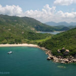
Then down again, towards the southwest corner of Cheung Chau. Here, a big cemetery might not seem promising, but look for a turn towards, you’ve guessed it, the left, and you can stroll to the Italian Beach, as western residents dubbed it.
This is remote, by Cheung Chau standards, with rocky headlands, greenery, no buildings in sight – making it a pleasant spot to linger. If you fancy a little rock scrambling, try the headland to the east – after a rocky slope, look for a slender track through the vegetation, before the rocky hilltop.
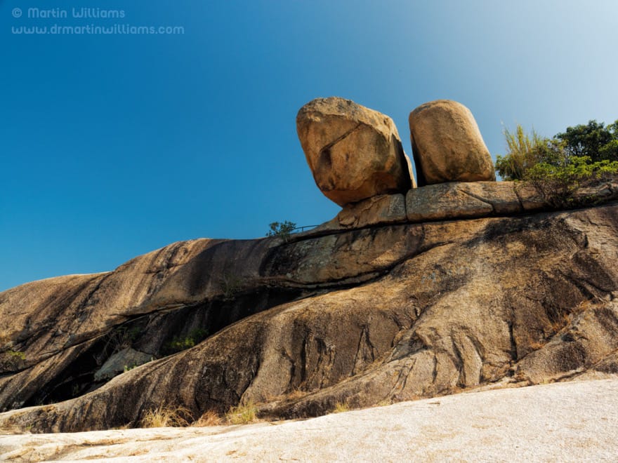
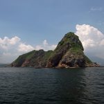
Westwards, a path makes for the top of the opposite headland, where a short walk leads to the Hanging Rocks – a pair of immense boulders, partly overhanging the rocky slope. With a little more rock scrambling, you can admire the best views of these. While have a look at the waters between here and Shek Kwu Chau, as sometimes Finless Porpoises are feeding here.
Next, a tiny inlet, where the path disappears for a while; something to do with ownership, apparently. Unless there’s a really high tide, it’s easy to cross the rocks and sand, before returning to the concrete trail that’s here built over bare granite.
Soon, the path leaves the shore, through a cleft in the granite, and up steps between boulders. At the top, you might turn left and down to Cheung Po Tsai Cave, but note this is slim rather than cavernous, and the famous pirate maybe never even visited, let alone stashed his booty here as legend says.
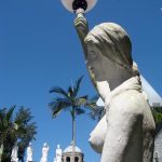
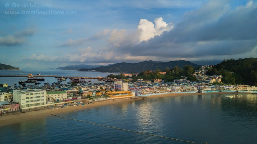
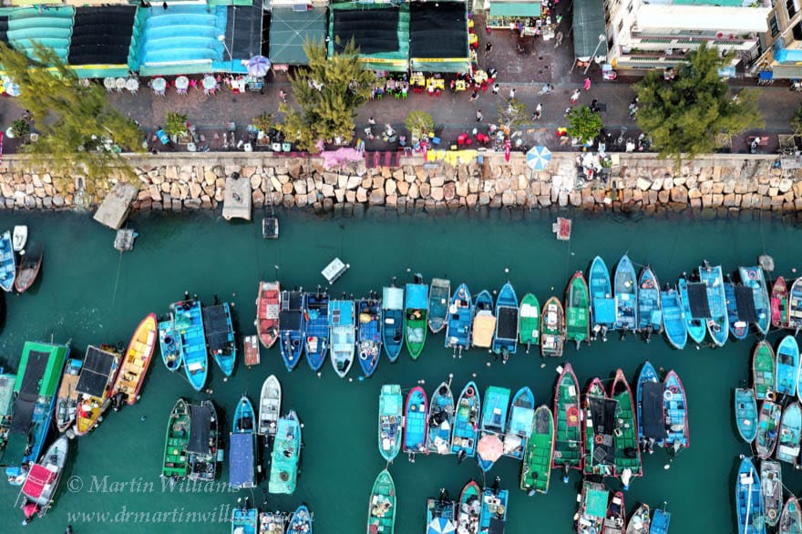
So it’s time to interrupt the left turns. On the right, a toilet block might be handy after all the exploring. Opposite it, more steps drop down to the island’s main Tin Hau temple, which looks out across the harbour and its breakwaters that provide the fishing fleet with more practical safeguards against typhoons.
Village interlude
From the harbourside, sampans shuttle across the harbour, to a pier by the main ferry pier. It’s a scenic ride, but you might instead choose to keep on walking. Not necessarily along the waterfront road, which is popular with pedestrians and cyclists. That road is relatively new, but the old path remains, and you can find it on the right, just after a tiny harbour.
The path angles up the hillside, through dense trees. There’s a compact village, then down to a verdant valley with a stream below an old pavilion.
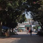
Next, you walk down, leaving the southern hilly area. This might be a good time to explore the streets, perhaps stop for a meal at one of the restaurants and cafes.
North Cheung Chau
Then, if you have time and energy, north Cheung Chau awaits.
From the ferry pier, walk north by the harbour, passing a row of restaurants, before soon leaving the main village and walking up and over to the northwest coast. A couple of beaches face Lantau, across a narrow channel plied by ferries.
Though you can’t get too far along the coast, there’s a slender road that curls up the hillside, to a sitting out area where the expansive facilities seem designed for busloads of visitors, even though there only a smattering of people might hike this far.
There’s a lookout pavilion atop the hill, which is a fine vantage for admiring Cheung Chau, and reflecting on the outing so far. Below, flights of steps lead down a windswept headland, then to a secluded beach, seemingly far from the madding crowds.
Sadly, this beach is prone to arrivals of wave borne rubbish like plastic bottles and chunks of polystyrene, and unlike gazetted swimming beaches there’s no daily cleanup service. But at least views of the surroundings and out through the inlet towards Hong Kong Island are pleasant.
There are more steps, leading up, from the north end of the beach. They arrive at a rough track, where you might turn right towards the very north of the island, maybe to check out what’s become of an abandoned farm. Or, walk left, to pass the pavilion, below which there’s a path that heads towards the main village, with a flight of steps down to Pak Tai Temple.
See also website I’ve done: Cheung Chau HK.
[Written for the South China Morning Post]