
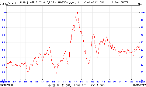
Severe Tropical Storm Pabuk looked set to have passed Hong Kong, barely causing an impact other than a pulse of thunderstorms, some rain. Headed towards Hainan, and forecast to dwindle to nothingness. But, it stopped, strengthened again, and turned around – and headed straight for Hong Kong as a tropical storm, hitting on 10 August 2007; seems the rather hazy centre hit Lantau, before it moved off towards west, and weakened..
Led to hoisting of Number 1 and then, a couple of hours or so later, the Number 8: latter causing massive confusion, as people scurried home from work.

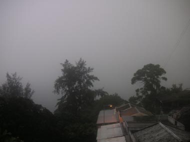
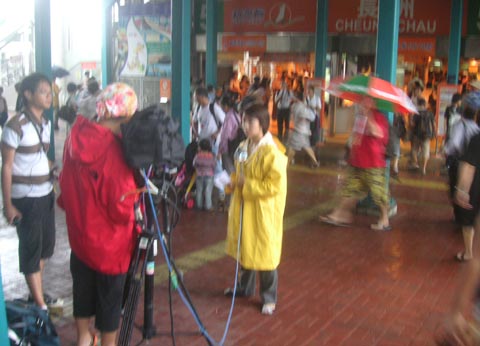
Here are views from Cheung Chau, as Pabuk approached (again!), and as it came close, with intense rainband.
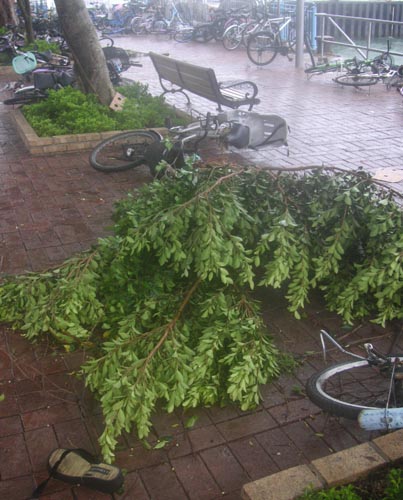
I had to take a ferry. As I neared the pier, passed bicycles blown over by powerful wind, and this broken tree branch.

The ferry took 15-20 minutes just to leave the pier! – blown against it by the wind!
Even in the typhoon shelter, the gale to storm force wind was blasting small waves w white water. Here, took shot in pelting rain.
{mov}pabuk-ferryrideweb{/mov}
There were big waves – some 3-4 metres? – soon after the ferry left the typhoon shelter. The ferry took an unusual course, to avoid as much as possible the roughest seas towards Hong Kong – north past Hei Ling Chau, to pass near Peng Chau. Even so, once we were beyond the lee of Hei Ling Chau, the ferry rolled in big seas; a few times, rolled pretty far then hit by waves that sent spray to windows of middle deck (where I was).
I shot these clips, inc as arrived in Victoria Harbour.
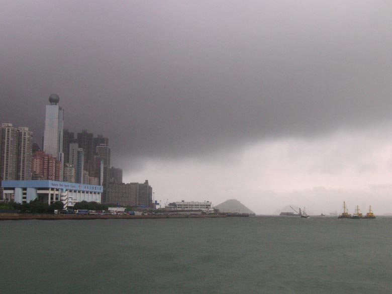
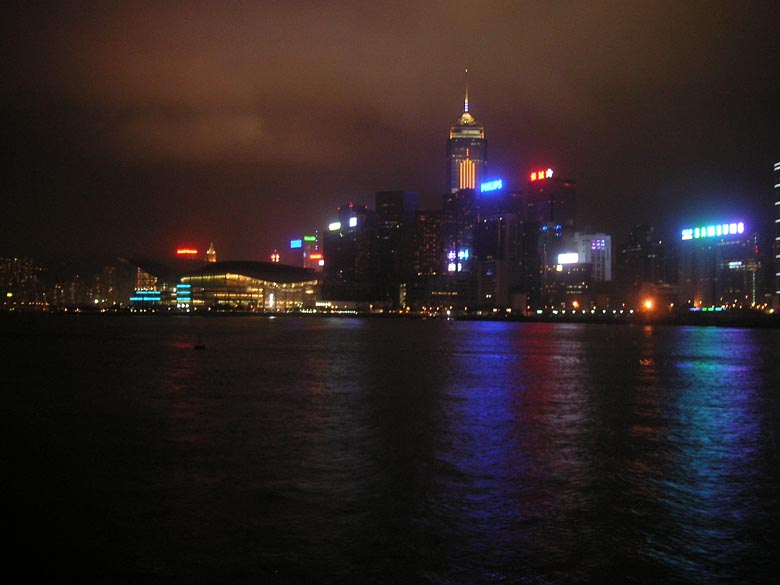
Calmer in the harbour, tho some dark clouds moved over.

I arrived in Central to find large crowd of people, waiting to catch ferry to Cheung Chau. (and go home – not for holiday!) The Number 8 was imminent, or up already.
{mov}pabuk-ferryrush{/mov}
Took quite some time for ferries to arrive. When a small – two deck – ferry berthed, there was degree of chaos as people rushed along exit way, dashed onto ferry without paying, w much shouting. But then, gate closed behind them, and things quiet again: the ferry left, and I figured I was glad not to be on it, as surely would bounce even more than three-deckers (as I’d come in on).
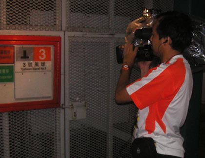
There were tv news crews around, reporting on people waiting for ferries. (Maybe, too, on the storm – but in Central it was pretty quiet; hard to guess how rough the seas were towards Cheung Chau, and how strong the wind had been there.)
Weather including tropical cyclones

Rare November Tropical Cyclones Including Typhoons in Hong Kong
As I write on 13 November 2024, Tropical Cyclone Toraji is set to pass over Hong…

Typhoons and Rainstorms Past Help Hong Kong Forecasts Today
Wetter, Wilder Weather Events Loom with Warming World You may find yourself on a Hong Kong…

“Typhoon to Hong Kong Soon” Makes Great Clickbait
While Hong Kong is sometimes hit by typhoons, predicting them in advance is tricky. Yet this…

Lightning-packed Supercell over Cheung Chau, Hong Kong
Yesterday evening (30 April 2024), weather monitoring imagery showed an intense rainstorm/thunderstorm area – a “supercell”…

Tropical Cyclone Ma-on Headed for Hong Kong
25 August 2022 (evening) update: Ma-on took a track somewhat south and west of earlier forecasts;…

Severe Typhoon Mangkhut highlights perils of massive reclamation by Lantau
Typhoon Mangkhut helped show “storm surge” is a threat to modern cities, not just something for…

Typhoon Jebi a Warning for East Lantau Metropolis aka Lantau Tomorrow Vision
To anyone concerned about plans for Lantau Tomorrow Vision, the clobbering of Kansai by T Jebi…
Mad Lantau Metropolis Plans Should be Scuppered by Storm Surge Threat
A consideration of science suggests the reclamation plans, including for East Lantau Metropolis are foolhardy, even…
As Hong Kong Sizzles the World Keeps Warming
While climate change may have long seemed an issue for hardcore, tree-hugging environmentalists, concerns are spreading.
Typhoon Haiyan Lessons for Hong Kong
Typhoon Haiyan was among the strongest storms on record, and devastated a swathe of the Philippines.…

Forecasters Benefit from Flights into Typhoons
As well as computer models and weather station info, the Hong Kong Observatory is uses flights…
Hong Kong weather outlook warmer wetter wilder
With global warming only just getting started, according to scientists, it’s time for Hong Kong to…

Typhoon Vicente hurricane force winds blast Hong Kong
Severe Typhoon Vicente slammed Hong Kong on 23 and 24 July 2012, with hurricane force winds…
HK Number 8 Signal
Hong Kong's Number 8 tropical cyclone warning can be controversial.

Hong Kong Typhoons including Calamitous Storm Surges
Typhoons have sometimes caused massive damage and loss of life in Hong Kong. Just months after…
Hong Kong tropical cyclones
Hong Kong can be impacted by tropical cyclones including and typhoons. Happily, typhoons are scarce near…