One of the best ways of getting some outdoor exercise is to get on a bicycle, and ride away some of those coronavirus claustrophobia blues. Hong Kong hardly abounds with good routes for relaxing cycling, but there is an especially fine one in the northeast New Territories, from Tai Po Market to Tai Mei Tuk.
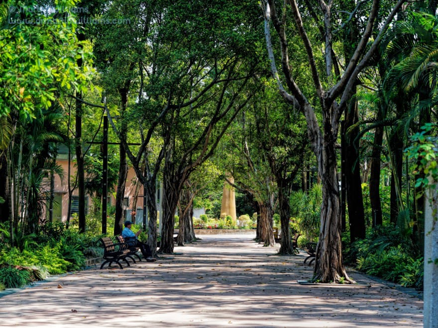
Tai Po Waterfront Park
There are several cycle hire shops along the route, and you could even hire and start south of Tai Po Market, such as in Sha Tin or Tai Wai – then follow the Shing Mun River and the west shore of Tolo Harbour, past the Science Park. But Sha Tin and the Science Park are hardly too scenic, so it may be better to begin the journey somewhere more attractive – like Tai Po Waterfront Park.
This is the largest park managed by the Leisure and Cultural Services Department, and features expansive lawns, shrubberies and flowerbeds, paths shaded by banyans and other trees. So perhaps have a look around, before heading to one of the cycle hire kioks by the waterfront, just below a Spiral Lookout Tower.
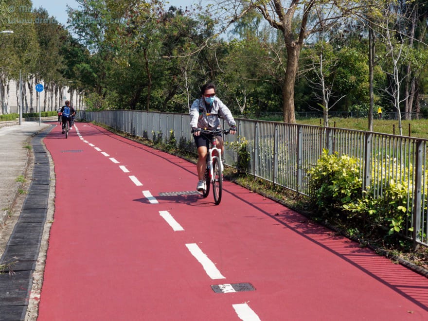
There’s a cycle track by these kiosks, and you can set off eastwards along the waterfront. It’s a pleasant ride through the park. But while the cycle track looks all set to continue round the coast, it comes to an abrupt end at the eastern boundary of the park. So, you’ll need to find another way towards Tai Mei Tuk – which means first heading to Ting Kok Road, a kilometre to the north.
The most direct way passes through Tai Po Industrial Estate, which you might reach via a park exit just east of Tai Po Waterfront Park Viewing Point. Then travel straight along Dai Kwai Street, and you arrive at a cycle track alongside Ting Kok Road.
A couple of minutes’ ride to the east, you pass the edge of the industrial estate, and there’s greenery to north and south of the highway and cycle track. Trees afford some shade, and by Hong Kong standards this is pleasant, rural cycling.
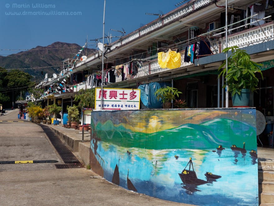
Sam Mun Tsai New Village
There’s a short stretch beside Tolo Harbour, and you arrive at a junction with Sam Mun Tsai Road, which leads down by The Beverly Hills, on the right. This allows for a short side trip, though don’t get too excited with ideas you’ll soon encounter Hollywood movie stars, for this is of course not the Beverly Hills, but a grandiose private housing estate.
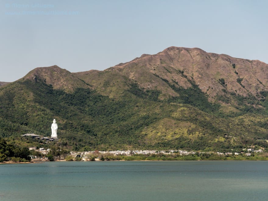
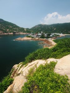
The road drops gently down, and there’s another right turn, to Sam Mun Tsai New Village. This was established in the 1960s, as the original Sam Mun Tsai – accessible by three sea channels (sam mun) – was relocated here to make way for Plover Cove Reservoir. It’s a fishing village, with a row of two storey houses facing a harbour that hosts a few vessels, especially speedboats.
If you’d like a short hike, a path from here leads up and over a headland, then down to arrive at Ma Shi Chau – Horse Poop Island. Despite being saddled with this name, the island is worth visiting for the outcrops along its shorelines, with sedimentary rocks dating from the Jurassic and Permian eras, up to around 280 million years ago. Some fossils such as bivalves have been discovered here, and Ma Shi Chau is part of the Hong Kong Geopark.
Otherwise, there’s little to do at Sam Mun Tsai apart from strolling onto the pier for more harbour views, and maybe buying refreshments before setting off again.
Rather than head straight back to Ting Kok Road, turn onto a small road leading north, to Sha Lan Village. While the village is little more than a jumble of Spanish villa type houses, the coastal scenery is pretty, with views across a bay backed by green hills including the Pat Sin Leng Range. There’s a small beach of silt and shingle, beside which a sign warns Uneven Seabed and Reefs; Unsuitable for Swimming.
Now, back to Ting Kok Road and the cycle track. If there’s a way through the village, it’s not obvious, so the easiest way is to return along Sam Mun Tsai Road.
Onwards, to Tai Mei Tuk
Then, onwards, towards Tai Mei Tuk. The route passes villages including Ting Kok, each with more of the Spanish style houses that provide maximum area within the small house regulations, and are typically home to commuting city folk rather than local villagers.
Tai Mei Tuk is likewise more akin to a suburb than a classic rustic village. The shoreline by the west of the village – known as Lung Mei – was formerly home to marine life including seahorses. But in 2012, persuaded by some local people, the government decided to create a bathing beach here, and there’s now a construction site that looks far from becoming a beach anyone will want to visit.
Many city folk stop at Tai Mei Tuk during outings to the northeast New Territories. Thai, Indian and bistro style restaurants cater to them, and there’s an array of kiosks renting bicycles and four-seater quadracycles.
Ting Kok Road continues east, then northeast – soon becoming Bride’s Pool Road as it winds alongside Plover Cove Reservoir, then climbs to near the Bride’s Pool and Mirror Pool waterfalls. This is a magnificent area, but there’s no cycle track, so riding here you have to take special care regarding cars, while being keenly aware that many Hong Kong drivers are clueless regarding cyclists as road users.
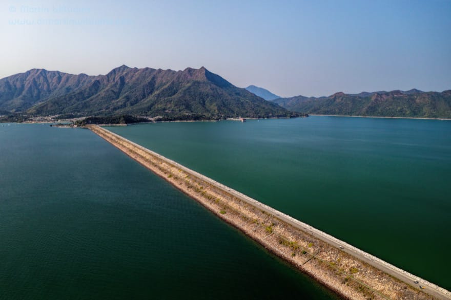
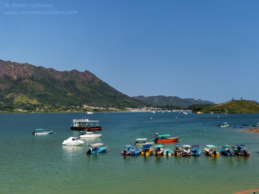
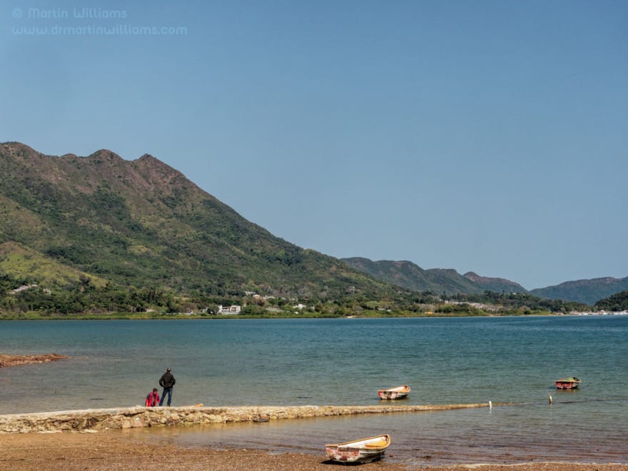
Plover Cove Reservoir
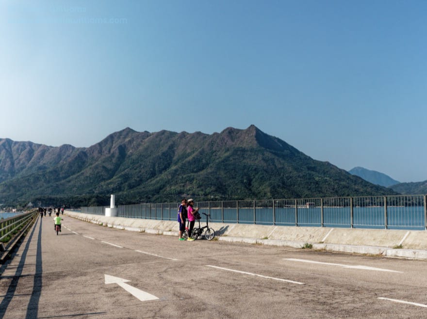
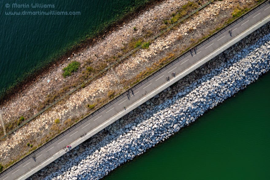
But you can take a safer option, by following the cycle track across the road to the east of the village, then alongside the narrow Tai Mei Tuk Road. Just before Tai Mei Tuk Water Sport Centre, there’s a turn to the left, and you can skirt around a barrier that stops cars without permits, then climb an incline, and arrive at the top of the main dam of Plover Cove Reservoir.
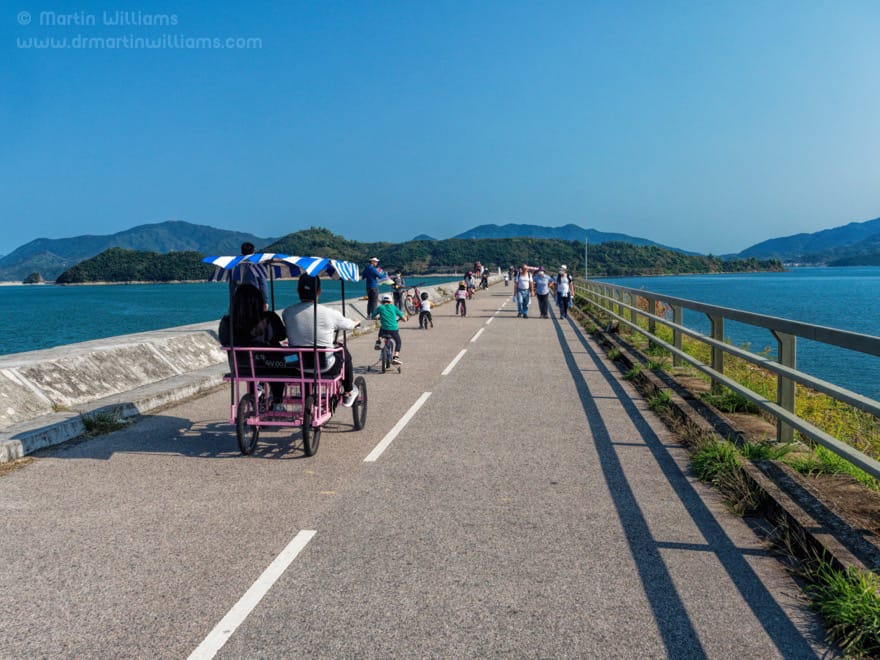
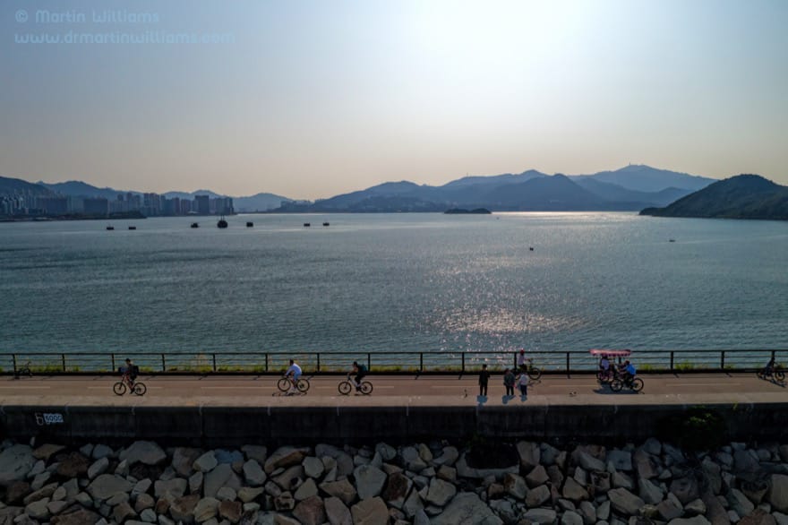
The two kilometre long dam leads southeast, dead straight, and you can cycle along the road on top of it. This could be wonderfully tranquil if there’s no one else around, but you may find it seems everyone who has come to Tai Mei Tuk is here, cycling and walking, or even roller-blading along the road, with umpteen rookie cyclists weaving and wobbling unpredictable routes. Still, it’s well worth coming.
There’s expansive scenery, with hills including the Pat Sin Leng Range serving as the backdrop to the waters of Tolo Harbour and the reservoir in the foreground. This is Hong Kong’s largest reservoir in terms of area, and was the world’s first reservoir to occupy a former tidal bay.
The idea for the reservoir originated with T.O. Morgan, then director of water supplies, as he swam in Plover Cove during the 1950s. The project began in 1961, with the main dam connecting to the islet of Pak Sha Tau, and a smaller dam linking to a headland sheltering the cove in the east. The reservoir was opened in 1968, helping to alleviate the water shortages that had impacted Hong Kong.
While hikers can continue past Pak Sha Tau, a sign notes cycles are prohibited. So, it’s time to start heading back towards Tai Po Market.
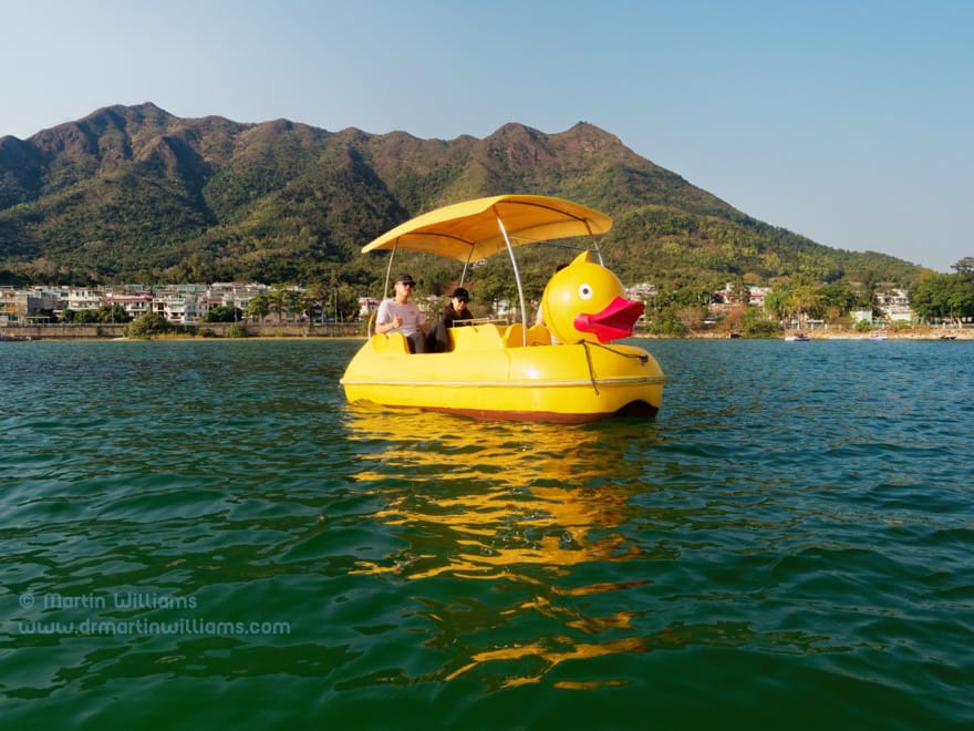
Before you depart Tai Mei Tuk, small cafes along the waterfront could be good places to stop for a drink, and to admire the tranquil bay. For extra excercise, hire a rowing boat or a pedalo for a short excursion. This is also a prime place for scintillating sunsets, but if you’re to arrive in Tai Po Market before nightfall, you’d better get going before the sun drops behind the hills to the west.
Travel tips
Hiring a cycle for the day should cost around HK$70-90, and you may be able to arrange to leave it at a Tai Mei Tuk kiosk. If you want a helmet, bring your own. It’s around 14 kilometres from Tai Po Waterfront Park to the end of Plover Cove Reservoir main dam, including the side-trip to Sam Mun Tsai. The return ride from Tai Mei Tuk is around 8 kilometres. You could spend much of a day for the entire outing, including plenty of stops en route.
[Written for the South China Morning Post]