
In past few days, computer forecast models have indicated a chance of stormy weather developing over the South China Sea near Hong Kong at the beginning of July.
Updating on evening of 29 June. The T1 signal is in effect, and Hong Kong Observatory forecasts:
The tropical cyclone over the central part of the South China Sea will move in the general direction of the coast of western Guangdong in the next couple of days and intensify gradually. Winds will strengthen gradually with swells over the northern part of the South China Sea and the coast of southern China. Its associated outer rainbands will also bring squally showers and thunderstorms to the region.
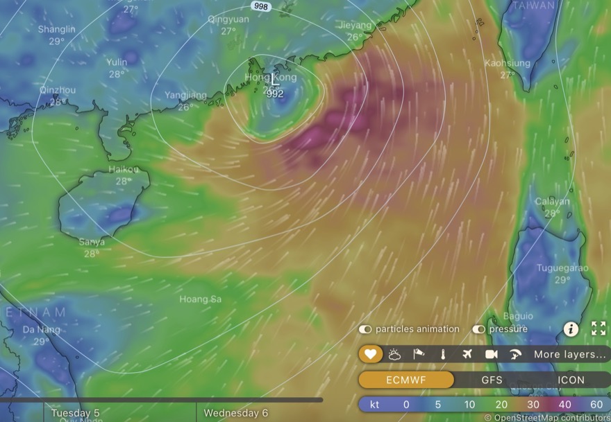
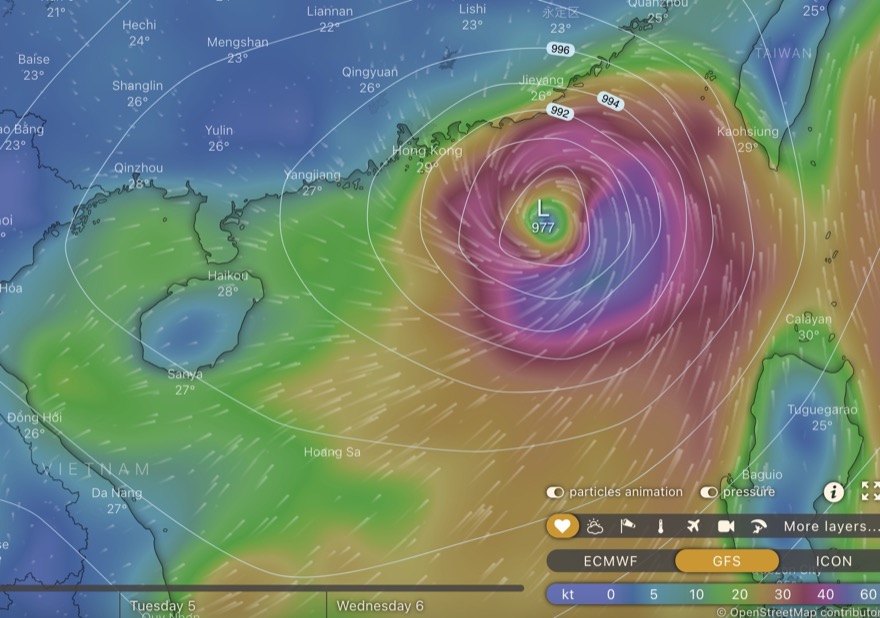
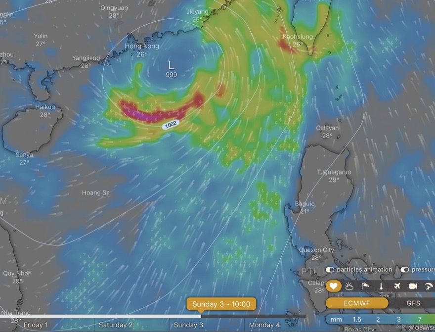
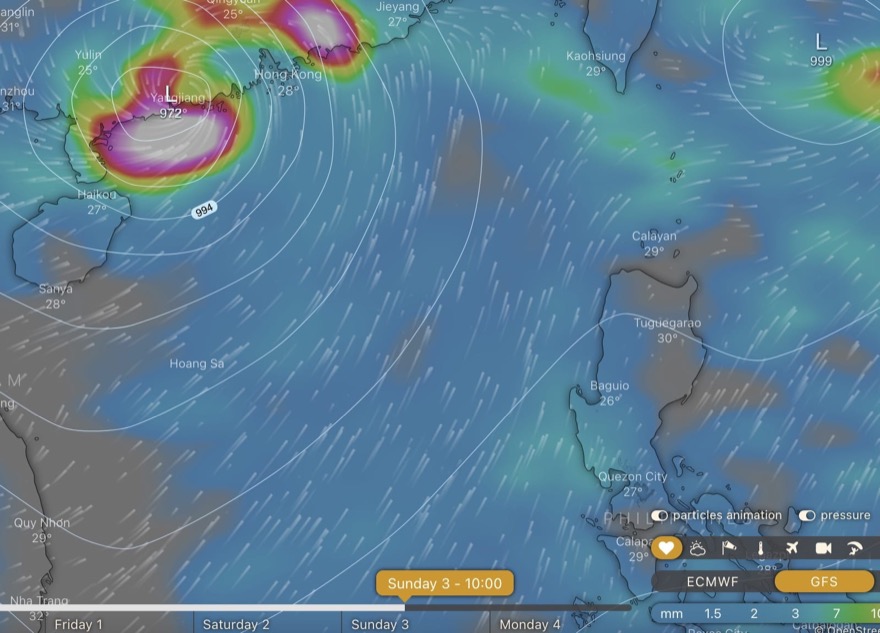
Now, forecasts by ECMWF and GFS are similar, tho GFS has a more intense storm landing to west of Hong Kong. [cf forecasts below: on earliest of them, no storm at all forecast by ECMWF].
Updating on 27 June, looking more likely a tropical storm will be close to Hong Kong around 3 July; two model forecasts here:
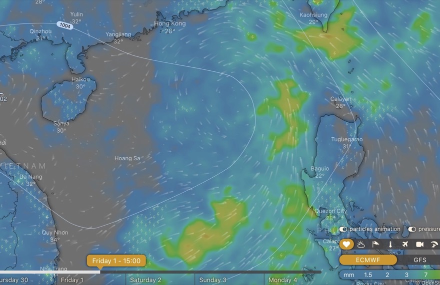
As I did original post on 25 June: there is rather more agreement between the forecasts for the two main models shown via windytv.com – ECMWF and GFS; while the Hong Kong Observatory notes: “A broad trough of low pressure is expected to bring showers to the northern part of the South China Sea and the vicinity of the Luzon Strait in the middle and latter parts of next week.”
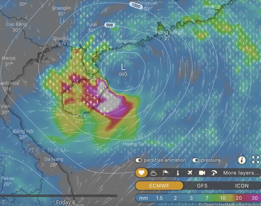
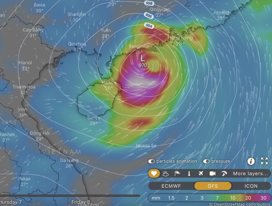
Here are forecasts – including indications of rainfall – from the two models for 1 July:
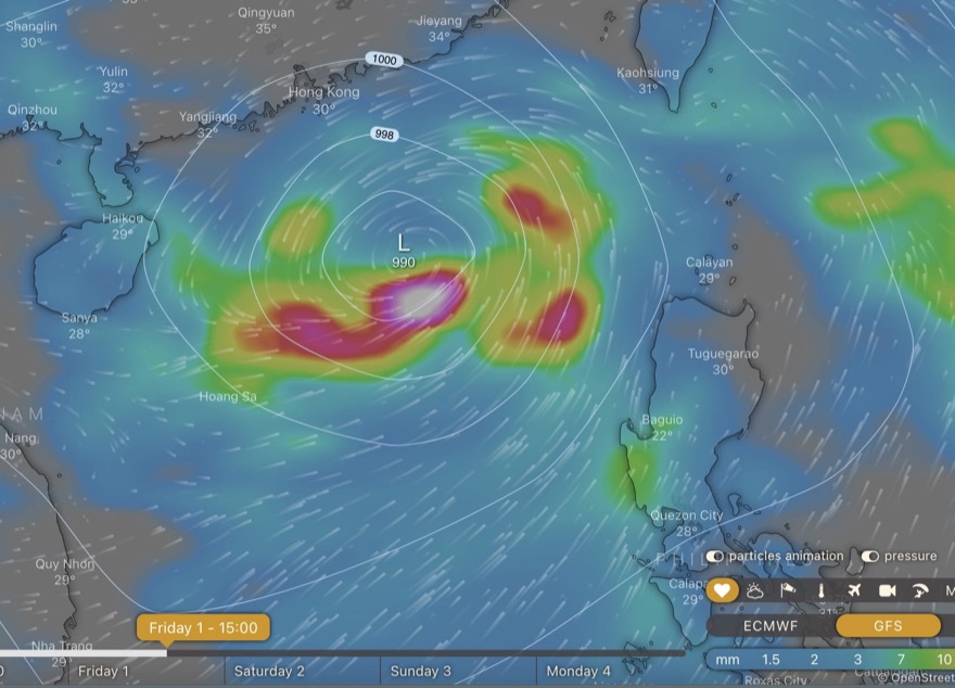
And here, for a couple of days later. On GFS, not so much a “trough” as a full blown tropical cyclone, maybe a tropical storm or even a typhoon.
Early days as yet, for any confidence in detailed forecast: does look like some rainy, wet weather will arrive though.