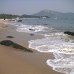
Less than a year ago, a visit to Tai O might have meant jostling with crowds along the narrow streets, and joining long winding queues to take a bus back towards the city. But in this strange new era for Hong Kong, the throngs of tourists are gone, and Tai O has become an attractive option for families and individuals seeking fresh air exploring, and relief from cabin fever and maskomania as coronavirus looms. Whilst there, you might slightly offset losses local businesses are suffering from the dearth of tourism (this may be worthwhile, yet an email to the Hong Kong Tourism Board, asking if they have plans to encourage Hong Kongers to become hometown tourists, went unanswered).
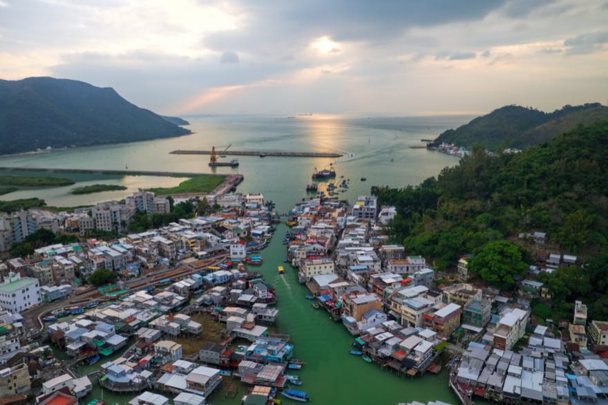
If you’ve been before, or just seen photos, you will know it’s far-fetched to call Tai O the “Venice of the Orient”. While there are buildings fringing tidal creeks, rather than canals, most are simple houses on stilts. They’re mainly home to descendants of Tanka fisherfolk who, according to Landscapes Lost and Found by Ken Nicolson, lived on boats till some time after the late 17th century, when they were allowed to settle on land, and began building homes on platforms atop granite pillars rammed into the riverbed.
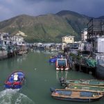
Stilt houses along the creek
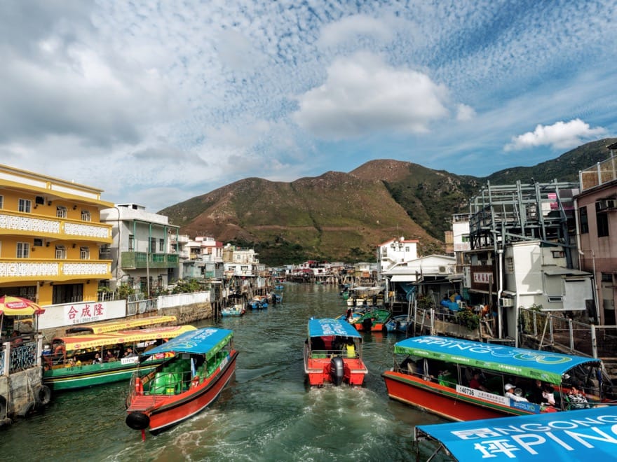
One of the best places for viewing the stilt houses is a footbridge over the creek near the Tai O bus terminus. To reach it, head towards the mouth of the creek, walk along a narrow alley past stalls with tourist souvenirs, and snacks like squid and fishballs, and take an obvious left turn. The bridge is modern, with metal railings, and looks north along the creek, lined with densely packed, box-shaped stilt houses, mostly clad in metal sheets. Speedboat operators used to do a roaring trade in Tai O, taking visitors sightseeing along the creek, and just offshore to look for dolphins. Nowadays, there might be five or more vessels moored below the bridge, with only occasional boatloads passing by.
From across the bridge, narrow, car-free roads offer the chance to explore. Turn left, and you can pass some of the stilt houses, plus typical village houses on terra firma above the tideline. The housing becomes more scattered, and there are gardens and woodland alongside the road, which ends at a small pier. From here, a two- or three-minute walk up a winding path leads to the Tai O Heritage Hotel.
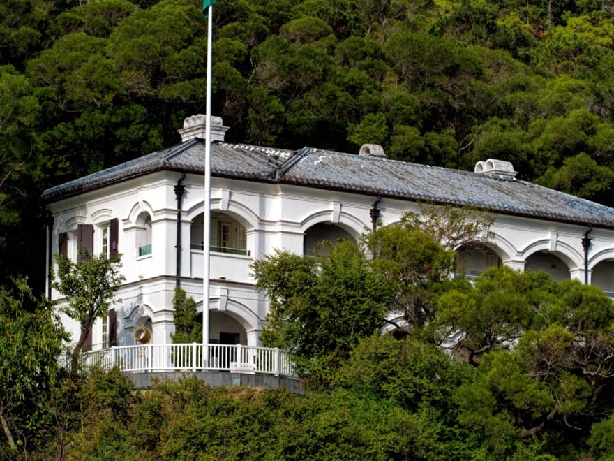
As the name suggests, this is no ordinary hotel. The white-painted, two-storey main building was originally the Tai Po Police Station, built in 1902, with rather splendid colonial-style architecture including arched windows, tiled roof, and a covered balcony overlooking the approaches to Tai O. It fell into disuse in 2002, but restoration work began seven years later, leading to a UNESCO Award of Merit for Cultural Heritage Conservation. Today, there are nine guest rooms, and even if you don’t stay you can check out places like a former holding cell for miscreants, along with an upscale cafe.
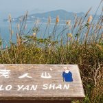
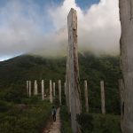
Ascent of Tiger Hill
Heading back along the road back to Tai O, there’s a left turn towards Heung Shing Temple, beside which a flight of steps leads up Fu Shan: Tiger Hill. It’s an easy “climb” – Fu Shan is a piffling 75 metres high – and the path soon arrives on a ridge with scrub and grassland, by a statue of four Chinese white dolphins frolicking in and leaping above waves. The path turns right here, towards a pavilion that’s supposedly a dolphin lookout.
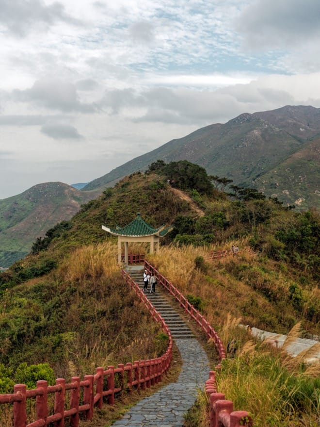
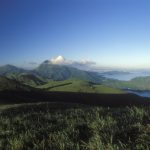
You’d probably need considerable luck, and sharp eyes, to spot a dolphin from here. But there are impressive views across the mouth of the Pearl River – and with a section of the Hong Kong–Zhuhai–Macau Bridge barely two kilometres away, you can watch for buses and cars that were scarce enough in normal times.
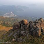
Another minute or so further along, the smart trail of slabs set in concrete comes to an abrupt end. Perhaps it’s time to turn back; but there is a rough track that continues, making for a somewhat more challenging hike. This first climbs to a sharp peak, with Tai O laid out below. From here, you can just see the river that flows down from Lantau hills, passes through Tai O village, then splits into two creeks, so that Fu Shan is set on a small island.
Onwards and downwards, there’s a scramble along a path of small stones that can skid underfoot, with lengths of rope strung between bushes to help you keep your balance. After passing through trees, the trail meets a concrete path to Yeung Hau Temple, at the mouth of the northen creek. From here, a narrow road passes alongside stilt houses, towards the footbridge.
Keep an eye out for a path on the left. Around 50 metres along this, there is another, smaller footbridge. While mainly used by villagers rather than visitors, it’s another good vantage for seeing the stilt houses, which are here beside the fork in the river. There’s also a lane along this running parallel with the southern creek, which is interesting to walk along as there are several cafes and shops, with handicrafts, coffee and cakes, and a relaxed, almost “hippy” style vibe.
Southward, to Yi O
One of the shops belongs to Yi O Agricultural Cooperation, with goods including vegetables and rice grown at Yi O, around three kilometres to the south. This is a wonderful place to head if you’d like a gentle hike from Tai O.
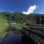
The coastal path to Yi O starts by the bus terminus, from where you can skirt around a mangrove restoration area to a hamlet, Nam Chung. From here it’s perhaps a 40-minute walk, mostly along an easy concrete path round a wooded headland, then down to and around the edge of the bay at Yi O; where you might take a short detour alongside a stream, to find a plunge pool below a series of cascades. The farming area is just beyond here, above mangroves and mudflats.
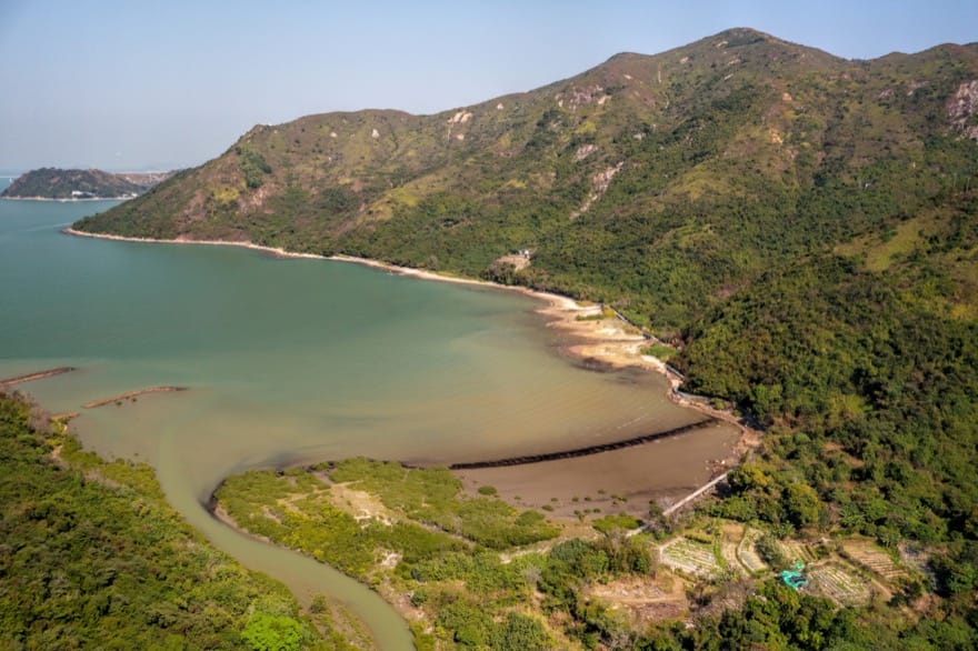
Just by the coast, the Yi O farmers grow vegetables, market gardening style. A track leads inland, through a wood dotted with ruined houses that residents abandoned over two decades ago. The current farming venture was initiated by former town planner Andrew Lam Siu-lo, who established a cooperative venture with ex-villagers, along with some cityfolk who were keen to try rural lifestyles. Lam chose to focus on reintroducing rice farming, and you can find the paddies a couple of minutes’ walk further south.
Eight years ago, this area was overgrown with swarthy grass and scrub, but after clearing and creating a a step-like pattern of fields on the gentle slopes, along with an irrigation system, the first rice crop was harvested here in 2014.
On a recent visit, most of the paddyfields were bare, awaiting planting of a new crop to coincide with spring rains. But with its setting in a valley cradled by the hills of western Lantau, seemingly far from town or city, this was still one of the most tranquil, bucolic places in Hong Kong – serving as a temporary haven from a world gone crazy.
Getting there
While a favourite way to Tai O was by bus 11 from Tung Chung Station Bus Terminus, if you’d prefer to avoid breathing indoor air with many strangers – to reduce Covid risk – it may be preferable to take bus 1 from Mui Wo Ferry Pier – partly as you can take a ferry from Central to Mui Wo, and ride in the open air middle or lower decks (scenic rides, too), and this bus is usually quieter than the number 11.