With the record May heatwave [in 2018], and the driest start to a year since 1963, this year may serve as a wake-up call regarding the importance of our local reservoirs, and recognising the tremendous engineering feats that created them. For insights, and an enjoyable, easy outing, head to the Tai Tam valley on Hong Kong Island, where four reservoirs were built over a century ago.
Picturesque setting, with exposed russet shorelines
On a comfortable day, the most scenic route into the Tai Tam valley is surely along the Hong Kong Trail from beside Parkview – up and over Jardine’s Lookout and neighbouring Mount Parker, then down a slender access road. But when the weather is roasting, it’s far easier to just walk down the access road that also starts by Parkview.
Almost immediately, the only building in sight is Parkview. The broad valley is within Tai Lam Country Park, which occupies a fifth the area of Hong Kong Island, yet is akin to a secret place, secluded amongst hills.
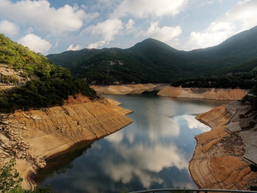
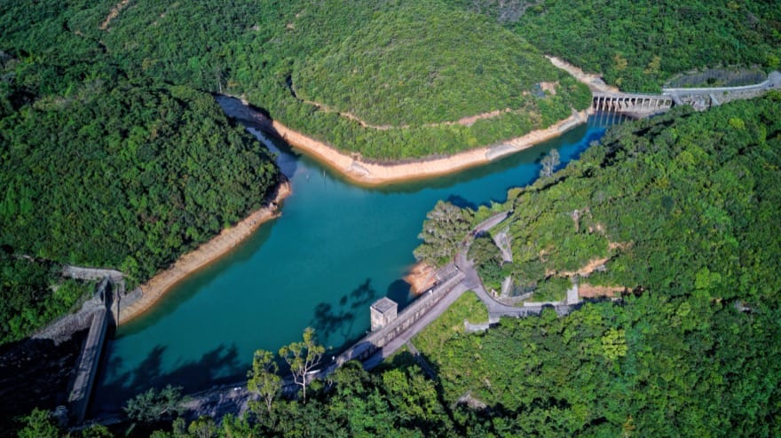
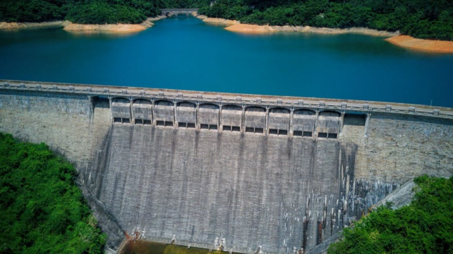
The road arrives by the southern shore of Tai Tam Upper Reservoir, in a picturesque setting amidst the lush green hillsides. Yet as the May heatwave almost came to a climax by the end of last week, the water was low, with steep exposed shorelines of orange sand and rocks; on 1 June the Water Supplies Department reported it was at just 31 percent of capacity.
When full, this reservoir looks as if it forms a single water body with the smaller Tai Tam Byewash Reservoir, immediately to the south of it. But it is actually separate, which is especially obvious when there is little water, exposing a spillway beneath a narrow bridge supported by three columns of stone blocks.
This bridge is stop 1 along the Tai Tam Waterworks Heritage Trail, which leads down to the coast below the valley, and takes in 21 waterworks structures that have been declared historic monuments. While the bridge looks plain, it adjoins an aqueduct of the sort the Romans might have been proud of – with 12 closely spaced columns.
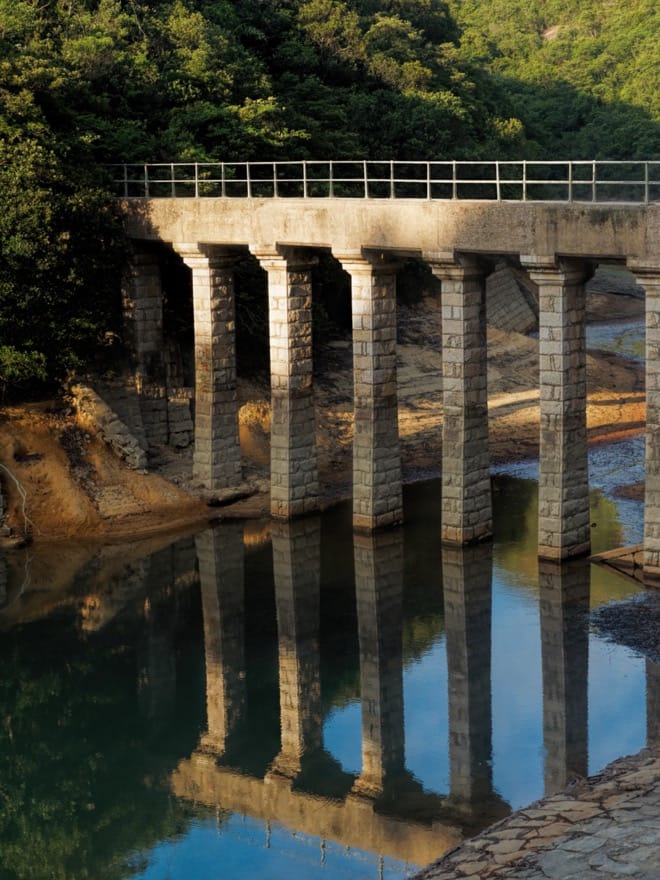
This aqueduct was originally built to carry water from a catchment, across a stream to the Tai Tam Upper Reservoir – which for 20 years was the only reservoir in the valley. From across the bridge, there are two possible, easy walks to the dam, skirting a tiny hill.
Prominent dam, hidden tunnel
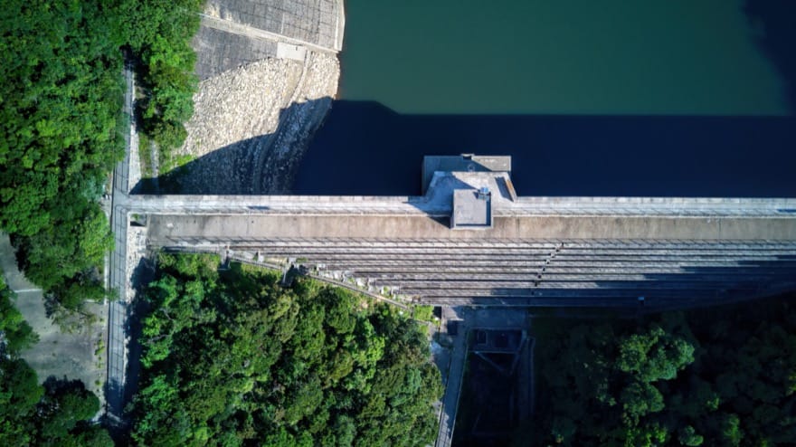
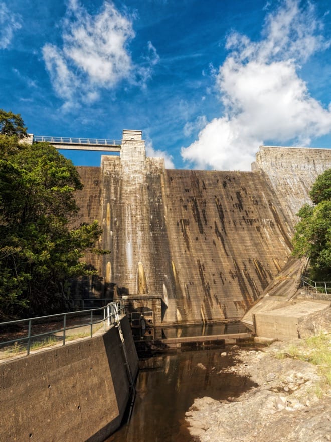
The dam is an imposing structure, 123 metres long, 30.5 metres high, and widening from a broad path at the top, to 18.3 metres wide at the base. Today, it’s in a tranquil setting, and on a weekday morning you might encounter no people other than a jogger and a couple of hikers heading purposefully past.
It’s hard to imagine, then, the situation as the dam was built from 1883 to 1888 – when Queen Victoria reigned in Britain, and China was ruled, officially at least, by the Guangxu Emperor. A photograph from 1883, in Water for a Barren Rock: 150 Years of Water Supply in Hong Kong, shows work beginning in a veritable moonscape, where the slopes seem bereft of grass, let alone trees. The project cost HK$1.25 million – more than double the cost of Hong Kong’s first major reservoir, at Pokfulam, and was key to the city expanding eastward from Victoria (now Central District).
There’s a valve house, a solidly built stone structure with a square profile that’s almost part of the dam. Usually, water should flow into pipes here, before being transported to the thirsty city. But last week, the water was so low that two inlet pipes were left high and dry; an outlet pipe at the opposite side of the dam just oozed a ruddy brown trickle of water, rather than feeding a stream channel. There was, however, the sound of rushing water just a little downstream – where a waterfall tumbled down from a channel below a squat, relatively modern stone building. This water was surely from the Dongjiang River in Guangdong, pumped here after first being stored in Plover Cove Reservoir in the New Territories.
This building also covers a tunnel inlet that’s a historic monument. A photo of this shows the entrance is an attractively built stone archway, showing the early engineers considered aesthetics as well as function. It leads to a 2220-metre tunnel that took over two years to construct, first with only basic machinery, later with new machines from England.
The tunnel opened to the Bowen Aqueduct, which was built along the hillsides of north Hong Kong Island, and is now topped by Bowen Road – with its grand arches now sadly obscured by vegetation.
High water in intermediate reservoir
The service road continues down from the pair of reservoirs. There’s dense forest here, where in summer you hear cicadas, and birds including black-throated laughingthrushes with their rich whistled songs. This is closely related to the reservoirs, as trees were planted and protected to enhance the catchments, reducing erosion and boosting flows in dry weather.
Even with the forest, the streams were meagre towards the end of the recent heatwave. A stream below the road can be a lively cascade in the wet season, though by last week there was a mere trickle. The base of the next dam down the valley – at Tai Tam Intermediate Reservoir – was even quieter; not even a dribble of water emerged from the exit pipe, and little but a buzzing fly broke the stillness. Oddly, the reservoir itself was full, surely with water from the Dongjiang.
This dam, along with the byewash reservoir, was built between 1904 and 1908, during a project to expand water supplies from Tai Tam. The project also included an access road leading to the upper reservoir, with four masonry bridges spanning stream channels.
Bridges over dwindling water
One of these masonry bridges spans the channel below the intermediate reservoir, and this dry spring its six grand arches between columns were fully exposed, rather than largely submerged as during wetter times, when the channel here becomes an inlet of the lowest and largest of the Tai Tam reservoirs.
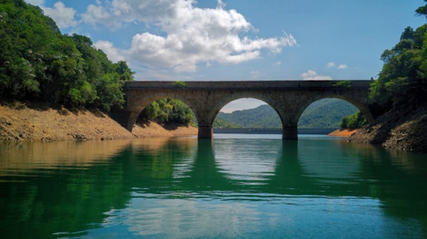
This is the Tai Tam Tuk Reservoir, built during another major engineering project, which lasted six years and was completed in 1917, with the reservoir opened at a ceremony officiated by Governor Henry May in February the following year.
The access road is still in use, though nowadays mainly by hikers and other country park visitors. It affords views across the expansive, 1km long reservoir from atop two handsome bridges that nowadays cross inlets, and last week was another reservoir looking like the tide had gone out to expose russet shorelines.
Pump it up
Reaching a junction where the access road meets Tai Tam Road, it’s probably wise to end the outing, and head for home. But there are more sites along the heritage trail, notably down Tai Tam Reservoir Road, just across the highway.
This road drops gently down to the north shore of Tai Tam Harbour, where a Victorian-era building around the size of an English house once held steam-powered pumps, for transferring water from the nearby reservoir uphill, to the tunnel and the Bowen Road aqueduct. It has been renovated and is still in use, with more modern pumping equipment.
Perhaps ten minutes’ walk along the road as it skirts the tideline, there are at last views of the Tai Mei Tuk Reservoir dam, with cars and buses travelling on top of it. At the end of last week this imposing edifice was baked dry, without a drop of water emerging from the pipe.
Getting there
Bus 6 from Central to Stanley passes through Wong Nai Chung Gap, perhaps ten minutes’ walk from Parkview. From Tai Tam Road at the end of the route, there are stops for bus 14 bound northwards to Shau Kei Wan, and westwards to Stanley.