
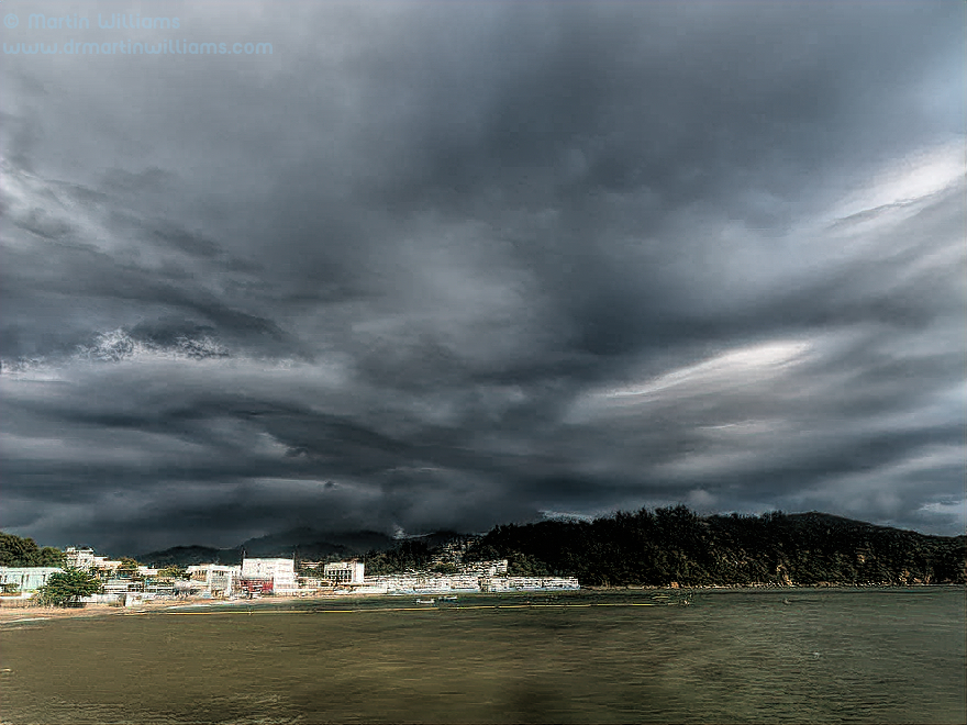
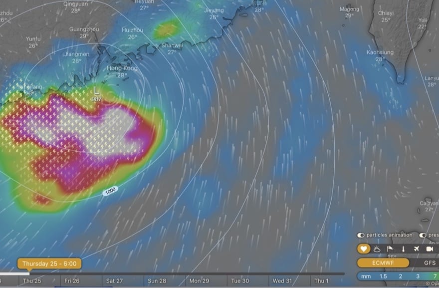
25 August 2022 (evening) update: Ma-on took a track somewhat south and west of earlier forecasts; passed within 200km of Hong as a severe tropical storm early this morning. So, “no biggie”. Quite dry while it passed Hong Kong too, with intermittent showers; though still some heavy rain in evening.


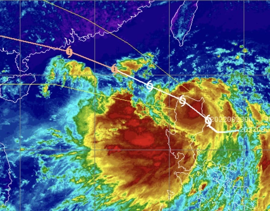
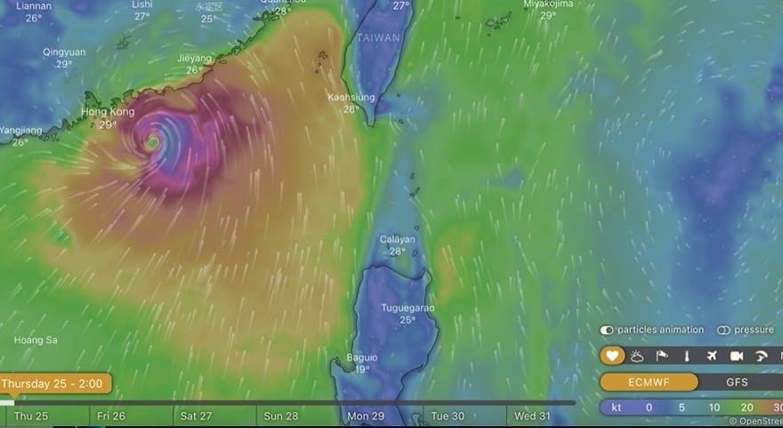
23 August 2022 (aft): Ma-on intensified into a severe tropical cyclone; but as it passes over north Luzon, track maybe shifted slightly south/west of Hong Kong, rather than pretty much direct hit as was forecast, as per GFS here. Still time to change this. Will be closest early Thursday 25th morning; which also coincides with high tide – so if strong southerlies/easterlies could be some storm surge here.
Does appear that most rain will be to south of Hong Kong [perhaps along with strongest winds, in rain bands].

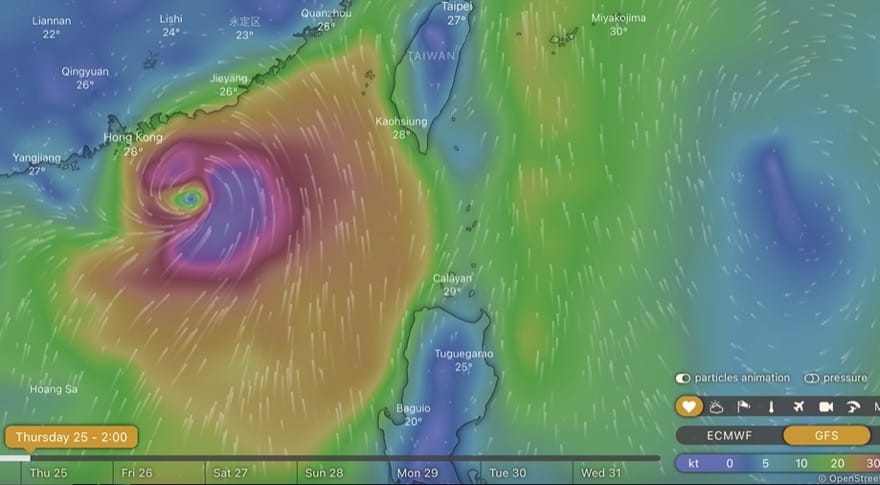
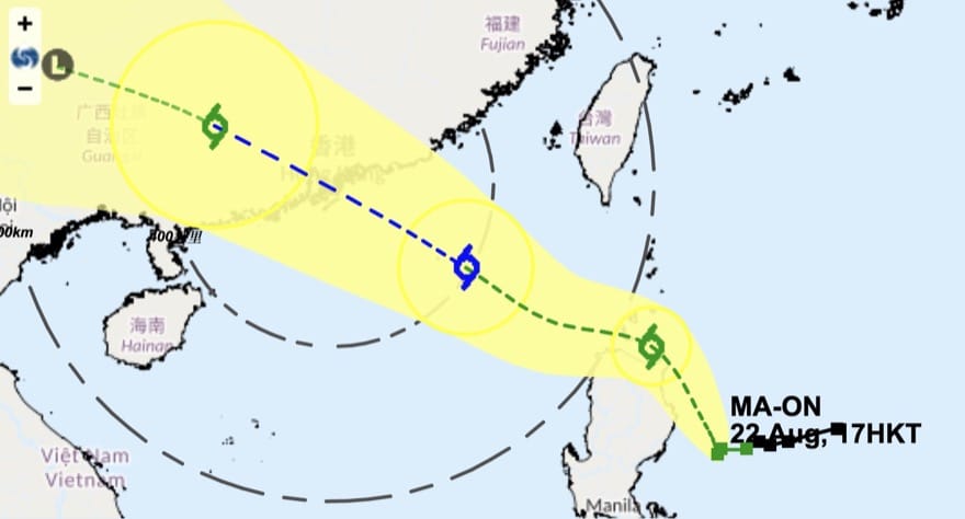
22 August, 2022: pretty good agreement in forecast models that Ma-on, a tropical cyclone just forming to east of Luzon, will head for Hong Kong. HK Observatory forecasting at least severe tropical storm strength, might become a typhoon – with rapid intensification helped by the recent hot weather, plus heat stored in ocean [more with global warming]. Looks like a direct hit is possible, maybe early on Thursday.
Fast moving storm; if it indeed passes just south of Hong Kong, the winds north and just east of eye [easterlies, then southerlies, roughly] could push a storm surge: much worse if in morning with high tide, not so bad perhaps if in afternoon with low tide.
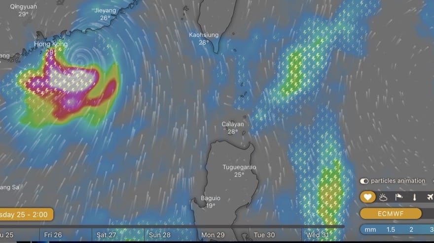
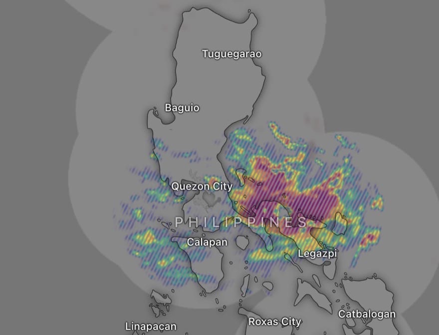
Also looks like a “wet” storm; radar here, too, with current rainfall indicated by Philippines radar. Could be intense rain over Hong Kong, with thunderstorms; then rain moving inland over south/southwest China.
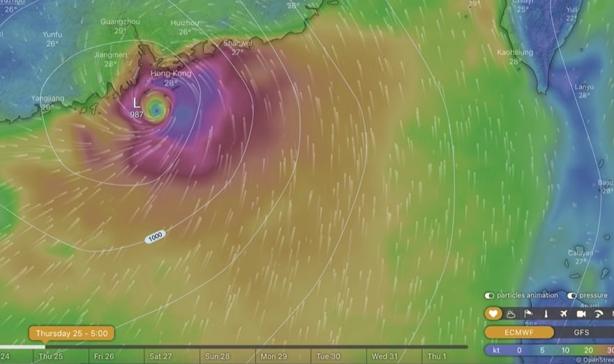
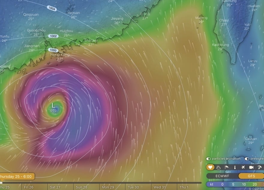
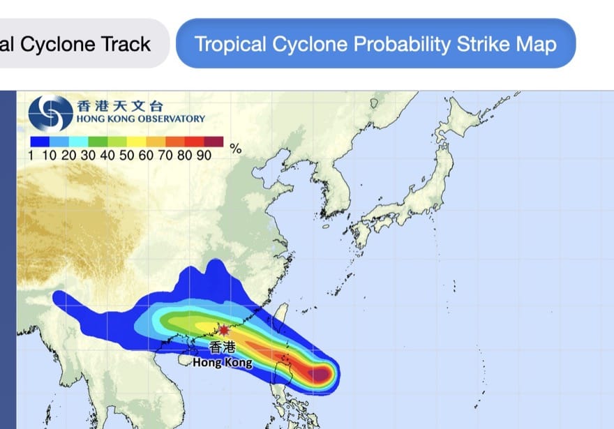
More updates to come; meanwhile, a few images from windytv [GFS and ECMWF forecasts for wind – stronger storm forecast by GFS], HK Observatory:
Weather including tropical cyclones

Rare November Tropical Cyclones Including Typhoons in Hong Kong
As I write on 13 November 2024, Tropical Cyclone Toraji is set to pass over Hong…

Typhoons and Rainstorms Past Help Hong Kong Forecasts Today
Wetter, Wilder Weather Events Loom with Warming World You may find yourself on a Hong Kong…

“Typhoon to Hong Kong Soon” Makes Great Clickbait
While Hong Kong is sometimes hit by typhoons, predicting them in advance is tricky. Yet this…

Lightning-packed Supercell over Cheung Chau, Hong Kong
Yesterday evening (30 April 2024), weather monitoring imagery showed an intense rainstorm/thunderstorm area – a “supercell”…

Severe Typhoon Mangkhut highlights perils of massive reclamation by Lantau
Typhoon Mangkhut helped show “storm surge” is a threat to modern cities, not just something for…

Typhoon Jebi a Warning for East Lantau Metropolis aka Lantau Tomorrow Vision
To anyone concerned about plans for Lantau Tomorrow Vision, the clobbering of Kansai by T Jebi…
Mad Lantau Metropolis Plans Should be Scuppered by Storm Surge Threat
A consideration of science suggests the reclamation plans, including for East Lantau Metropolis are foolhardy, even…
As Hong Kong Sizzles the World Keeps Warming
While climate change may have long seemed an issue for hardcore, tree-hugging environmentalists, concerns are spreading.
Typhoon Haiyan Lessons for Hong Kong
Typhoon Haiyan was among the strongest storms on record, and devastated a swathe of the Philippines.…

Forecasters Benefit from Flights into Typhoons
As well as computer models and weather station info, the Hong Kong Observatory is uses flights…
Hong Kong weather outlook warmer wetter wilder
With global warming only just getting started, according to scientists, it’s time for Hong Kong to…

Typhoon Vicente hurricane force winds blast Hong Kong
Severe Typhoon Vicente slammed Hong Kong on 23 and 24 July 2012, with hurricane force winds…

Severe Tropical Storm Pabuk
Severe Tropical Storm Pabuk looked set to have passed Hong Kong, barely causing an impact other…
HK Number 8 Signal
Hong Kong's Number 8 tropical cyclone warning can be controversial.

Hong Kong Typhoons including Calamitous Storm Surges
Typhoons have sometimes caused massive damage and loss of life in Hong Kong. Just months after…
Hong Kong tropical cyclones
Hong Kong can be impacted by tropical cyclones including and typhoons. Happily, typhoons are scarce near…