Support this site; gifts or treat yourself:

Tung Ping Chau beach
Though it doesn’t boast Hong Kong’s best beach, Tung Ping Chau is a place where you can sometimes stroll the sand and feel almost like Robinson Crusoe – though you have to ignore the rural Shenzhen coastline little more than a stone’s throw away! – and its beach is special because you can walk into the water, and moments later snorkel or dive over some of Hong Kong’s finest corals.
If you’ve been to the island, you’ll know there’s an easy way to the beach. You alight from the ferry, walk off the pier, turn right, and you’re there. But as we’re talking about hiking, you should just admire the beach as you leave the ferry, and walk on past.
There are several paths to help you explore, perhaps by following the circuit of the island and occasionally heading down side trails. It’s of course up to you whether you walk the circuit clockwise or counter-clockwise, though I suggest you decide which direction might be most peaceful. Tung Ping Chau has lately become a magnet for “eco-tours” – which to my eyes often just seem to be great crowds of people following leaders with megaphones – and if there are tour groups as you leave the ferry, you might see which way they head, then set off in the opposite direction.
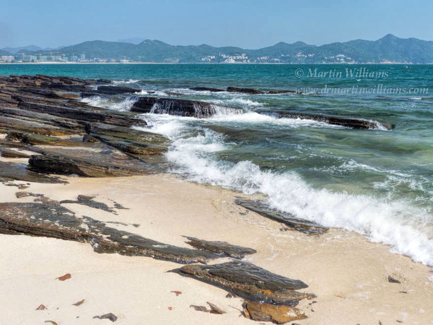
As Peng Chau is a relatively flat island, thanks to the layered mudstone that’s so different from the volcanic rock typical of Hong Kong, the island circuit’s an easy walk. If you choose counter-clockwise, you can take a concrete footpath north to a hamlet, then turn to the tide line and continue towards Tung Ping Chau’s northern tip. Here, there’s a short climb to a path through small trees, which swings round to follow the low cliffs of the west coast.
This is a relatively wild coastline – the islanders who once farmed on Tung Ping Chau built their hamlets on the more sheltered east coast, or in more central areas, where woods are now reclaiming the landscape, with trees sprouting from ruined houses. You can look west across Mirs Bay, to the seemingly distant hills of the eastern New Territories.
The path climbs a little, to the highest point on Tung Ping Chau, 48 metres above sea level. Then, you can descend, and explore the rock pools and natural rock sculptures of the island’s southeast corner. North again, you’ll pass through a small village, and soon return to the pier, and the beach.
Though there are no government facilities at the beach, if you check out the village just north of the pier you might find there are masks and snorkels for hire. [[I’m not sure about this]]. And you can return here for a shower and perhaps a meal, after you’ve explored Tung Ping Chau’s underwater realm, hopefully enjoying seeing some of the island’s 30 species of hard corals, and finding other interesting marine life including colourful fish.