The Sunset Peak massif dominates the interior of eastern Lantau, and its high grassy slopes make for some of the finest upland hiking in Hong Kong. There’s an expansive feel to the landscape, which seems splendidly remote from the city – making for a welcome escape, especially during the pandemic of our time.
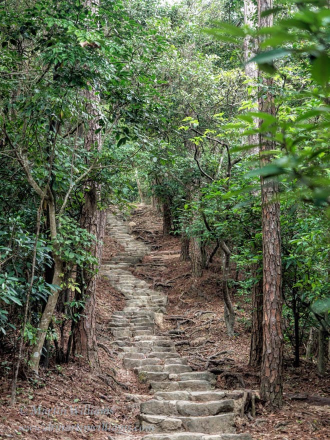
But first, you have to get there, and that means hiking up a winding trail with boulder steps, and later descending another rocky stairway. The most popular route follows a section of the Lantau Trail, which you might start from the western end, at Pak Kung Au, 333 metres above sea level; or at Nam Shan to the east.
Nam Shan is perhaps half an hour’s walk from the ferry pier at Mui Wo, though you could save time and effort by taking a bus or taxi. It’s around 100 metres above sea level, and is in a dip between hillsides, with a pavilion in a grassy area. A signpost indicates the way to Pak Kung Au, suggesting the hike there will take 2¾ hours. In my view, you might take this with a pinch of salt, for while some people might stride jauntily up and over the mountain in this time, and others seemingly run the trail with blissful ease, this is a relatively tough outing, and could take six hours with stops for rests, photos, and a picnic lunch.
From Nam Shan through trees
“The mountains have usually a dreary and barren aspect … trees are seldom met with,” wrote the Reverend R. Krone in 1858, as referenced in Hong Kong Country Parks by Stella Thrower. But as in much of Hong Kong, there was extensive reforestation of lower and mid-elevation slopes last century, particularly to help moderate and maintain water flows to Shek Pik Reservoir, which was built in southwest Lantau from 1957 to 1963. Now, the plantations are luxuriant, and the trail from Nam Shan leads up through the densely arrayed trees.
While affording welcome shade if it’s sunny, the trees block views, making for somewhat monotonous hiking as the trail climbs the steep slope. At last, the trees give way to shrubs and grass, and you can look down to the south, finding you’re already above the hills of the Chi Ma Wan Peninsula. Near the peninsula’s southern tip, Shek Kwu Chau appears as a compact island with a couple of low, rounded hills.
Small boats are clustered off the west coast of Shek Kwu Chau. These include barges and boats with cranes, all working to build an island that will host one of the world’s largest waste incinerators. An environmental assessment on siting this incinerator argued against a site on a Sai Kung island, as it would be visible from country parks. Yet here you are, in South Lantau Country Park, and it’s obvious the incinerator will stick out like a sore thumb, except far uglier and larger, with a chimney maybe 150 metres high.
Ah well, it hasn’t been finished yet, and the scenery mostly looks natural and glorious, including the grassy slopes above, and woodland in a nearby ravine, where trees of various species are differing shades of green, some of them peppered with white flowers.
A stream, and easier hiking along the upper ridge
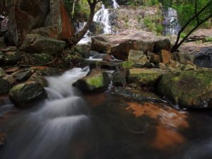
There’s still some climbing to do, but it’s not simply up, up and up. The trail levels a little, angling left to cross a tiny stream, and pass through a grove of slender bamboo where there’s another stream – which on hot days can provide a welcome chance to splash your face and even sun hat and shirt with water to help cool off a little.
Then, up again, to cross a ridge by a junction with a slim path that leads east, towards 766-metre Lin Fa Shan. The Lantau Trail continues westward, and the hiking is easier now.
Now, the main views are to the north. The airport is below, nowadays not busy with flights arriving and departing, but serving more as a gigantic park for serried ranks of planes, grounded while so few people are entering and leaving Hong Kong.
As I wrote this, Covid had killed the typical tourism industry, pretty much worldwide. But Hong Kong still has locals as tourists, expecially in outdoor places like country parks, and these tourists can help keep some small businesses afloat, albeit with caveats like the need for great care regarding virus transmission. Plus while we may be almost confined to Hong Kong for months, outings like this on Sunset Peak might serve like mini holidays, helping ease some of the stress in the city.
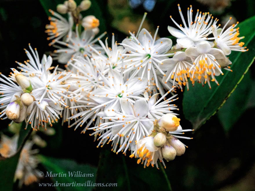
A little higher, the path leads through a band of woodland, with trees growing between boulders flanking the upper reaches of a stream. If you’re lucky, some might be in flower, like Sweetleaf with its clusters of fragrant white blooms attracting bees that busily collect pollen.
Then, there’s more grassland. “The Chinese are accustomed to burn down the grass on the tops of the mountains in order to procure a more luxuriant herbiage [including for cattle grazing],” wrote the Reverend Krone, and trees still find it difficult to grow on these high slopes where much of the soil has been eroded away.
If you’d like to switch to a forest walk, you could do so at a junction with a right turn to the Wong Lung Hang Country Trail. The forest is certainly attractive, in places looking almost as if there might be elves nearby. But, oh dear! The steps! The trail drops relentlessly down the steep side of the valley above Wong Lung Hang Stream, to near Tung Chung, with somewhere around a bazlillion steps. So, maybe keep to the Lantau Trail just now.
The former missionaries’ resort
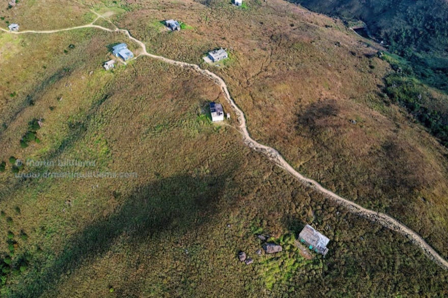
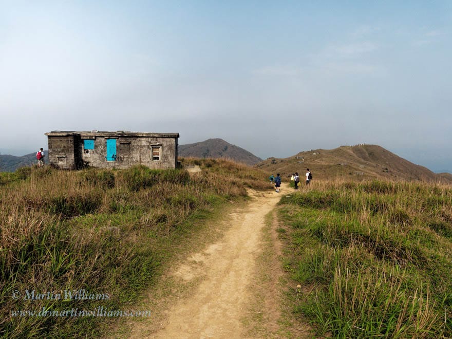
The path turns a corner, to a high valley, where the slopes are scattered with around twenty squat square, stone-walled huts. According to an article in the Independent, these were built during the 1920s as a “resort” for missionaries working in China, who stayed during the hot summer months. It seems most are still maintained, though little used nowadays.
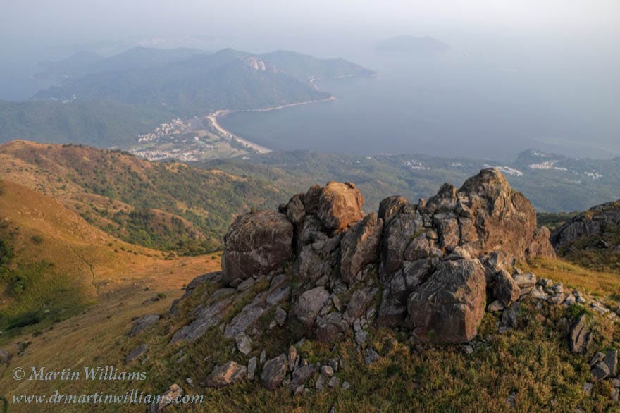
At the head of the valley, the path swings left. A short side trail leads to a rocky outcrop with wonderful views down to southeast Lantau.
There’s a short uphill stretch, then another side trail, on the right. Though not signposted, this leads to the summit of Sunset Peak. It’s a fairly easy climb over the undulating grassy landscape, to a cluster of boulders by a sign noting the elevation is 869 metres – making this the third highest mountain in Hong Kong, after Tai Mo Shan and Lantau Peak.
A few narrow trails offer ways down from here, but perhaps involve scrambling, so it may be best to retrace your steps to the Lantau Trail. This trail no longer climbs, but is almost level across the southern shoulder of Sunset Peak.
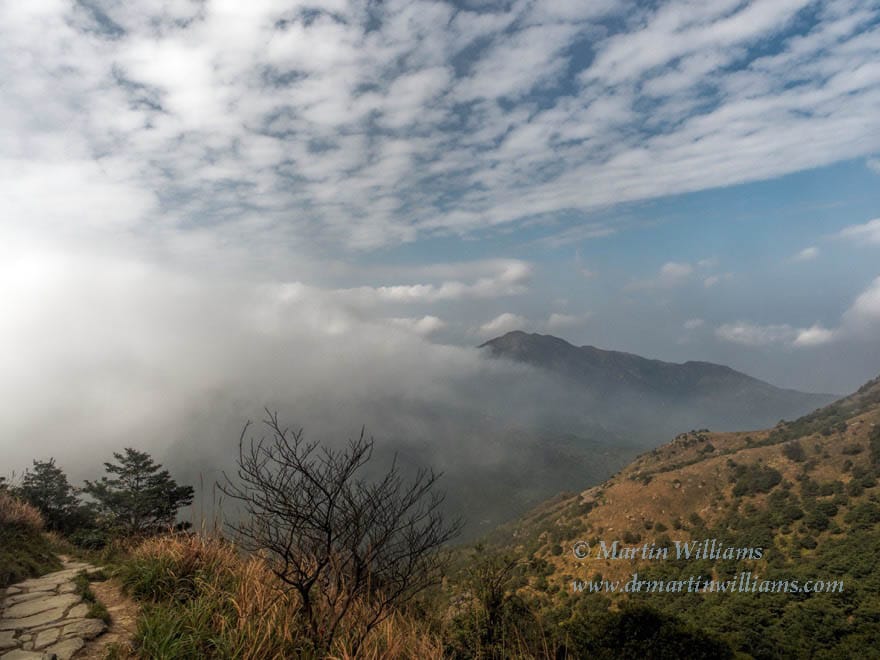
And soon, the downhill stretch begins. Again, there are flights of stone steps. The sharp cone of Lantau Peak dominates the western horizon – and if you’re feeling energetic, you might aim for this too, keeping to the Lantau Trail as it climbs to the summit, then drops to Ngong Ping.
The scenery changes little as you descend, till grassland gives way to woods. Passing through trees, the trail turns left and right, and left again, always downhill. The sounds of buses on the road below become louder, and eventually you arrive at Pak Kung Au, maybe all set to carry on hiking, or perhaps feeling a tad weary, ready for home.
Travel tips
While most people heading for Sunset Peak travel via Tung Chung, in these days of the Covid it may be worth considering taking one of the ordinary (aka slow) ferries from Central Pier 6 to Mui Wo – as you can travel in outdoor air in ordinary class, and sit outside in deluxe class. From beside Mui Wo ferry pier, all buses stop at Nam Shan, or you could walk up alongside the road. To return via Mui Wo, take the 3M bus from Pak Tung Au.
Remember standard advice for hiking – such as using sunscreen, taking plenty to drink, and checking weather forecasts to ensure thunderstorms are not likely.