
- This topic has 3 replies, 2 voices, and was last updated 15 years, 11 months ago by
 4047536.
- AuthorPosts
- 23 June 2008 at 9:13 am #7127
I have personally found several paths on HK Island that were closed by landslips after the Black rain storm on June 7th – and some may not reopen for months. So perhaps we can inform each other of known closed routes and when they reopen – saves so many steps retraced !
1. Worst I know is the Conduit path – from Conduit Rd to Queen Mary Hospital – is throughly closed by a substantial slip above the University – about 40m of path completely missing
2. Lower end of Chatham path – just above May Rd. was blocked with mud on 8th June – might be reopened now ?
Anyone have more to add to the list ?
6 July 2008 at 12:46 pm #8162I went to Lantau Island yesterday, for short hike at Ngong Ping. Several landslides were very obvious, including blocking trails.

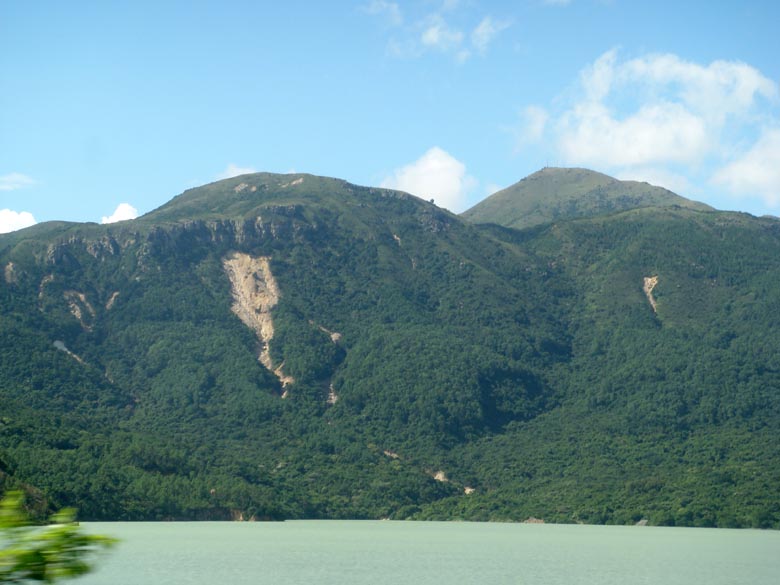
Here’s the largest landslide we saw – above Shek Pik Reservoir (from the bus). Clearly, ripped through Lantau Trail section that leads down from beside Ngong Ping; and I’d think it will be quite some time before this stretch of trail can be restored.
Heading uphill, the bus passed a section of road – near turn off to Ngong Ping – where a landslide had evidently at least partly blocked the road.
At Ngong Ping, we walked towards the Nei Lak Shan Country Trail, to start at the end near where a trail drops down to Tung Chung. A guy warned us this was blocked, and we would have to burn back, but as we’d walked along past the Tea Gardens, hadn’t seen scarring on the hillside, so thought we’d give it a go.
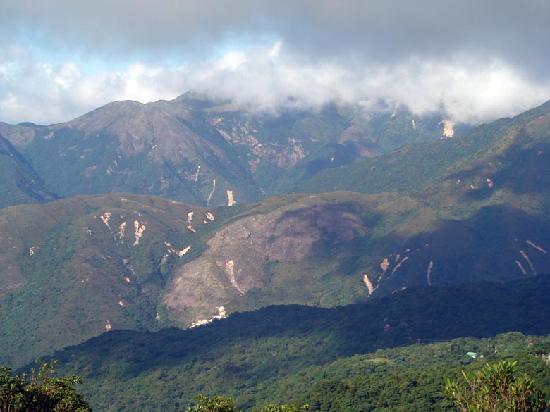
Here’s a shot looking east northeast from the Nei Lak Shan trail, towards northern slopes of Sunset Peak. Clearly, several landslides scar the landscape; tho I wasn’t sure if and where they have cut through trails.
We walked along the trail, taking the route around southern slope of Nei Lak Shan – great views over Ngong Ping. Eventually came to a landslide as reached the end of the trail, near junction where can walk right, and perhaps follow remainder of the circuit the trail makes around Nei Lak Shan. We crossed this without much difficulty, tho needed care; helped that the weather had been dry (and that it was a few days since the landslide, so slope somewhat stabilised).
From here, walked down, to meet the main trail that runs close by the Lantau Skyrail; walked down to this over a v small landslide. Looked like landslie material had been cleared from this path; if so, I’d reckon as it’s important for Skyrail (inc emergency access).
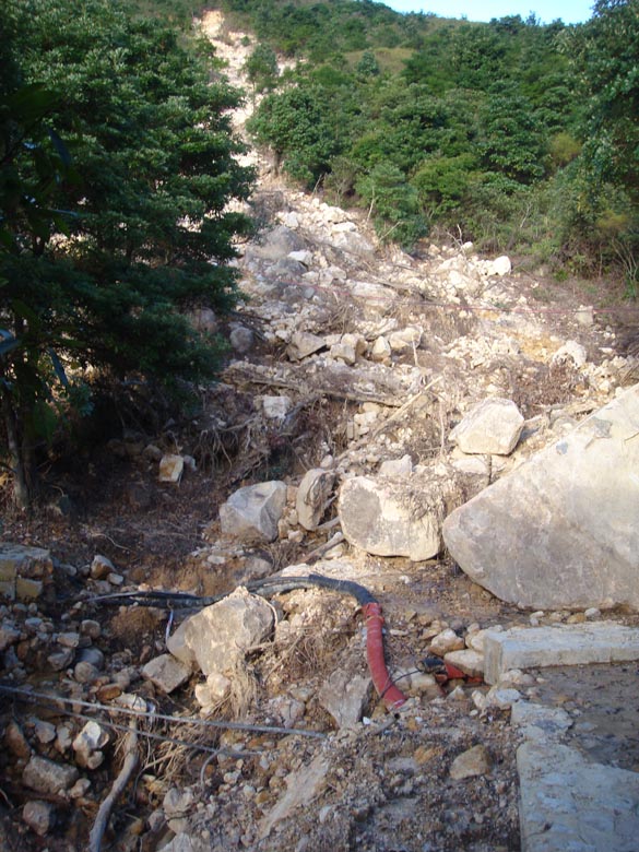
Then, turned towards Ngong Ping. Crossed lower part of the landslide we had walked over a few minutes before; here, the landslide had clearly rushed down a ravine, sliced through a path made of concrete and rocks.
19 August 2008 at 1:39 pm #8174I took this on a boat trip round the west end of Lantau. Although Tai O was cut off by slips for a while the most damaged slope is round the next headland west.

What I find interesting is that these slips are happening on slopes that have had no human activity – these are quite natural events and seem to be the main mode of erosion that shapes the landscape of HK.
19 August 2008 at 1:40 pm #8178Chatham path in mid levels is open again, the path round LuFu Shan to Pokfulam is closed – but you can hike up round the slip – the Hash did this a few weeks ago and others have cut across the concrete temporary covering.
The path from Ngong Ping to Shek pik is marked closed but none of the slips are too hard to cross – but a nest of very agressive paper wasps is harder to deal with !
- AuthorPosts


- You must be logged in to reply to this topic.