- This topic has 10 replies, 2 voices, and was last updated 15 years, 10 months ago by
DocMartin Williams.
- AuthorPosts
- 19 September 2008 at 2:45 pm #7146
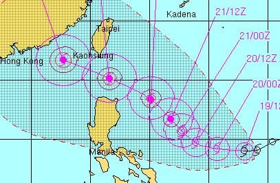
Just seen forecast for Tropical Storm Hagupit; and Joint Typhoon Warning Center track is "interesting" – ie, could become pretty powerful typhoon, and head to somewhere around (or over) Hong Kong.
Edit: indeed proved "interesting" – one of the strongest storms (or the strongest storm) to affect Hong Kong in recent years. Moved west across sea to south of Hong Kong, approaching to within 180km (roghtly the distance as I edit this, with winds at Cheung Chau severe storm force to almost hurricane force; night time, so not good for photos/video). Here’s some video I shot this afternoon – winds stengthened quickly from lunchtime; waves built up rapidly too.
[video:http://www.youtube.com/watch?v=rYa4Lp5-BRM%5D
Here’s some video from Cheung Chau this morning, including winds/rain as eye making landfall around 300km wsw of Hong Kong, and some coastal damage on Cheung Chau:
[video:http://www.youtube.com/watch?v=eQKU5Nu9Qds%5D

Was a forecast for the storm; in the event, it took a somewhat more southerly course, so not direct hit on HK.
23 September 2008 at 12:31 am #8201Hagupit has moved on track somewhat south of the forecast above; even so, set to impact Hong Kong, perhaps a strong impact if at all close to us.
Now, past Luzon, and will be closest to us sometime this evening/overnight, probably over 100km away. With max sustained winds of around 100 knots (190km/hr), it would rank as Category 3 on hurricane scale, so powerful – even well over 100km away, will be strong winds, heavy rain.
Currently Number One signal in effect; could be Number Three soon [in a couple of hours], and Eight may be issued this afternoon.
23 September 2008 at 2:51 am #8202Number Three signal issued as Typhoon Hagupit barrels towards s China coast (maybe tracking slightly more towards us than forecast)
Getting windy here on Cheung Chau; trees bouncing about, sea choppier. A little rain, too; spots only as yet.
Winds to over 50km/hr; unusually for approaching storm, CC max wind so far higher than Waglan.23 September 2008 at 7:04 am #8204Went out for lunch on Cheung Chau; pretty quiet as walked along beach on way there.
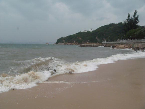
After lunch, again walked by beach, and windy, with some pretty good waves on beach and pounting rocks; winds freshening since then – HK observatory shows winds now reaching gale force for Cheung Chau. Also, rain becoming persistent.
 23 September 2008 at 11:21 am #8205
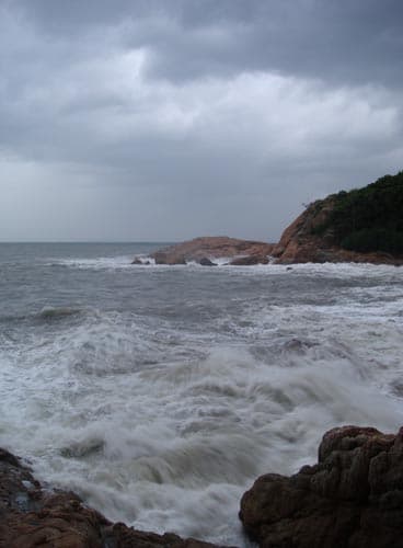
Bigger waves rolling in to Cheung Chau late this aft; also rainstorms passing. Took this shot at southern Cheung Chau, where I was sheltered from the northerly wind, but still large waves.
Quarry Bay tide level around 0.5m above forecast [gap seems to be increasing, so bit of a storm surge]; set for high tide around 4am.
http://www.hko.gov.hk/tide/marine/hko_qb.htm 23 September 2008 at 3:35 pm #8207
Even though the eye of Hagupit is maybe around 180km away, it is powerful enough to be causing a storm surge in Hong Kong.
At Quarry Bay, tide height now over 1m above forecast; while at Tai Po Kau (Tolo Harbour) tide around 2m above forecast; still rising at both localities, with high tides forecast for around 4am (now 11.35pm). Here at Cheung Chau, too, tide high due to the storm – now over 1m higher than around same time yesterday.
27 September 2008 at 2:42 am #8208The storm surge evidently hit Hong Kong far harder in the west than in the east (at Sai Kung, not much more than a whole load of lap sap floating in the typhoon shelter).
News report from Chinese language tv showedTai O, Lantau, during the storm surge (inc intrepid reporter up to his chest in water; evidently on a street!).
[sadly, link to this not working any more; aug 2022]
27 September 2008 at 3:00 am #8209NASA has a pages with some images of Hagupit, inc revealing it was extremely cold at the toip of the storm, and there were thunderstorms up to 15 km high:
27 September 2008 at 1:38 pm #8210Anonymous
I can certainly see the storm surge from the video you posted. But only because I know that bit of coast normally. I can also agree with the video itself. ie. not too much going on to scare us then next day more than normal damage. There is a lampost down and lots of tree damage at TaiPoKau. I was walking in TaiPoKau reserve, and checking out some watercourses between 1200-1600 that day. Got wet once we left the forest, but that was it. Went out for a drink and didn’t have any problem, a few drops of rain. Slept at my brother’s top floor Homantin Hill flat and didn’t notice anything. Walked through Kowloon Park next day without even thinking and got blocked by a huge tree covering a 50m diameter area.
It was certainly a strange one. My mother said that the airport at 0700 next day was the worst wind she had experienced in 25yrs. For me it was at it’s worst whilst I was having a drink in Jimmy’s next to a glass window. Damp but no wind.28 September 2008 at 1:44 pm #8212Went to Lantau today; partly for day out to some great places, also to see some of damage caused by Typhoon Hagupit – chiefly by the storm surge, coupled with winds to around hurricane force.
Typhoon Hagupit damage at Pui O, Lantau, Hong Kong
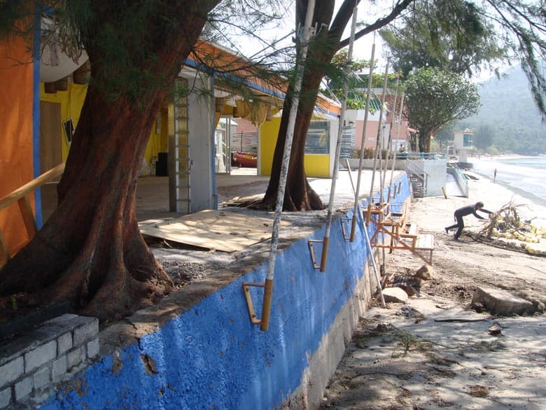
We walked to Pui O; here saw the badly hit Treasure Island. Notice where paint ends on wall; below this was sand before I believe. [BUt far more sand stripped away at Tong Fuk, later]
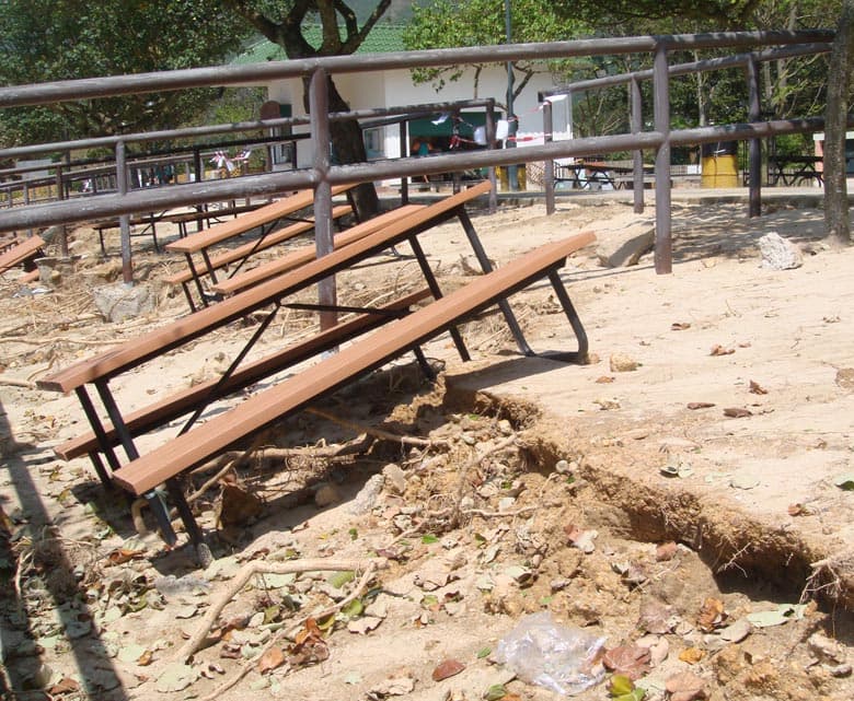
Near Treasure Island, by campsite, a row of picnic tables were at crazy angles like this – as sand evidently washed away from below them. One of the tables had been tossed onto beach above the tideline. There were some trees down along tideline, too.
Typhoon Hagupit damage at Cheung Sha, Lantau, Hong Kong
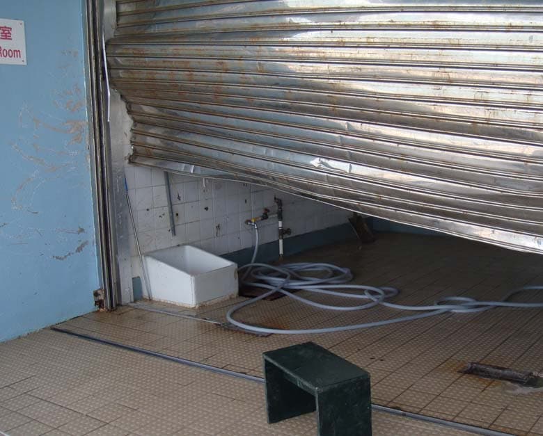
Next, headed to upper Cheung Sha (western end of the beach). The swimming beach facilities had been badly hit; inc this metal door bashed.
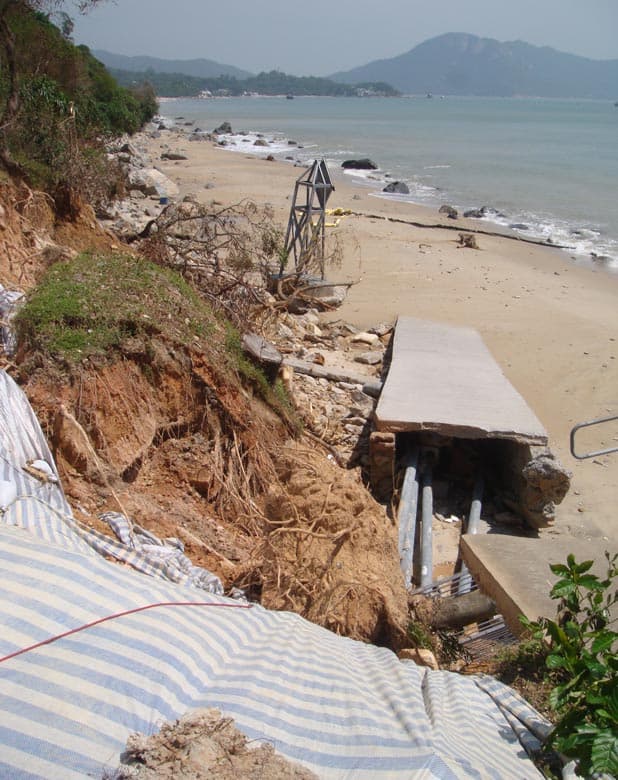
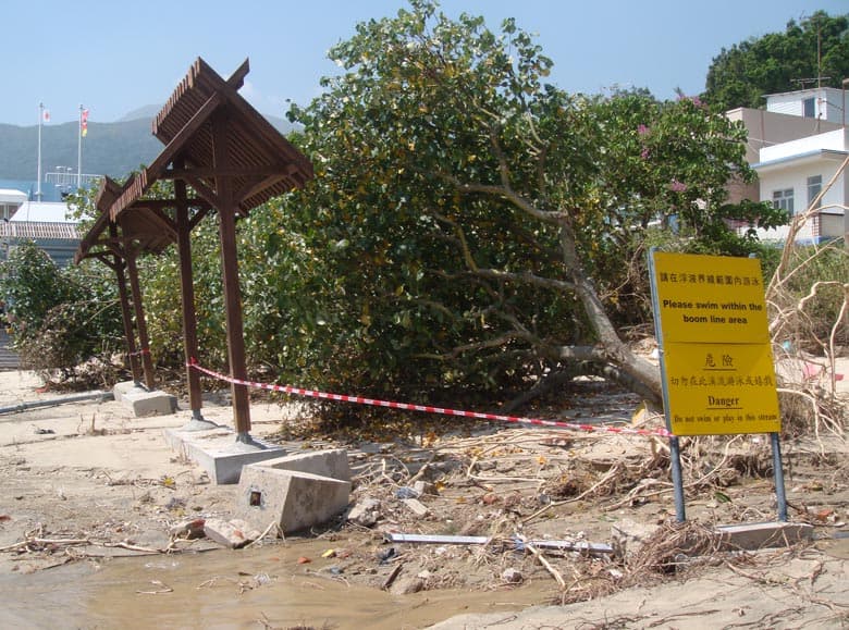
There had been a path down to the beach beside the swimming facility; this had been wrecked – several trees were down above tideline near this.
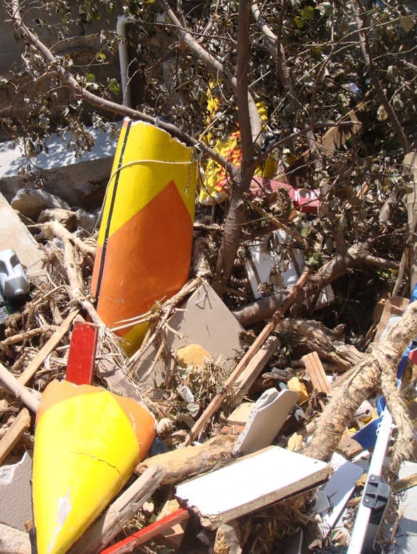
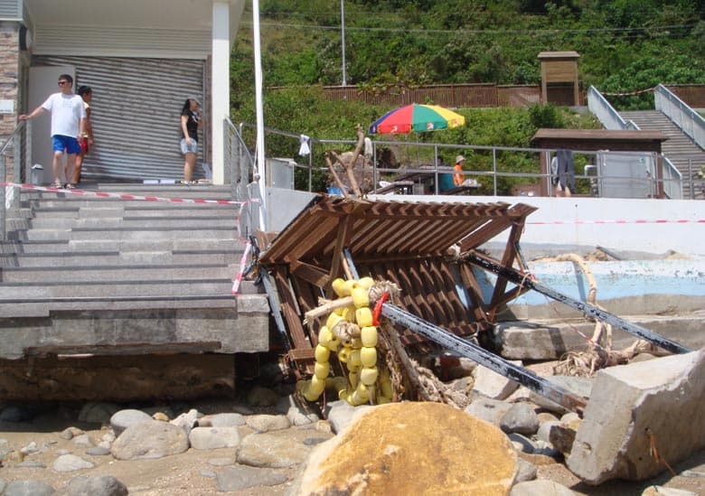
Just by this broken path was a pile of debris, including remnants of a lifeguards’ rescue boat.
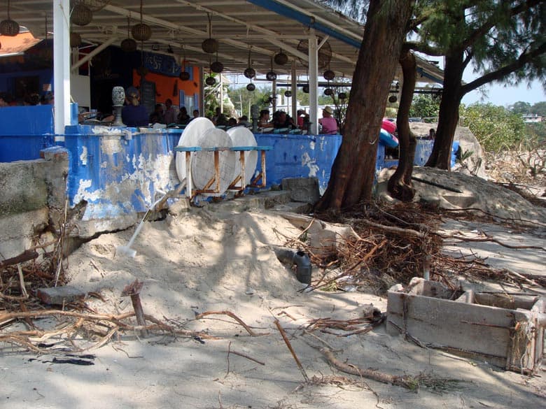
We later went to Lower Cheung Sha for lunch. Compared to Treasure Island, seemed restaurants here had fared pretty well, tho again the wind and waves had caused damage, and sand had been eroded away. Here’s the popular Stoep – less shady after large tree or two down.
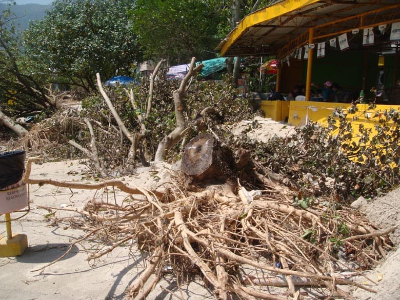
Here’s a tree down right outside a Thai restaurant next to the Stoep.
– and here, a row of battered trees just west of the village. In foreground here, there was previously a small stream and a pool.
Typhoon Hagupit storm surge damage at Tong Fuk, Lantau, Hong Kong
We also went further west, to Tong Fuk. Here, there had been far more erosion than even at Cheung Sha, so close by. This scene was reminiscent of tsunami damage I had seen on south coast of Sri Lanka (tho on far smaller scale): likewise about ruined, w soil, vegetation gone, to a line, above which all seemed about normal.

At Tong Fuk beach swimming facility (lifeguard etc here), major damage. Also, sand had been stripped from the beach, even exposing some huge boulders that had been covered with sand. The steps and paint on the wall indicate former sand level – I reckond a couple of metres of sand had gone.
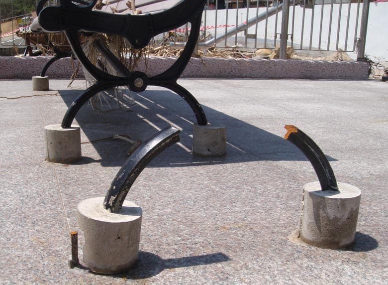
Also missing from Tong Fuk – a bench. All that remained were these supports, made of thick metal – snapped right through by the force of the waves.
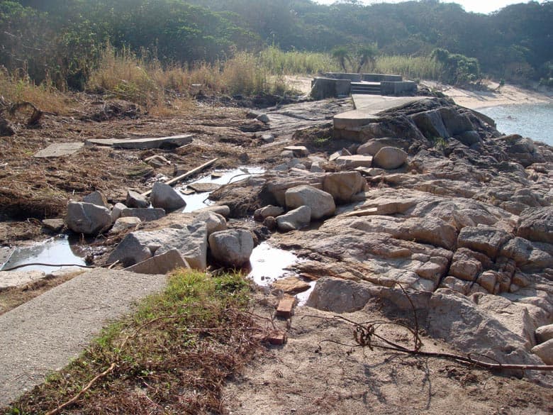
29 September 2008 at 2:58 pm #8213I went to southwest Cheung Chau this morning, partly as interested to see if affected by Hagupit. Found a section of the path to Italian Beach had been smashed, with even rock below it gone; vegetation showed waves had washed well past the path. (I’ve been here over 20 years; this path intact all the time, till now.)

- AuthorPosts
- You must be logged in to reply to this topic.
