Soaring above the new town that bears its name, Ma On Shan – Horse Saddle Mountain – is among Hong Kong’s most distinctive and highest peaks. And while also near the expanding Sai Kung town, it makes for outstanding hiking through majestic landscapes that in places seem remote from urban areas.
Reaching the top is somewhat challenging, but the rewards are panoramic views from the most splendiferous summit in Hong Kong. Even if you pass by the main peak, there’s much to enjoy, though it’s best to only hike here in fine weather and during daytime, taking plenty to drink if it’s hot.
Woodland Stroll
Though there are several ways to climb Ma On Shan, one of the best follows stage 4 of the Maclehose Trail, starting at Kei Ling Ha, along the road from Ma On Shan town to Sai Kung. At first, there’s a path curving gently uphill through dense woodland.
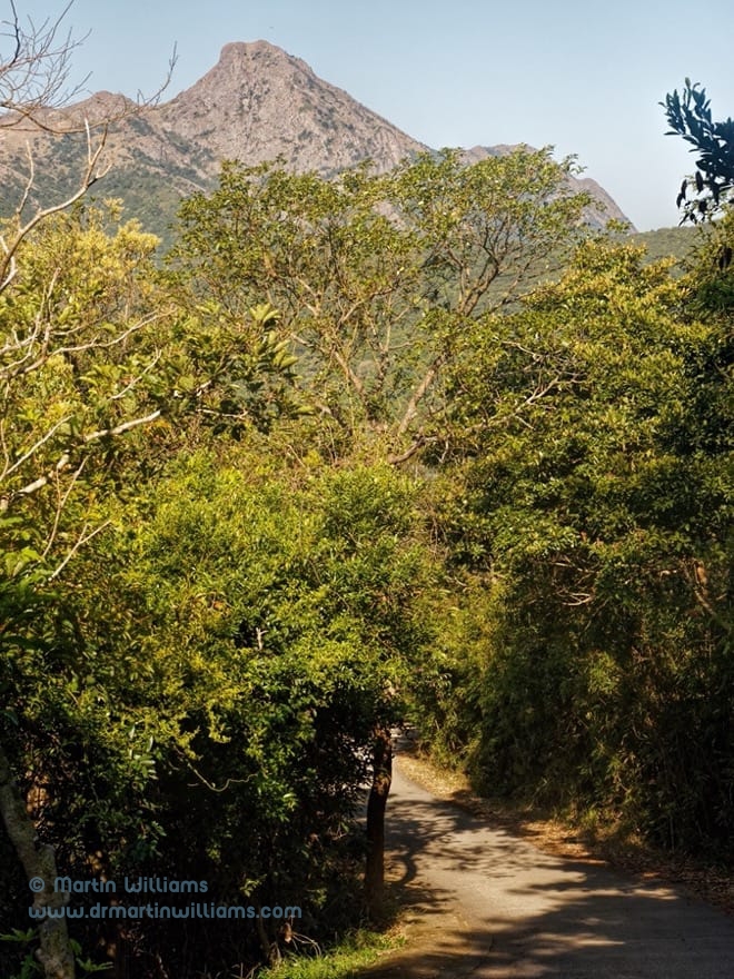
The trail joins a narrow road, passing a campsite and reaching the crest of a hillside where shrubs are colonising formerly open ground, largely obscuring formerly expansive views over Port Shelter and islands. The road dips towards the village of Wong Chuk Yeung, which is hidden away amidst the trees, and the Maclehose Trail bears off to the left.
Till now, hiking into the hills has been a cinch, with nothing to challenge even dedicated couch potatoes. But this all changes after a junction in the woods.
Going Up!
The trail winds up a steep slope, and though ultra-fit action sportspeople might stride up whilst chatting as casually as if chilling on a park bench [[as when I went…]], the rest of us could begin some serious puffing and panting up the flights of steps fashioned from rocks and boulders.
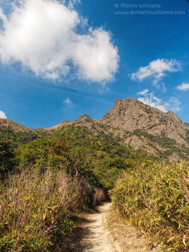
Around 120 metres above the junction, the slope eases. The woodland is thinner, looking younger here, dominated by camellias with trunks wrapped in ruddy orange bark. From below, there were glimpses of the rugged summit of Ma On Shan, but now it looms larger, the east face appearing almost vertical. “Woah!” you might think, looking at rocky ramparts of the kind that guard an orc fortress. “Am I really going up there?”
Well, you’ve come this far – so onwards and upwards, as the Maclehose Trail heads for a col south of the peak. The hillside here is being colonised by small trees, and bamboo thickets. These have in turn attracted several pairs of a small bird, brownish-flanked bush warbler – which is hard to see but readily heard, as its song is a long, loud whistle ending in an abrupt “wee-chuh“.
To Peak or Not to Peak?
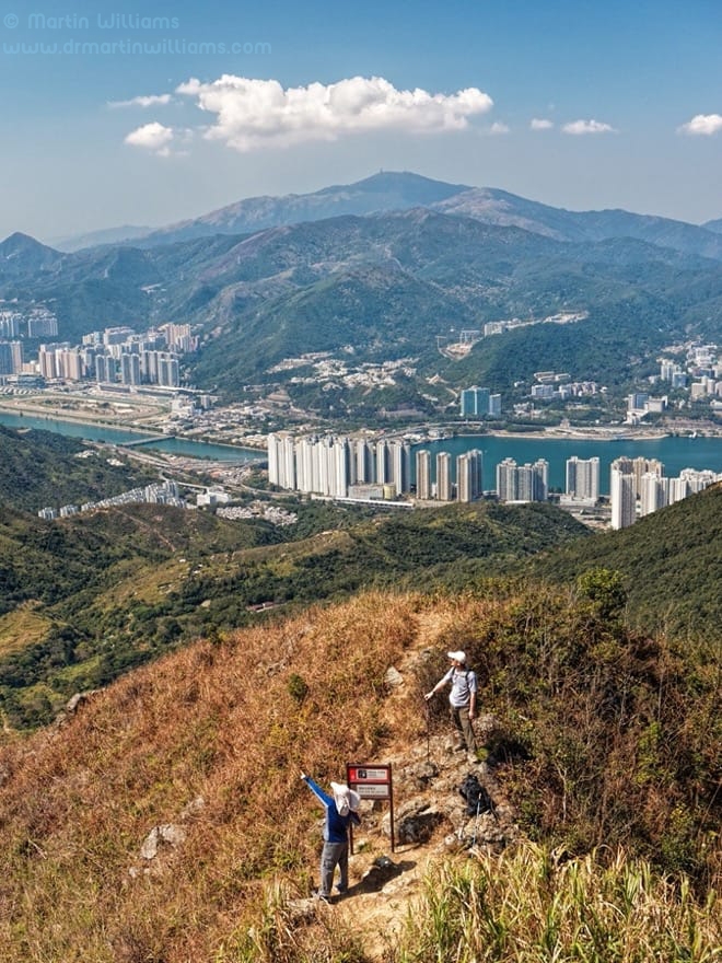
At last, the trail reaches the col. From here, there’s a downhill stretch of Maclehose Trail. But simply continuing would mean missing the best part of Ma On Shan, the summit area – and for that you must take a side trail.
Though well trodden, this trail is not easy. A sign even advises as much, noting, “Please do not proceed.” Especially if you’ve found the hike to the junction tough, you can pass it by, and continue with what’s still an exhilarating hike.

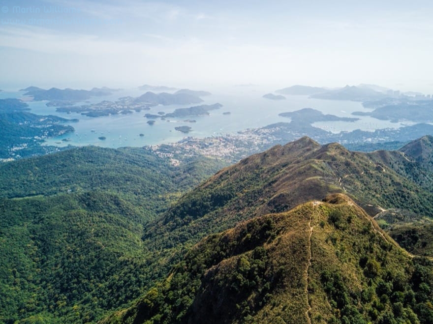
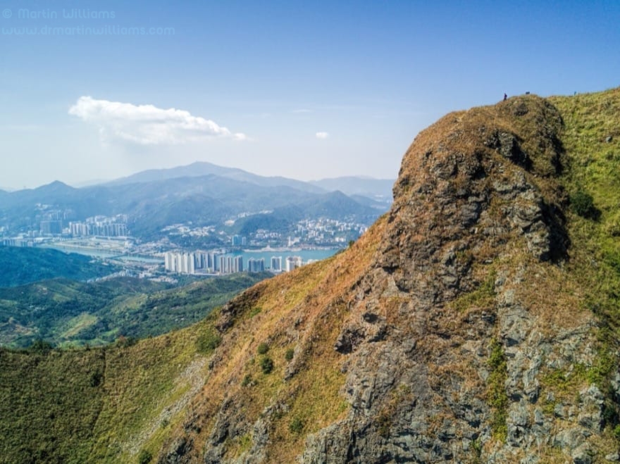
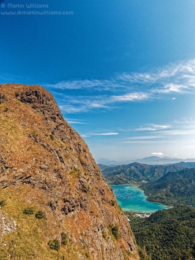
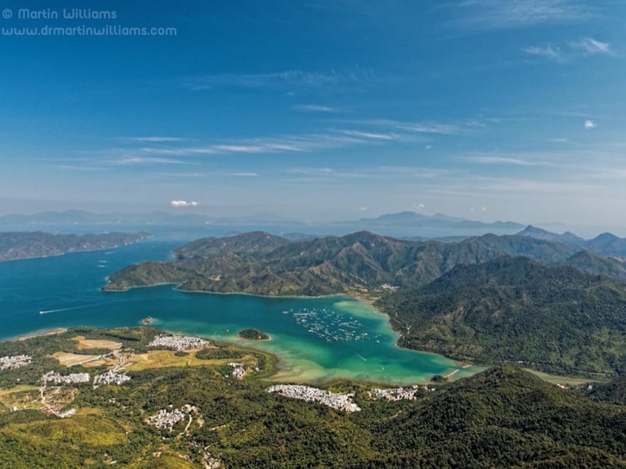
Ignore the sign’s advice, and you find the side trail is bound for a ridge, and in places requires careful scrambling up exposed soil where it’s hard to get a footing. The rewards are soon apparent, with the ridge affording magnificent views over the Sai Kung Peninsula, and the craggy summit close by.
There’s just a little more scrambling to reach the very top. It’s surely impressive in any weather, but on a clear day you can look north to Shenzhen skyscrapers, south to Hong Kong Island, east to the Dapeng Peninsula across Mirs Bay, and west to Tai Mo Shan that’s a backdrop to Sha Tin. Another peak hides Ma On Shan new town, but that’s just as well since it’s none too pleasing to the eye from any angle.
High Life

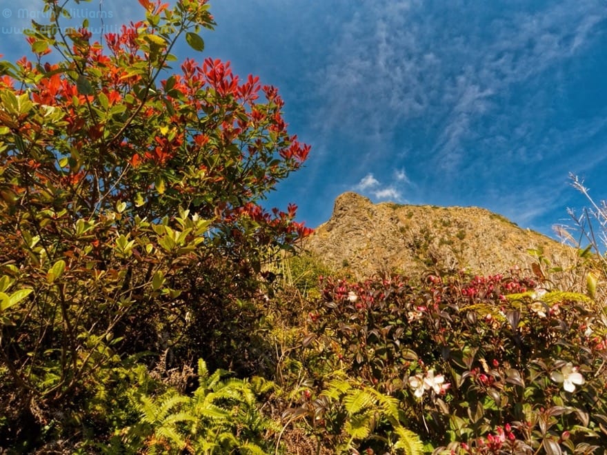
The upper slopes of Ma On Shan are a haven for plants and animals, notably species that are found in Hong Kong’s highlands. These include Upland Pipit, a small brown bird that might be found seeking insects on grassy patches. For some butterflies, hilltops like this are akin to singles bars, where the males show off in hopes of attracting visiting females.
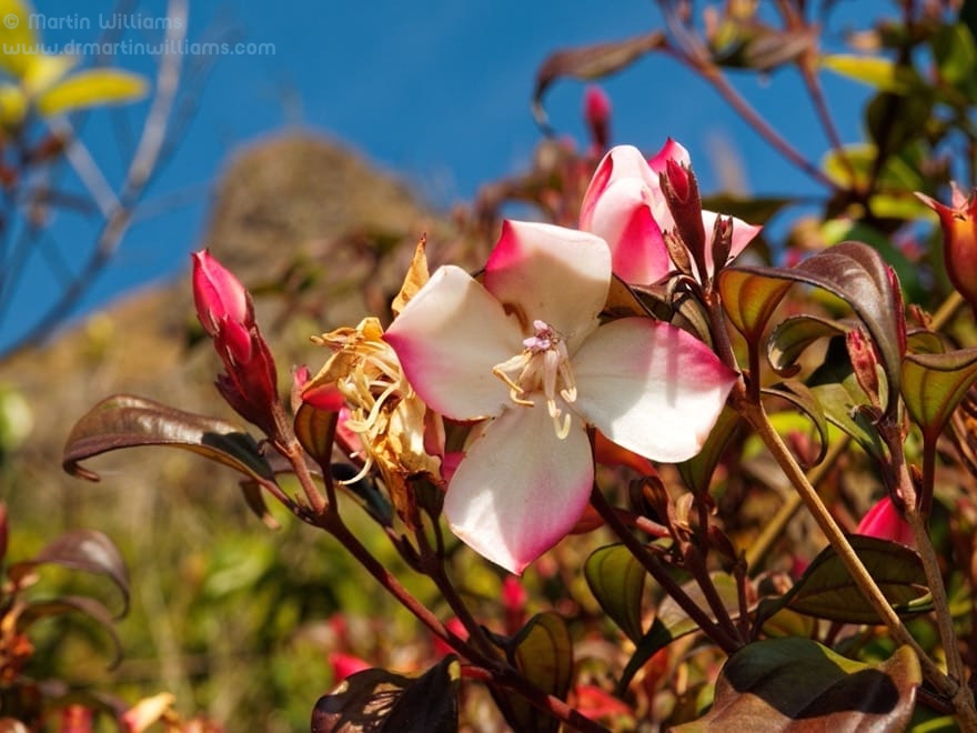
Rhododendrons (azaleas) are perhaps the most notable plants of Ma On Shan. All six species that are native to Hong Kong are found here, with their gorgeous blooms enlivening the slopes in spring. There are orchids, too, though finding the best of them might require searching treacherously steep slopes.
Natural Pyramid
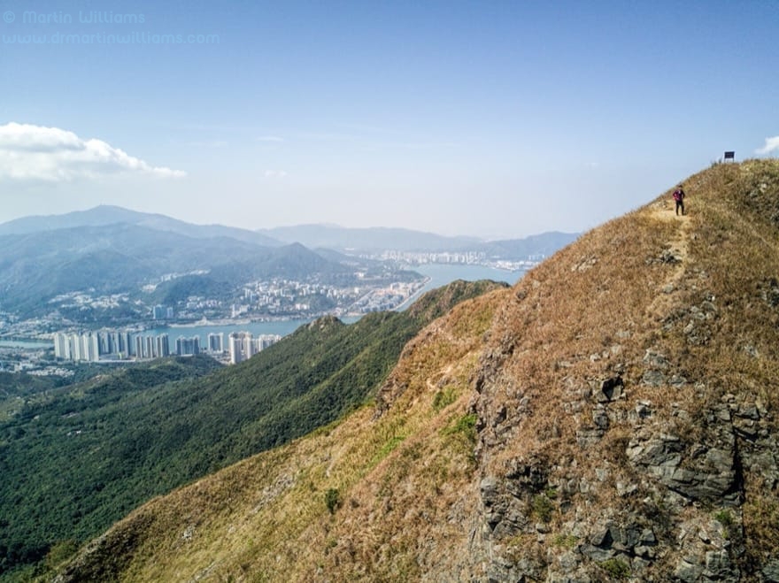
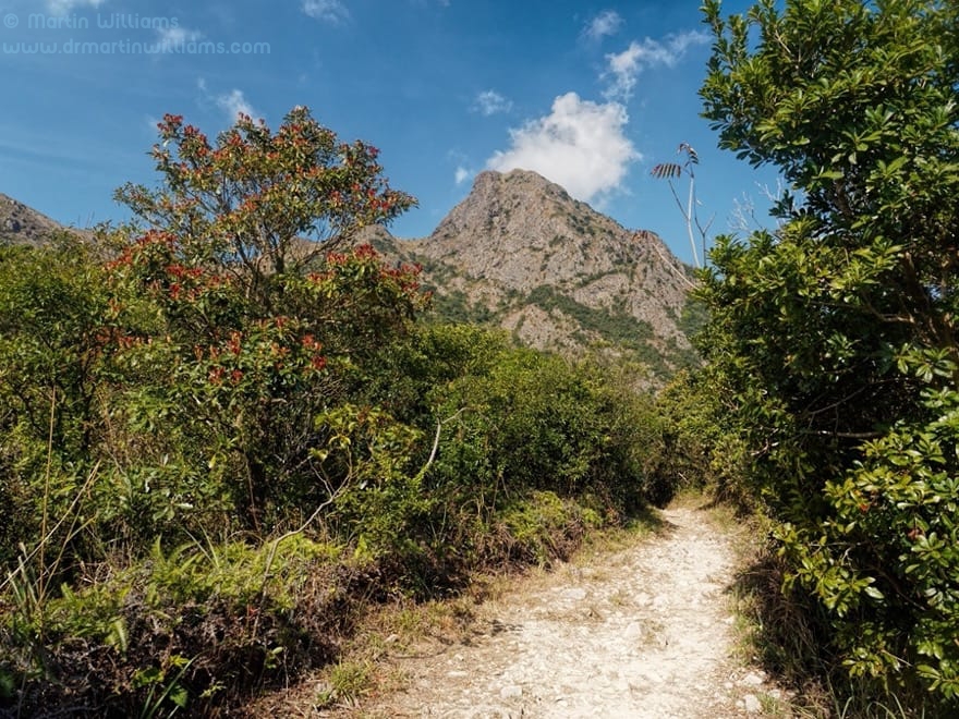
The trail from the col is almost level at first, skirting a hillside before dropping to a ridge with expansive views over Sai Kung to Port Shelter islands and High Island Reservoir. Then, down again.

On the right is a small spur topped by a cluster of boulders. To geologists like the authors of Hong Kong Landscapes, this is a tor, and the boulders are made of rhyolite, formed from thick, slow flowing lava that was erupted from volcanoes around 141 million years ago. While to most hikers, this is simply a fine place to stop, rest and soak in the scenery.
Pyramid Hill is close by, named for its triangular profile. A trail to the top may seem tempting, but be warned that it’s steep, the views are little different, and the trail on the other side is steeper still. So the wiser choice is to stick to the Maclehose Trail, which soon arrives at Ngong Ping.
Back to the Madding Crowds
Like its namesake on Lantau, Ngong Ping is an upland plateau. But here, there are no large buildings, roads or phoney “village” – just a rolling land of grassy areas and woods. Some people come to picnic, fly kites, or launch themselves into the air, paragliding. The Maclehose Trail continues westward, but it’s a long way till the next place with public transport.
So you may prefer to take an easier route back to urban areas, maybe northwards past the former iron mine to the fringe of Ma On Shan town, or south and down to Tai Shui Tseng near Sai Kung.