
Head into the hills from near Tai Po Market, taking a narrow road from the fringe of the industrial estate, and it’s almost as if you’re leaving 21st century Hong Kong behind. The road climbs through woodland, curls to the right to cross the crest of a ridge, then dips into a basin ringed by hills. This is Shalotung: a tranquil place, with old village houses – many of them crumbling to ruins; plus streams fringed by woodland, and marshy patches where there were once paddyfields.
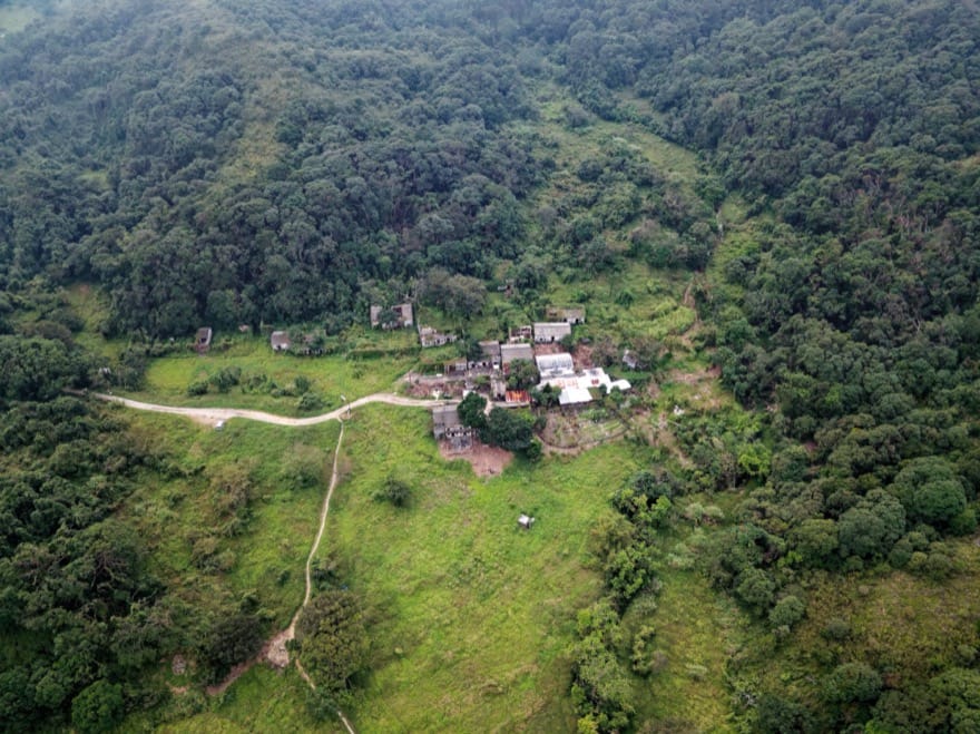
Shalotung is among the gems of the Hong Kong countryside, and makes for a wonderful easy outing, with opportunities for longer hikes if you wish. Yet it could have looked very different, had the plans of a would-be developer been realised.
This year marks the 40th anniversary of the Shalotung Development Company buying up villagers’ rights to land here – which led to decades of wrangling over a variety of plans for profiteering from golf courses, luxury housing and even a columbarium, while conservationists strived to safeguard Shalotung and its rich wildlife. Now, its future as a natural haven at last seems assured.
The road ends beside a stream, and from here you can explore by following a dirt track. Just across a bridge over the stream, there’s a junction with an old footpath on the right. This must have been well used when Shalotung was thriving, but became overgrown in the years since. But it had been partly cleared of grass and shrubs by December, affording a chance to follow the stream to an abandoned hamlet, Lei Uk.
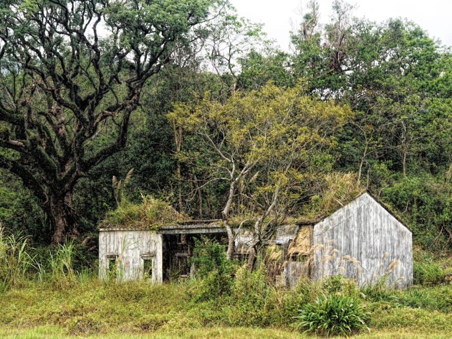
This is typical of traditional hamlets in Hong Kong – a row of about ten narrow, two-storey houses on a terrace facing the stream and former paddyfields, with a wooded hillside behind. Little remains of the houses but their solidly built brick walls. The roofs have collapsed, and gaping doorways reveal plants and small trees growing in former living rooms.
Past Lei Uk, the path drops down and skirts the eastern fringe of the former paddyfields, and arrives at a smaller cluster of ruined houses. There’s also an ancestor hall that is still well maintained, with tile roof intact, recently burnt incense sticks in a small bowl by the red-painted door.
On from here, the path soon fizzles out, so it seems best to return part of the way to Lei Uk, then turn onto a stony track up a gentle slope that’s roughly in the middle of the basin. This leads through an area of mostly cleared land, perhaps the area of a couple of football fields.
If this land could talk, it might tell of being affected by Shalotung’s changing fortunes through the years. After farming halted by the 1980s, with most villagers leaving for a life in the city or overseas, it became overgrown with rank grass and trees. Villagers had headed elsewhere partly as many had sold their land rights to the Shalotung Development Company, which dangled further enticements by promising more money once it built a golf course plus luxury housing across much of the undulating basin.
The company’s plan received official support, including approval from the Country Parks Authority in 1990. But green groups vehemently objected, arguing Shalotung was a special place for nature and the golf course would restrict public access, and there was even a complaint of maladministration, which was upheld, quashing the original plan. Some former villagers expressed outrage, and announced they would return to restart farming. A couple of bulldozers arrived, ostensibly to clear land for this purpose, but only crashed and rampaged through grass and trees on this central slope. No farming ensued.
There was more land clearing in 2015 and 2016, by villagers who planted rapeseed. Though the areas of yellow flowers attracted local photographers, they were of no value to local wildlife.
In mid-2017, the government arranged for a land swap, with the developer gaining rights to land at the Shuen Wan Restored Landfill, east of Tai Po Market, in return for surrendering its land at Shalotung to the government. Before the exchange is implemented, perhaps in 2020, ngo Green Power has begun implementing a two-year management plan aimed at restoring ecosystems including the wetlands. This has led to some more bulldozing on the central slope – mainly to remove trees damaged by Typhoon Mangkhut last September.
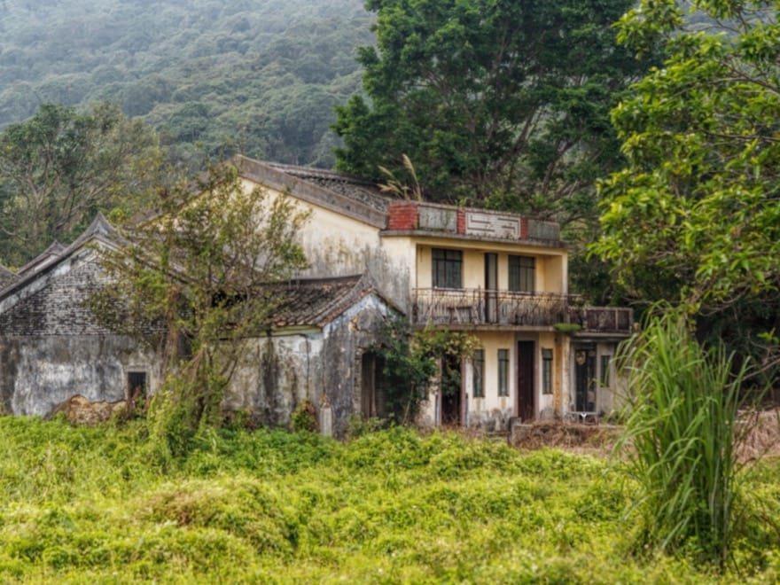
Sadly, the plan does not include the village houses, which in 2009 the Antiquities and Monuments Office classed as Grade II Historic Buildings, ie “of special merit”. You can find the main cluster of these at Cheung Uk, less than ten minutes’ walk north of the sloping land.
Rather than a terrace, Cheung Uk is a cluster of houses, arranged very roughly in a grid. There might be 15 or more buildings here, some of which are ruins almost swamped by greenery. One is well maintained, and hosts a simple cafe serving hikers and other visitors.
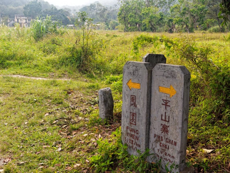
From Cheung Uk, there’s a slender footpath leading east across scrubland, to a junction where stone signposts indicate paths to Hok Tau, and Ping Shan Chai.
The Ping Shan Chai route climbs a ridge, then descends into a neighbouring valley. This seems a wild, remote place, with the steep slopes of the Pat Sin Leng range rising to the north. At Ping Shan Chai, little remains of a former hamlet except a few crumbled ruins within a wood of grand old trees. There’s a splendid stream, flowing swiftly through the shady glen, which is a fine place to linger. A trail from here follows the valley’s northern side, down to Hok Tau Reservoir.
As the signposts indicate, you can reach this reservoir more quickly by taking the trail to Hok Tau. But don’t rush. First, you cross a tree-lined stream, where you might look for some of the creatures that help make Shalotung a standout haven for Hong Kong nature. In winter, you have a strong chance of finding Hong Kong newts – lizard-like amphibians that breed at this time of year.
When it’s warmer, there are dragonflies. Shalotung is among Hong Kong’s prime sites for dragonflies, with 76 species, one of which was new to science when it was first discovered here. Their diversity was an important consideration in decisions to safeguard Shalotung.
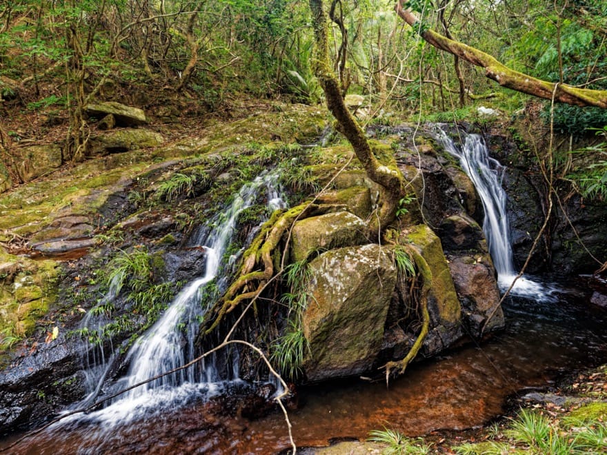
Past the crossing, the path runs through a small gorge carved by the stream exiting Shalotung. It’s an easy walk, partly along an old boulder trackway of the kind that linked local villages in the days before modern roads. There’s a picturesque waterfall below the trail, though you have to scramble down a steep slope for close up views.
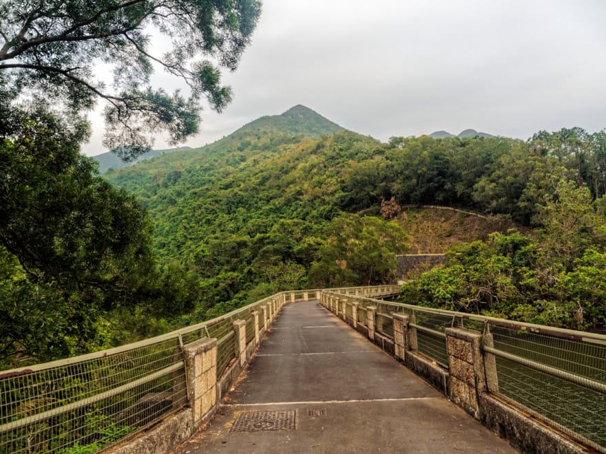
The trail arrives near the slender Hok Tau Reservoir, which was built to help irrigate farmland below. An easy, 2.5 kilometre family trail leads around this trail, and there’s a junction where you could keep straight on or take a right turn to reach the dam.
The right turn is perhaps best, especially as the path this way drops to a bridge over the stream, beside a pool and a cascade amidst the trees. The reservoir itself isn’t so attractive – it’s barely 90 metres across at the widest part, though a look at the dam’s outer wall shows the water is tens of metres deep.
From the dam, a road leads downhill towards Hok Tau village.
Getting there
The road to Shalotung starts at an inconspicuous junction with Ting Kok Road, around 2 kilometres from Tai Po Market MTR Station. You might head there by taxi – and perhaps ask if the driver is willing to take you up to Shalotung as well, or by bus 74K or 76K from the station. From Hok Tau Reservoir, walk down to the junction to the side road to Hok Tau village, and follow this to find the stop for minibus 52B to Fanling MTR Station.