Support this site; gifts or treat yourself:

Port Island – Chek Chau – and its Ruddy Rocks
Port Island lies at the mouth of Tolo Channel. Its Chinese name, Chek Chau, means Red [Ruddy?] Island, after the mainly reddish hued rocks. These reddish rocks are sedimentary, and though just 1 kilometre long, and rising to 131 metres, Port Island is one of the few sites in Hong Kong with rocks formed after Hong Kong’s volcanoes became extinct.
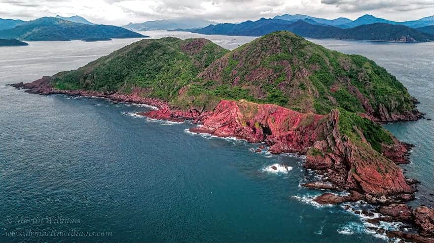
The steep slopes of the island’s west coast – seen from ferries and excursion boats heading out from Tolo Harbour – are formed partly of grey tuffs that belong to the same formation as tuffs east of Lai Chi Chong and around Long Harbour. Radioactive dating indicates they are around 142 million years old – from almost the end of the Jurassic period.
A major fault – the Chek Chau Fault – lies just to the west of Port Island, and runs southeast–northwest, taking it through the islands of Double Haven. The northeast side of this moved down relative to the southwest, forming a basin across what is now Mirs Bay. After Hong Kong’s volcanoes fell silent in the Early Cretaceous, rivers poured sediments into the basin, creating a rock formation that is only exposed here on Port Island and three smaller islands – Round Island, Channel Rock and Shek Nga Chau, yet is thought to underlie much of Mirs Bay, and has been estimated to be 1200 metres thick.
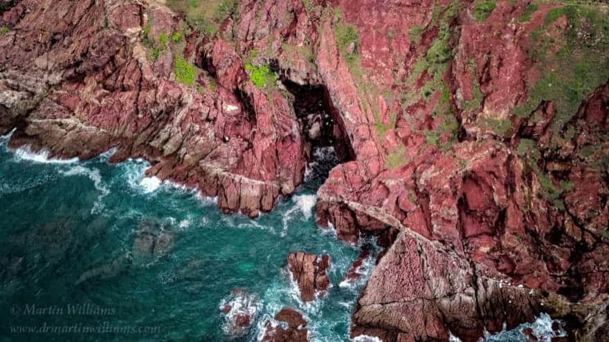
There are sea caves along the east coast. The largest is Chek Chau Cave, which is 10 metres high, 8 metres wide and 20 metres deep.
Sediments from Rivers Crossing a Desert Plain
At Port Island, the sedimentary rock layers dip gently towards the east – and this has greatly influenced the island’s profile, with steeper slopes to the west, somewhat gentler slopes to the east. There are also cliffs and crags.
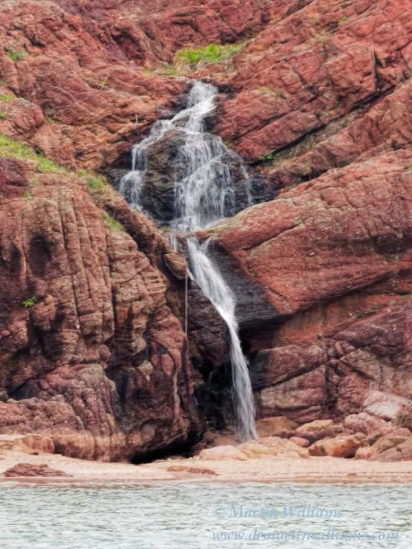
Rather than being simply in uniform bands, the mudstones, siltstones and conglomerates of Port Island are often in thick lenses, with cross bedding caused by water currents. These lenses formed as sediments accumulated in river channels that were up to six metres deep. There are also some thinner, more extensive bands of rock, which resulted from flash floods surging across a plain.
As the thickness of the deposits reveals, the former volcanoes were readily eroded. The reddish hues, resulting from iron oxides, coupled with rocks formed of sediments that had dried out, reveal that conditions here were mostly arid, almost desert like. Though no fossils have been found here, the rocks have been correlated with red beds in nearby Guangdong, where fossils include dinosaur eggs.
Even on its somewhat gentler eastern side, Port Island is roughly hewn, with no inhabitants, tough terrain, and only few possible landing places for visitors. In places, great chunks of rock have broken away from the upper layers of rock, and crashed down to the coast. Erosion has resulted in features that have been given names such as “Dog’s Head”, “Lost City” and “Cobra Climbing the Hill”.
Hard and Soft Corals
Port Island is one of Hong Kong’s best dive sites, though divers must take care with potentially dangerous currents. Soft corals are plentiful, and there are communities of hard corals, dominated by massive corals in the family Faviidae, such as brain corals Platygyra spp. and honeycomb corals Favia and Favites spp.


