The Chi Ma Wan Country Trail loops within the Chi Ma Wan Peninsula, southeast Lantau.
According to trail info from the AFCD, walking the full circuit could take around 8hrs. Add time needed to reach the start and end point – around 30 minutes walk from Pui O, and it would make for a long day out. But you can only cover sections of the route, and perhaps join/leave part way along by taking a sampan from Cheung Chau, or a ferry to Chi Ma Wan pier.
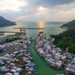
Sampan to Tai Long Wan
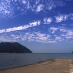
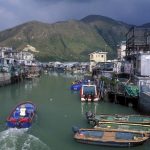
There are invariably sampans (water taxis) waiting at Cheung Chau public pier. Ask here, and you should be able to hire one to Tai Long Wan, at the southern tip of Chi Ma Wan Peninsula. Cost may be around HK$100.
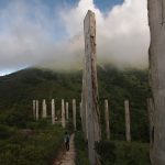
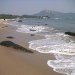
At Tai Long Wan, there’s a fine, relatively secluded beach – a good place to visit in itself. Concrete paths lead inland, to a hamlet beside fields where organic vegetables are grown. Pass the east of the village, and there’s a concrete path leading past ruined houses, and up the side of a small valley. It may be a little overgrown, but is still used and readily followed. There’s pleasant woodland – with wildlife including, on one late April visit, many day-flying moths.
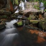
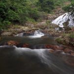
The stream that carved the valley is mostly out of sight amidst the foliage, but there’s one place with a view of a cascade plunging through the trees. The path climbs to a small, level clearing, with fields that have become overgrown.
Onwards and upwards – to Lung Mei, and the path from Tai Long Wan meets the country trail. Turn left here, and the trail heads west, dropping to near Yi Long Wan, and Sea Ranch (where a development failed to become popular, and remains a tiny Discovery Bay wannabe) – before turning and heading north to Chi Ma Wan Road.
Rock Wonder
Also from Lung Mei, you could continue straight on – northwards – and descend to Shap Long Irrigation Reservoir. Or, for a more leisurely route to the reservoir, turn right along the country trail.
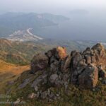
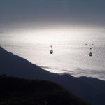
Though the country trail gets a difficult rating from AFCD, it’s easy going here, roughly following contours around a hill in southeastern Chi Ma Wan Peninsula. At first, it aims southward, and in places there are fine views across Tai Long Wan, and to nearby Shek Kwu Chau.
The trail makes an abrupt turn, and crosses a scrubby hillside strewn with big granite boulders – the area billed as “Rock Wonder”. Cheung Chau comes into view, little more than a stone’s throw across the Adamasta Channel.
On round the hill, and the country trail turns northwest, then southwest. Again, there are views to the sea, this time dotted with the small platforms of fish farms. There’s another trail junction, with a left turn to nearby Lung Mei, and the country trail continuing straight on, soon following a narrow track that leads down to the reservoir.
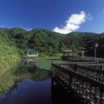
Shap Long Reservoir and Lo Yan Shan
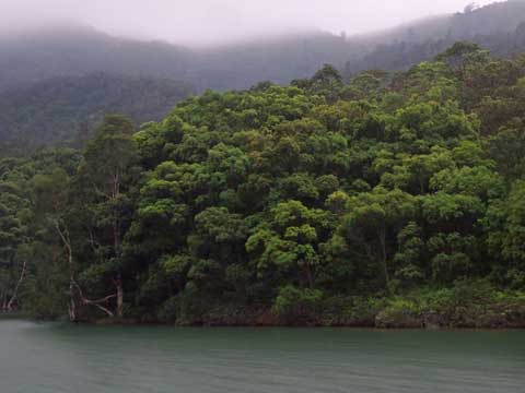
The country trail crosses the dam of Shap Long Irrigation Reservoir – which is small and narrow, set in a wooded valley.
This is a good place for joining or leaving the trail, as Chi Ma Wan ferry pier is nearby. Ferries run to Cheung Chau, Mui Wo and Peng Chau, though note they are infrequent: inter islands timetable.
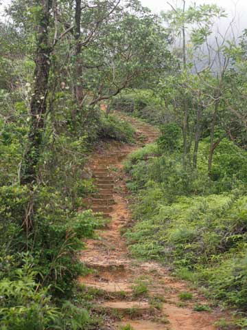
The country trail north of the dam climbs rock steps, is almost level as it skirts the shore of the reservoir, and then climbs the undulating flanks of Lo Yan Shan.
 There’s a mix of scrubland and secondary woodland alongside the trail. They’re not ideal wildlife habitats, with tree diversity appearing low, yet an early May walk here was good for wildlife, including changeable lizard, butterflies, moths – and stick insects remarkably common, with at least 10 seen by the path.
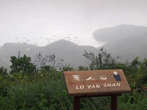
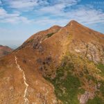
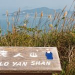
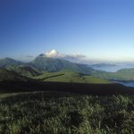
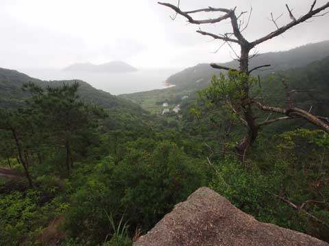
The trail ascends to a ridge with low trees, and then on to the top of Lo Yan Shan (Old Man Mountain), where there’s a small fire lookout hut, and a grassy area that’s a fine place to rest and enjoy the scenery.
Though this is the highest point along the Chi Ma Wan Country Trail, it is not all downhill from here. Instead, the trail drops down a fairly steep flight of steps, then climbs again, to reach another, wilder hilltop.
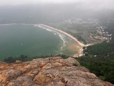
Here there’s exposed granite above west facing crags and cliffs. Pui O beach is below; and beyond, the hills and south coast of Lantau.
Now it’s all downhill – and mostly dropping down steep flights of irregular steps, towards Chi Ma Wan Road. Just before the road, there’s a track to the right, where a stream by a campsite is great for cooling off on a hot day.
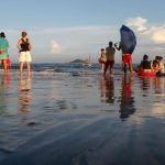
Pui O lies nearby, along the road. There are small restaurants in the village; and if it’s been a hot walk over the hills, the beach here is wonderful for a swim – and a shower – before heading for home.