Nei Lak Shan Country Trail circuits Nei Lak Shan, above Ngong Ping and the Big Buddha.
Nei Lak Shan Country Trail circuits Nei Lak Shan, above Ngong Ping and the Big Buddha.
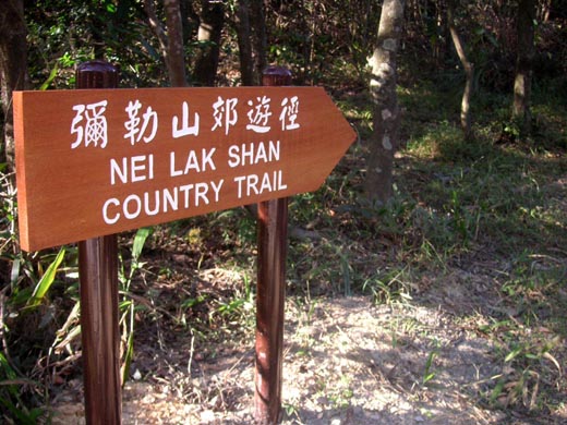
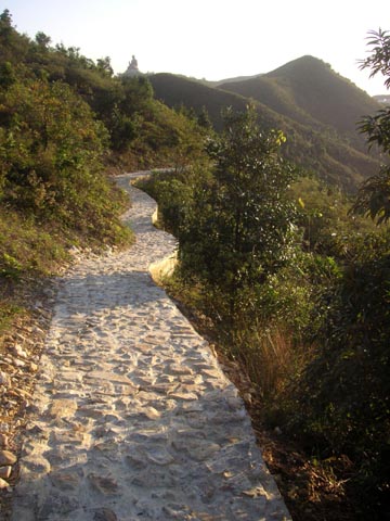
There’s a new trail starting at Ngong Ping, Lantau Island. The 5-km Nei Lak Shan Country Trail circles round Nei Lak Shan, which at 751 metres is the sixth highest peak in Hong Kong. You can start on the trail in northeast Ngong Ping – just where a trail starts dropping down towards Tung Chung.
The trail is clearly marked by this signpost, from which you climb a little; then reach a junction, where you can choose to walk a full circuit, or walk to near the Lantau Skyrail station, looping along the southern slope of the mountain or (longer) heading along the north slopes.
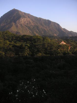
I walked the southern slope in spring: pleasant, with grand views over Ngong Ping including the Big Buddha. Just tried the northern loop, which though longer is more interesting, with views over hills, Tung Chung, the airport and channel across to Tsuen Wan. Passes through woods, and close enough to the Lantau Skyrail that can hear babble from cable cars passing above.
Around the North Slopes of Nei Lak Shan
The trail around the north slope is fairly narrow in places; sometimes looks very new, in other parts looks older – so maybe some was recently cut, in other parts follows old village trails (?).
Soon after the junction, rounded a corner, and expansive views below, with Tung Chung high-rises (not nice), the airport, and Tung Chung Bay (yet to be destroyed by government hell-bent on adding yet more concrete to the coastline here). Could just see skyrail cable cars passing over Tung Chung Bay.
When I arrived in late 1980s, there was stil farming in the Tung Chung valley – but although this had been spared major development, so far, the fields now looked abandoned, overgrown. Left alone, maybe could become great wildlife habitat…
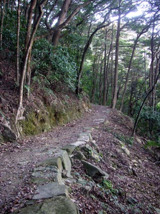
There were grassy slopes, as I’d expected. But also, the trail passed through some good woodland.
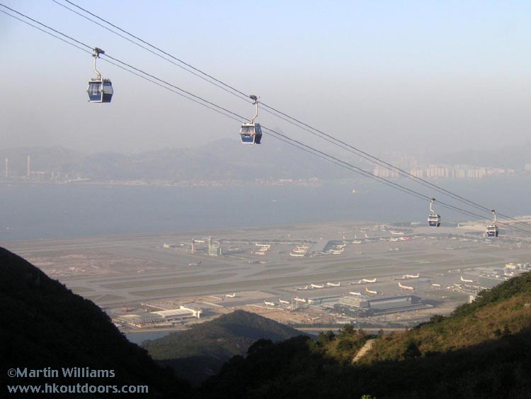
Though on a map near the start, the trail appears to follow contours much of the way, in practice there were more ups and downs than the map indicated: nothing straining, but it wasn’t real smooth. There was a short uphill section, as turned towards western slope of Nei Lak Shan; and came close to the skyrail – looking down, saw cable cars against the airport, and smog – albeit not heavy smog, after some rains and arrival of brisk northeasterly monsoon.
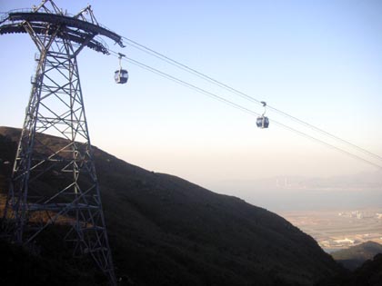
Don’t let anyone fool you that this Skyrail is akin to real eco-tourism: here, get some idea of how massive the pylons are: a major impact on the landscape.
Especially here, at gap between hills, can really imagine powerful winds sweeping up north slopes of Lantau, and shaking the cable cars about.
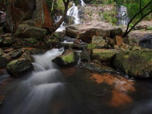
The trail turned to follow head of a small valley; on right, a stream tumbled away, turning westwards and down, in general direction of Tai O. Ahead, could see the Big Buddha.
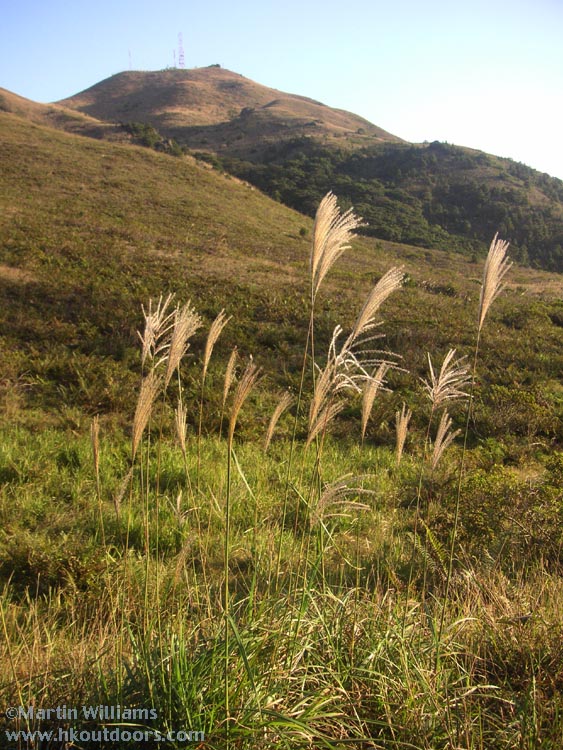
Dry winter grass; and Nei Lak Shan – complete with communications thingy on top.
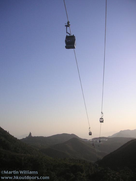
The cable cars went right over the trail at one part. Instead of peace of the countryside, could hear people talking in the cars, albeit couldn’t distinguish words.
Almost at the end of the trail (by this stage, have passed junction with country trail section along the southern slope, and so not really on the country trail any more. Even so, a good trail, leading to very near the Ngong Ping 360 station.
Turned left just before the station; walked a little along the outside of the Ngong Ping 360 Village thing. Soon found an entrance to the village.
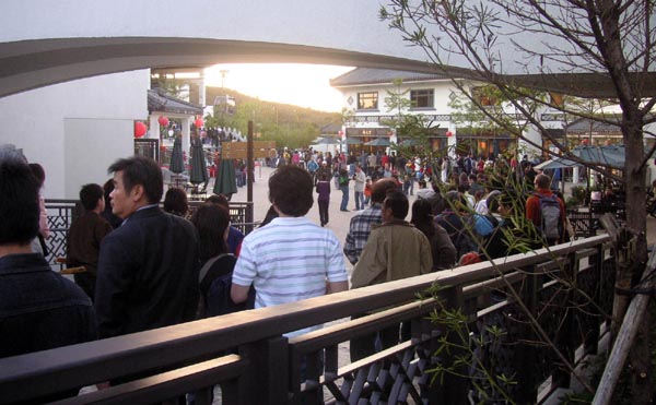
There were lots of Ngong Ping 360 Village people. Though not a single villagers – for this is no village in any real sense. Not even modelled on any Hong Kong village – which I think is both sad and insulting. People here in queue for Skyrail down. The shops and restaurants were mostly quiet – but then, seemed to me an ill-judged mix: a restaurant with “gourmet” food, fancy shop devoted to tea, other fancy shops with Chinese statues, or jewellery, and so on. Surely not at all what the average punter coming to Ngong Ping is looking for. A shop specialising in bird’s nest soup showed there was no intention to make this a sustainable tourism project: no surprise I reckon, after all, Tourism Commission involved.
A Starbucks was doing ok trade, though. And we found a Seven-Eleven: just HK$7 for two cups of coffee (not great coffee, but never mind after a hike).
While just outside the “village”, a proper – local – village shop was selling a variety of cheap souvenirs etc, including colourful windmills that were popular with kids (bought one for my lad).
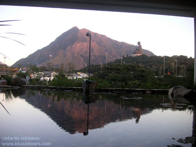
From just outside the Skyrail station, took this shot of Lantau Peak and Big Buddha, reflected in small pool.
The Ngong Ping 360 may be a mess – with the rather horrible village, the skyrail and its monstrous pylons (and of course the giant sticks with graffiti – aka the Stupidity, oops Wisdom Trail). Yet there is still natural beauty and grandeur here, with stately peaks that will outlast human silliness.
Around the South Slopes of Nei Lak Shan
The trail around the southern slope of Nei Lak Shan is easier and shorter. Affords some fine views over Ngong Ping, including to the Big Buddha.