Support this site; gifts or treat yourself:

Hong Kong Typhoons including Calamitous Storm Surges
Typhoons have sometimes caused massive damage and loss of life in Hong Kong.
Just months after British sovereignty over Hong Kong Island was first declared in 1841, “a violent typhoon flattened all the insubstantial housing and damaged shipping.” (Endacott, A History of Hong Kong.) (For a little info on how typhoons form, and Hong Kong’s typhoon signals, see my article Hong Kong tropical cyclones.)
Here’s brief information on some of the typhoons that have impacted Hong Kong to varying degrees. It’s worth noting that for the main impact – including with southerly components to winds that may drive storm surge, the eye should pass over or south of Hong Kong. If a typhoon makes landfall to the east, it should weaken before the centre perhaps passes just to the north , and the southerly winds will be less intense, with far less potential for storm surge; see With Super Typhoons Near Hong Kong, Small Variations in Tracks Mean Huge Differences in Impacts. “Classic” tracks for damaging typhoons in Hong Kong start over the west Pacific, then pass through the strait between Luzon and Taiwan – with no landfall that could cause any weakening.
The 1874 Typhoon: devastation of Pearl River Delta including Hong Kong
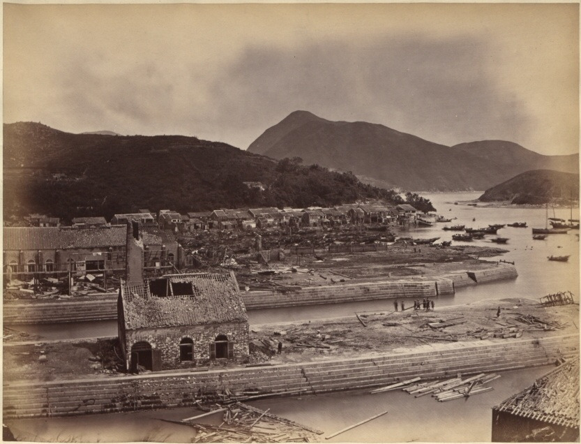
One of Hong Kong’s worst typhoons struck in 1874; according to an eyewitness, Eitel, in Europe in China (1895):
“the town looked as if it had undergone a terrific bombardment. Rows of houses were unroofed, hundreds of European and Chinese dwellings were in ruins, large trees were torn out by their roots … in every direction dead bodies were seen floating about or scattered among the ruins … thirty-five foreign vessels, trusting in their anchors, were wrecked or badly injured.”
Welsh, A History of Hong Kong.
The typhoon made news around the world – but not instantly as today. According to one account:
The Praya [former waterfront promenade; Des Voeux Road is now along at least part of the Praya] is demolished, the embankment having been washed away so far as to undermine the fronts of many of the buildings, the face walls of which fell ; and the waves washed up to within a few feet of the Queen’s Road.
The Straits Times, 3 October 1874
An account in the Hong Kong Press later appeared in the New York Times; it included:
The barometer kept rapidly falling, and the wind increased frightfully in violence, raging and howling at first, and after a time sounding like one continued peal of musketry, breken at intervals by artillery, as sudden and. more violent gusts swept through the harbor and over the lanes At times, even above the fierce bowling of the wind could be heard the pitiful cries or thousands vainly battling with the storm. Not a single ship in port escaped undamaged, and the casual ties and loss of life—the latter estimated at over 2,000 souls, have exceeded anything which has ever before been upon record.
The city, after the occurrence, presented the appearance of a town ‘which had been besieged. In all directions were roofless and shattered houses, crambling walls, naked poles and rafters standing out gloomily against the leaden sky. The roadswere strewn right and left with debris, wreck of boats and trees, some of gigantic size, torn up by the roots. The telegraph on the island, and the marine telegraph between Hong Kong, and Saigon wore interrupted, the gas-pipes were torn rip, dead bodies in all directions washed ashore.
The tide was exceptionally high, and to the eastward a great deal of injury both to life and property was caused by the height of the water, which on the plain at East Point was, on an average, about four feet high.
Typhoon at Hong Kong: Great Destruction of Life and Property
This article included an eyewitness account:
“I had been out dining with a friend and started to return home at a little after 11. It was then blowing very hard. but neither I nor any of my companion had any idea of the severity to which the gale was destined to reach. I accordingly went with a companion to the Prays to see the sight, and certainly never witnessed anything so striking in my life. Although I have seen many typhoons during a stay of over fourteen years in Hong Kong, I do not know of any which has caused so much injury to the colony and so much loss of life. By the time we arrived at the Praya, the wind had freshened rapidly, and the typhoon was raging with full vigor. The sea was breaking over the Praya with terrific force, while the roar was deafening.
“The waves broke briefly, with phosphoresent light, and presented a striking and awful sight. The lights on shore flickered through the darkness and seemed only to render it the more intense. Gradually the swell increased and the waves rushed first half across the Praya snd afterward quite across it, and before I had reached Pustan’s wharf, towards I was going westward, they were more than acros the Praya, and I had to push my way knee-deep in water. Clinging to such projections from the houses as were within my reach I endeavored to continue on my course, but soon found that it was too dangerous to persevere as the waves were coming in with such force that there was every chance of being washed away, while tiles and bricks were falling in all directions from the shaken housees. It was 1 o’clock when I was thus forced to beat a retreat, and I may mention that up to that time none of the sad casualties which have been recorded had occurred; and as the gale began to moderate by 3 o’clock, it is evident that the havec must have been the work of little more than two hours.”
There was no proper death toll; perhaps 2000-10,000 people were killed in Hong Kong; this storm helped spur the establishment of Hong Kong Observatory.
The typhoon also caused major damage and deaths elsewhere in the Pearl River area:
The AD 1874 typhoon caused sea level to rise by ca. 5 m, the flooding of 10 counties covering about 20,000 km2 and a death toll of ca. 10,000.
RECONSTRUCTION OF AN 8,000-YEAR RECORD OF TYPHOONS IN THE PEARL RIVER ESTUARY, CHINA
Macau was devastated by the typhoon, with around 5000 people killed; as noted in a recent paper that drew on various sources to analyse the storm. This indicated that the storm had arrived from the east, probably after passing through the strait between Luzon and Taiwan – a typical track for the most severe typhoons impacting Hong Kong. Also:
The results show that both the maximum storm tide (4.88 m above Hong Kong Chart Datum) and maximum storm surge (2.83 m) brought by Typhoon 1874 at the Victoria Harbour in Hong Kong are higher than all the existing records since the establishment of the Hong Kong Observatory in 1883.
Reconstruction of the track and a simulation of the storm surge associated with the calamitous typhoon affecting the Pearl River Estuary in September 1874
This typhoon was assessed in a paper published in 2020; its abstract includes:
Both the maximum storm tide (4.88 m above the Hong Kong Chart Datum) and maximum storm surge (2.83 m) brought by Typhoon 1874 at the Victoria Harbour estimated in this study are higher than all the existing records since the establishment of the Hong Kong Observatory in 1883, including the recent records set by super typhoon Mangkhut on 16 September 2018.
Reconstruction of the track and a simulation of the storm surge associated with the calamitous typhoon affecting the Pearl River Estuary in September 1874

18 September 1906 Typhoon: 10,000 or more deaths
Another typhoon, also bringing a major storm surge, struck on 18 September 1906, killing 10,000 or more people (a Wikipedia entry gives 15,000), many of them fishermen.
A book on the storm – sadly not readily available – begins:
ON the morning of the 18th September, 1906, Hongkong was visited by a typhoon which, though of short duration, proved to be the most appallingly destructive visitation of the kind that the Colony has ever experienced, not forgetting the historic typhoons of 1844 and 1874.
In the space of two hours enormous damage was done to shipping craft as well as to property ashore, while the number of lives lost in the waters of the Colony will probably never be known. Estimates range from 4,000 to 10,000. The enormous extent of the losses, both to, life and property, is attributable to the fact that, according to the Report of the Meteorological
Observatory, this typhoon ” gave no indication of its existence until close to the Colony,” and consequently no adequate warning of its approach was given by the Observatory.
The Calamitous Typhoon at Hong Kong
There’s also a paper published in 2022, which includes:
Typhoon 1906 was a midget typhoon, with a radius of maximum winds of 11 km or smaller, during its passage through Hong Kong. This explains why it was technically impossible for a forewarning to be given at that time when real-time weather observations from ships, meteorological satellites and radars were non-existent. We also estimate that the maximum storm surges (storm tides) in Hong Kong were not higher than 0.82 m (2.43 mCD) and 1.98 m (4.15 mCD) in Victoria Harbour and Tolo Harbour, respectively.
A historical re-analysis of the calamitous midget typhoon passing through Hong Kong on 18 September 1906 and its storm surge impact to Hong Kong
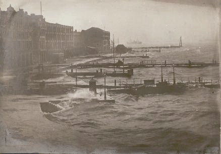
The Devastating Hong Kong Typhoon of 1937: perhaps 11,000 deaths, multiple shipwrecks
Another deadly Hong Kong typhoon slammed the then-colony on 2 September 1937, with the roaring winds pushing a great tidal surge that funnelled up Tolo Harbour, and swamped villages. With the surge arriving in darkness, many people were hit whilst they were sleeping. Perhaps 11,000 people died.
“At the time, Hong Kong harbor was the seventh busiest port in the world. During the height of the typhoon the sea level in the harbor rose about 1.8 m (6 ft) above the predicted level of high tide.”
1937- Great Hong Kong Typhoon
Here is a firsthand account of the typhoon, from a letter by Mr Story, later reproduced in a newspaper:
The signal that a gale was expected from the north-west was hoisted at 3.20 p.m.. and shortly after the liners Corfu and Ranpura. the Italian Conte Verde, and the Gneisenau moved out to take up more sheltered positions in the neighbouring bays, and by 6 p.m. these wharves were deserted. The warships in the harbour – the cruiser Suffolk, two destroyers, and three submarines, remained at buoys in the man o’ war anchorage. Hundreds of junks and fishing craft hurried to the typhoon shelters, and before dark the harbour had almost emptied.
At midnight there was a little rain and a rising wind from the north-west. From 1 a.m. to 2 a.m. its force rapidly increased, and shortly after two bombs were fired, indicating that the full force of the typhoon was shortly to be expected.
The squalls were then of terrific intensity, and, blowing from the north straight on to the seawall, swept huge waves up the streets. At the height of the gale nine four-storey buildings on the seafront were destroyed by fire. The fire brigade reached the scene with the greatest of difficulty.
Fifteen to 20 bodies were picked up by the officers and piled on the road-way ready to be moved to the public mortuary, but huge waves came along and washed all the bodies into the sea. Upwards of 30 lives were lost in this area.
The typhoon had reached its maximum force at 3.30 a.m., and the gusts at this period were beyond the measuring capacity of the Government anemometer, which stuck at 125 m.p.h. [200 km/hr].
Two private unofficial records both showed a maximum wind velocity of 164 m.p.h. [264 km/hr] The barometer fell to the new low record of 28.298 [958mbar], and 5 in. [127mm] of rain were recorded for the night. By 5 o’clock the gale had veered to the east, but showed no signs of abating until after dawn, when it continued to blow from the south-east, and it was still dangerous to be out of doors.
Dawn brought terrible scenes of chaos and destruction. Roads were blocked, lighting and telephones interrupted, and few buildings escaped damage. Householders spent a sleepless night, roofs were blown off or damaged, doors and windows shattered. and the force of the wind and rain had torn great areas of facing from walls, exposing the brick beneath. Many buildings gave the appearance of having been shelled. Trees which were not uprooted were stripped bare of branches.
Typhoon in Hong Kong. Former [South Australian] Man Gives Vivid Account of Night of Terror

For an account of this 1937 typhoon, along with photos mainly of ships blasted aground (with an initial shot with some of the ships on a tranquil day before the storm), see The Great Hong Kong Typhoon – 1937; ships also feature prominently among Photos of 1937 Typhoon; also try video on British Film Institute website: Typhoon Hong Kong September 1937 [restricted to viewing in UK; a VPN may help…]. The Great Hong Kong Typhoon article mentions the tidal surge, which also impacted Victoria Harbour, with the water reaching Des Voeux Road – and says the wind was so strong that small fish were blown, “many yards from the sea on to buildings 90ft above the ground.”
The storm surge was far more severe in Tolo Harbour:
At the narrow Tolo Channel, the storm surge crested into a 30 foot tidal wave that funneled into the bottleneck and practically erased the fishing villages Sha Tin and Tai Po. The low-lying towns were engulged, the squatter dwellings and houses completely destroyed, and the wave washed away nearly a mile of the adjacent Kowloon-Canton railway on its embankment. An estimated 10,900 people lost their lives, a little over 1% of the entire Hong Kong population in 1937. For days after, bodies rising and drifting clogged the harbor. A large number of the people that perished had been living aboard the fishing boats and were drowned when capsized, unable to reach shoreline.
There’s more info, and a lot more photos, on this webpage: The Great Hong Kong Typhoon of 1937.
Typhoon Wanda, 1 September 1962: most powerful Hong Kong typhoon recorded
Hong Kong’s most powerful typhoon on record [given records were sparse for 1874], Wanda, also pushed a tidal wave through Tolo Harbour, but this time residents were forewarned, and though properties were wrecked there was far less loss of life, with 127 fatalities in all. Its arrival on the morning of 1 September 1962 coincided with the forecast 7-foot high tide, and in Tolo Harbour the water level was around ten feet higher than this forecast height, with wind-driven waves pushing the water level another six feet higher (to around 23 feet above “chart datum”) near Sha Tin. The high water mark reached landmarks including Sha Tin railway station – where the water was over the track but below the platform.
About a fifth of the residential huts at Sha Tin were destroyed during Typhoon Wanda, mainly by logs or boats crashing into them. Part of the seawall at Sha Tin collapsed. Fields were inundated with salt water. Damage was widespread, with 72,000 people made homeless; of 132 ocean-going ships, 24 were beached and 12 involved in collisions; many trees were uprooted or snapped off, and even among those that survived, many were stripped of leaves. (I’ve drawn this info from Typhoon Wanda on the Observatory site.)
See also Impact of Typhoon Wanda on shipping in Tolo Harbour.
The maximum 10-minute mean wind speed recorded at the Observatory during Typhoon Wanda was 78 kots (144km [90 miles] per hour), and the maximum gust 140 knots (259km [161 miles] per hour); a maximum gust of 284km (176 miles) per hour was recorded at Tate’s Cairn, on the hills above Kowloon.
For various photos of the aftermath, see Damages and shipwrecks Caused by Typhoon Wanda; and Photos of 1982 Typhoon Wanda.

Wanda arrived during a relatively busy spell for typhoons hitting Hong Kong – the Number 10, hurricane-force wind signal was raised five times during the early 1960s, but only on six occasions since, with only one direct hit by a typhoon in each of the 1980s and 1990s.
Typhoon Ruby, 5 September 1964: at least 16 persons killed, ships ripped from moorings
As described by a newspaper article:
Typhoon Ruby smashed into Hong Kong with killer winds up to 120 miles an hour today, leaving behind a vast toll of dead and injured and extensive property damage. At least 16 persons were killed, 303 were injured and 25 were missing in the storm which dumped at least seven inches of rain on the city in 24 hours and caused considerable flooding. Casualty figures mounted hourly. Ships in the harbor were ripped from their moorings and set adrift. At least two sank from the battering winds and another 10 ran aground. One of the sunken ships was described as a “large vessel.” An additional 120 junks, yachts and “pleasure craft” also were reported to have gone down. Most of those missing were from the sunken ships. Weather bureau officials said the center of Typhoon Ruby passed 20 miles south of Hong Kong and was roaring off towards the coast of Communist China in the area around the Pearl River.
Hong Kong Smashed by Killer Typhoon
Ruby’s arrival was recounted by Hong Kong Observatory:
The first northerly gales were recorded in the Harbour just before noon, while northeasterly winds reached hurricane force at Cape Collinson soon afterwards. At about 2 p.m. the winds almost everywhere in the Colony suddenly changed direction from northeast to south-southeast. At Cape Collinson an hourly mean wind of 86 knots was recorded between 2 p.m. and 3 p.m., and winds did not fall below hurricane force until about 3.30 p.m. At the Royal Observatory winds averaged 60 knots between 1.50 p.m. and 2.00 p.m. with a solitary gust of 122 knots. The lowest pressure occurred as a very sharp minimum of 968.2 millibars at 1.50 p.m. when the centre of the storm was about 15 miles southwest of the Observatory. Radar reports indicated that the eye of the storm was about 20 miles in diameter. Winds at the Observatory decreased slightly at 1.55 p.m., but changed direction and increased again from the south-southeast almost immediately.
Typhoon Ruby
Typhoon Rose, 16-17 August 1971: 110 deaths, ships grounded, property damaged
According to a Hong Kong Observatory account:
Typhoon “Rose” was one of the most intense and violent typhoons that have affected Hong Kong. Maximum wind speeds were only slightly lower than in Typhoon “Ruby” of 1964 and Typhoon “Wanda” of 1962 and they occurred during the night whereas both “Ruby” and “Wanda” passed in daylight.
…
The Increasing Gale or Storm Signal, No. 9, was hoisted at 9.10 p.m. on August 16 when “Rose” was about 50 miles south-southwest of the Royal Observatory and was replaced by the Hurricane Signal, No. 10, at 10.50 p.m. as the eye of the typhoon continued to move northwards at 10 knots. During the night of August 16 – 17, winds of hurricane force were experienced in many places, particularly over the western part of the Colony. The edge of the eye of Typhoon “Rose” passed close to the west of Cheung Chau at about 1.52 a.m. on August 17. The surface wind at Cheung Chau decreased from 66 to below 25 knots in 15 minutes and the sea level pressure fell to 963.2 millibars.
…
Wind-generated waves of about 9.5 metres from trough to crest were registered by the electronic wave-recorder near Waglan lsland at noon on August 16 just before the submerged cable lead was broken by a landslide. However, waves estimated to be 14 metres high were observed by H.M.S. Argonaut about 70 miles north of the typhoon a few hours later. A survey of coastal areas in the west of the Colony showed that the rise of water did not exceed 3 metres,equivalent to a surge of about 1 metre. This is less than would be expected considering the intensity of the typhoon and past records.Tragically, “Rose” was the worst typhoon for fatalities and heavy damage to property in Hong Kong since Typhoon “Wanda” in 1962. In general, heavier damage was reported in the western than in the eastern side of the Colony. Over 30 ocean-going vessels went aground or suffered collision. About 300 small craft, including 100 pleasure craft, were sunk or damaged. Three of the 14 hydrofoils on the Hong Kong – Macau run were severely damaged and a total of 6 Hong Kong & Yaumati ferries went aground while taking shelter in Kowloon Bay. In addition, the “Fat Shan”, a Hong Kong – Macau Ferry, capsized and the ‘Lee Hong’, a laid-up ferry vessel, was sunk. The death toll from Typhoon “Rose” stood at 110 confirmed deaths. Most of the deaths occurred on board the capsized “Fat Shan”.
Typhoon Rose
Silent video of the aftermath of Rose, including ships that had run aground:
There’s another video here: HONG KONG: HIGH DEATH TOLL IN WAKE OF TYPHOON ROSE (1971).
Typhoon Hope, 1979: 12 killed, ship collisions, flooding near Tai Po
Typhoon Hope was the most severe typhoon to affect Hong Kong since Typhoon Rose in 1971. It passed rapidly over the New Territories on 2 August and caused twelve deaths and injured 260 people. Maximum gusts were generally around 100 knots increasing to about 130 knots at elevated sites. Maximum gusts of 130 knots, 123 knots and 111 knots were recorded at Cape D’Aguilar, Tate’s Cairn and Chek Lap Kok respectively. A maximum gust of 108 knots was recorded at Star Ferry Pier, Kowloon. This is the highest gust recorded inside the harbour since Typhoon Rose in 1971.
…
Typhoon Hope caused the highest toll of fatalities since Typhoon Rose in 1971. Twelve people were killed. 260 people were injured of whom 94 were hospitalised. About 2 000 people had to stay in temporary shelters provided by the Government. A total of 53 huts were destroyed and 796 people made homeless.At the height of the typhoon, eleven collisions involving eighteen vessels occurred in the harbour. Nine vessels had their cables parted from buoys and another two went aground. The Greek-registered 10 300-tonne vessel, M.V. ‘Argonaut’, rammed the piers of Star Ferry and went aground alongside the Kowloon Public Pier.
A Panamanian vessel, M.V. ‘New Ming Ren’, ran aground at Tai Lam Chung in the New Territories. The refugee ship, M.V. ‘Huey Fong’, grounded at Tai Tsing Chau northeast of Lantau lsland. The Royal Navy patrol craft ‘Beachampton’ was hit by a drifting 3 500-tonne vessel at its typhoon mooring and suffered damage.
Typhoon Hope
…
A tide gauge at Tai Po Kau indicated that the sea-level rose abruptly from 0.9 metres at 2.30 p.m. to a maximum of 4.3 metres at 4.30 p.m. Serious flooding in Tin Sam Village near Lam Tsuen River in Tai Po caused the death of three persons. Flooding was widespread all over the New Territories, especially in Tai Po Market and Sha Tin. Flooding was also reported in several urban areas.
Video of news footage: HONG KONG: TYPHOON HOPE AFTERMATH (1979).
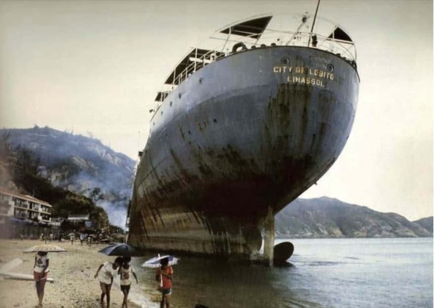
Typhoon Ellen, 9 September 1983: 10 killed, 26 ships ran aground

As an account on the Hong Kong Observatory notes:
Typhoon Ellen was the worst typhoon to strike Hong Kong since Typhoon Hope in 1979. It passed about 7 nautical miles southwest of Fan Lau, the southwestern tip of Lantau lsland. 10 people were killed and 12 were missing. The Hurricane Signal, No. 10, was hoisted for a duration of 8 hours, which was the same as during Typhoon Wanda in 1962. Hurricane force winds lasted for 5 hours at Cheung Chau. This was a longer duration than in Typhoon Wanda in 1962, Typhoon Hope in 1979 or Typhoon Rose in 1971 as a result of Ellen’s track and its relatively slow movement. The highest gust over Hong Kong, 134 knots [248km/hr], was recorded at Stanley. A maximum gust of 128 knots [237km/hr] was recorded at Cheung Chau, which was the highest gust there since 1953. At Waglan lsland, the maximum gust of 122 knots [226km/hr] was the highest since Typhoon Ruby of 1964.
Typhoon Ellen

26 ships ran aground during Typhoon Ellen; they included the City of Lobito, which almost hit beachside apartments on Cheung Chau, and became an unlikely sight on Tung Wan beach. See: The Day a Cargo Ship Washed up on Cheung Chau Beach.
Typhoon York, September 1999: 1 killed, windows blown out of buildings
Trees on north Cheung Chau, lashed by hurricane force winds during Typhoon York
Though I’ve been here since 1987, until 2012 I’d only experienced two direct hits by typhoons – York, in mid-September 1999; and Nuri, in August 2008 (albeit Nuri had weakened to around severe tropical storm as it hit, though winds exceeded hurricane force at Waglan Island).
York tracked relatively slowly across southern Hong Kong, forcing the Number 10 signal to stay up for a record 10 hours. The maximum gust was 234km per hour, at Waglan Island – the strongest gust Waglan has yet recorded. (Waglan also recorded the maximum hourly wind, 151km per hour.)
Though there was one fatality – a windsurfer who went out during the eye, Typhoon York caused relatively little damage: windows were blown out of buildings in Wanchai, fields were flooded, the container port operations severely disrupted.
During Typhoon York, I mainly stayed at my home on Cheung Chau, which offers a fine – though exposed – vantage over the sea to the west. As York approached, I was sheltered from the winds, which roared over the hills and trees behind my place. When the winds were strongest, the air was strewn with leaves ripped from the trees. (The island’s weather station recorded gusts of up to 182km per hour.) It rained, too, with downpours so severe visibility was cut to maybe a hundred metres; the clouds were so thick it was gloomy, street lights were on even mid-morning.
There were non-stop radio reports, mentioning that the eye was passing over southern Hong Kong and, sure enough, the winds moderated, eased, the rain stopped, and the sky brightened. It had been extremely dark under thick storm clouds, but now (late morning) it was like early morning – some birds called and sang. The air was filled with dragonflies – there must have been many thousands of them, surely swept into the storm and carried with it.
During the eye, with the rain over, I had chance to scan for seabirds, but there were only a few Bridled Terns. I went for a short walk; reaching the other side of the hill, facing east, it looked like a dark grey to black wall was in front of Hong Kong Island. This was surely the eye wall, and it looked pretty close, so I headed back home.
Soon, the wind was building again. From breeze, to wind, to strong wind, then hurricane again – I reckoned it took maybe half an hour or so for the full strength winds to return. But the winds had swung, and in anticipation of this I now had typhoon shutters up over the main window (and a kitchen window away from the wind partly open – I’ve heard this can help stop air pressure fluctuating in buildings [air condistioners can get tossed into rooms, windows may be blown out, simply by changing pressure]).
I then lived in an apartment that faced Lantau, which was little more than a stone’s throw away. So, it was odd to hear someone phone in to the radio saying he was on Lantau, and the air was calm; I called in to say the wind would soon strengthen, as the eye wall returned.
Typhoon Nuri, 22 August 2008: arrived as a tropical storm with a calm eye
I took some photos and video footage on this site, including within the eye, during Typhoon Nuri; “only” a tropical storm as it hit Hong Kong, though still caused some damage. And, there was calm here as the eye passed over, as in video I shot:
Typhoon Hagupit, 23-24 September 2008: not close to HK but storm surge in southwest
Typhoon Hagupit passed within around 200km of Hong Kong, and winds mostly peaked at gale to storm force, so the T8 signal was issued but not T9 or T10. Hence, compared to some typhoons, it seemed no big deal – yet there was an impressive damaging storm surge, chiefly impacting Lantau and southern Cheung Chau.

The above image became somewhat iconic, as an intrepid TVB reporter carried on reporting even while deep in waters as storm surge flooded Tai O on the west coast of Lantau. Even weeks/months later, the “high tide” line was obvious in a small museum, around a metre above the ground, which is usually well above the sea.

Tai O was surely fortunate to be sheltered, as waves along the south coast of Lantau and Cheung Chau were evidently destructive. I visited soon afterwards, and saw various damage, including a concrete path pounded to bits on Cheung Chau, and beachfront damage on Lantau including a lifeguard place with the metal door pounded in as if hit by a truck, and perhaps a couple of metres of sand just gone at Tong Fuk.
Here are some of my photos of the damage:


Typhoon Vicente, August 2012
In August 2012, a near miss by Typhoon Vicente led to the Number 10 signal being issued for the first time since Typhoon York:
Typhoon Usagi, September 2013: threatened Hong Kong but made slight northward turn
Typhoon Usagi provided a salutary tale, in how forecasts can indicate severe threats to Hong Kong, but even a small change in a typhoon’s trajectory can greatly affect the outcome. As recounted on Wikipedia:
As Usagi neared to Hong Kong, news and media began rapidly reporting on “the strongest storm in 34 years” [[not so according to a subsequent re-evaluation]] that would hit Hong Kong. However, in the afternoon of September 22, Usagi’s course veered northwest, and Hong Kong was subsequently spared from the impact of Usagi’s eye wall, only being covered by Usagi’s storm area. Usagi made landfall at 130 kilometers (80 miles) to the east-northeast, and continued further northward that expected. Even though Usagi caused a direct hit as it skirted at 80 km north of the Hong Kong Observatory Headquarters, the city faced only faced the strongest storm of the year, with northwest gales affecting many places….
Typhoon Usagi (2013)
Usagi did, however, cause 17 injuries, and a minor storm surge: Super Typhoon Usagi.
Super Typhoon Hato, August 2017: storm surge to south Hong Kong
Hato ranked as the first super typhoon to necessitate the issuance of the Typhoon 8 signal since Hope in 1979, according to Super Typhoon Hato account by Hong Kong Observatory. It passed to the southwest of Hong Kong, bringing a storm surge that was especially severe in Macau.
Some of my photos of Typhoon Hato storm surge damage at Cheung Chau;


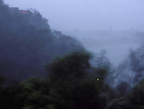
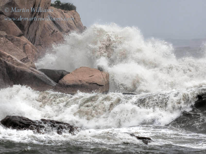
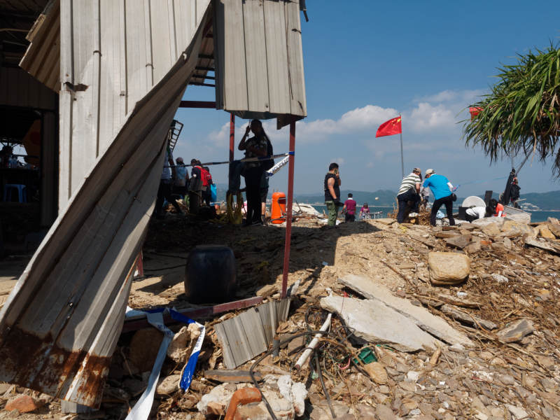
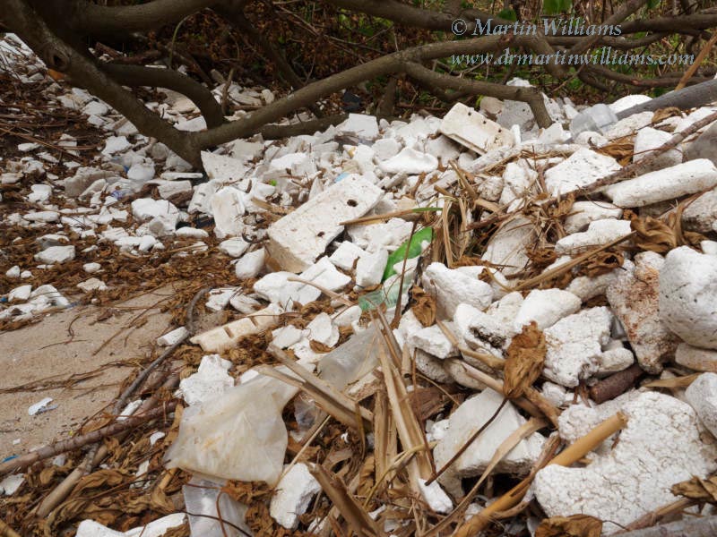
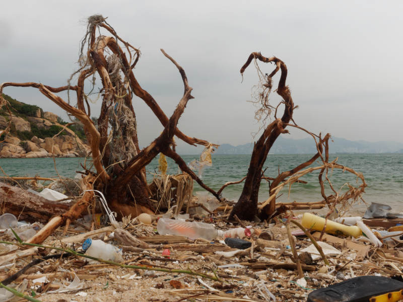
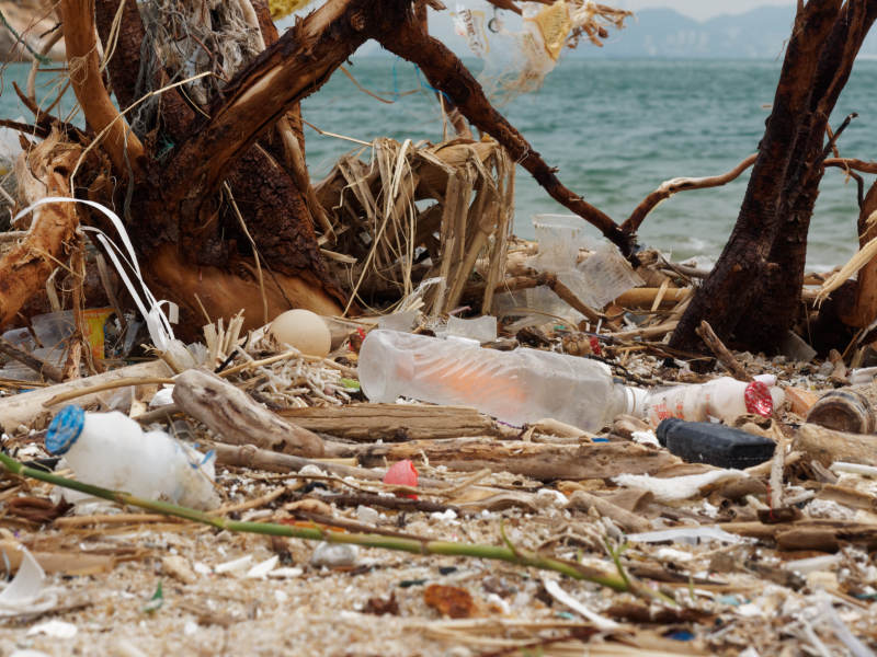
Super Typhoon Mangkhut, 16 September 2018: severe storm surge with coastal damage
Mangkut became a Super Typhoon over the west Pacific; lost a little power as it just hit tip of north Luzon, but was still powerful as the eye passed Hong Kong – with intense winds even away from the centre, causing a destructive storm surge in parts of Hong Kong. Videos included waves smashing into apartment buildings in Heng Fa Chuen, northeast Hong Kong Island – helping make this the most memorable typhoon for most Hong Kong people [many of whom were born after or too young to remember Wanda].

As noted in a report by the Hong Kong Observatory:
The maximum 60-minute mean wind speeds recorded at Waglan Island and Cheung Chau were 161 km/h and 157 km/h respectively. Both are the second highest records at the corresponding stations, just lower than the record high of Ellen in 1983. Gusts over 150 km/h were registered in most parts of the territory on that day and a maximum gust of 256 km/h was recorded at Tate’s Cairn, ranking after Wanda in 1962 and Ruby in 1964.
Super Typhoon Mangkhut
The report also covers the storm surge accompanying Manghkut:
Mangkhut’s track is a typical one causing severe storm surge in Hong Kong. When it skirted past to the south-southwest of Hong Kong, the associated ferocious east to southeasterly winds pushed water towards the shore and piled up against the coast. In addition, Mangkhut’s extensive circulation drove a more extensive area of the ocean which in turn raised the water level further. The severe storm surge induced by Mangkhut raised the water level in Hong Kong generally by more than two metres, resulting in an unusually high water level in many places in Hong Kong. Five of the six tide stations of the Observatory (including Quarry Bay, Tai Po Kau, Tsim Bei Tsui, Tai Miu Wan and Shek Pik) registered record breaking storm surges. Among them, the water level increases recorded at the tide station at Quarry Bay and Tai Po Kau were 2.35 metres and 3.40 metres respectively. As the tide station at Waglan Island was severely damaged by Mangkhut, the highest sea level was not recorded. The sea level (the sum of astronomical tide and storm surge) of Quarry Bay rose to a maximum of 3.88 metres (above Chart Datum, same below), exceeding the 3.57 metres registered during the passage of Hato in 2017, and only lower than the record high of 3.96 metres set by Wanda in 1962. A maximum water level of 4.71 metres was recorded at Tai Po Kau, also only lower than the record high of 5.03 metres set by Wanda….
The destructions caused by the heavy rain, storm surge and high waves induced by Mangkhut are more serious than those of Hato in 2017. Severe inundation triggered by storm surge and huge waves were observed in a number of coastal areas, including Tai O, Shek Pik, Mui Wo, Cheung Chau, Heng Fa Chuen, Siu Sai Wan, South Horizons, Lei Yue Mun, Tseung Kwan O, Sha Tin, Tai Po, Sai Kung, Yuen Long, Lau Fau Shan, Sha Tau Kok, Shek O and Peng Chau. Many coastal structures suffered from different levels of damages, including sewage treatment works, public beaches, waterfront promenades and sports ground. Flooding was serious in Tai O, Lei Yue Mun and Tsang Tai Uk in Shatin and many residents were evacuated. Sea water flowed into the estates and underground car parks in Hung Fa Chuen and Tseung Kwan O south, submerging a number of private vehicles inside. The cycle tracks and subways near Shing Mun River in Shatin, coastal area of Tolo Harbour, Lam Tsuen River in Tai Po were inundated. A number of villages houses in Nam Wai in Sai Kung, Lau Fau Shan, Sam Mun Tsai San Tsuen in Tai Po and San Tsuen in Sha Tau Kok were seriously flooded. Hundreds of vessels of various sizes were stranded, sunk or seriously damaged by the powerful waves. Farmland, fish rafts and fish ponds in all districts suffered different levels of damage.
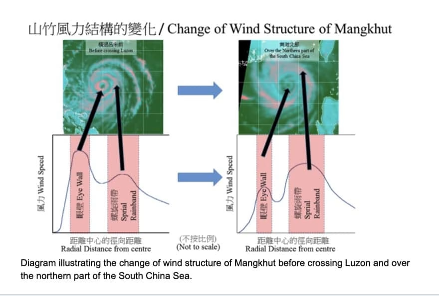
Here, from Hong Kong Observatory – Manghkut’s structure radically changed as it passed over north Luzon. Wind strength decreased, but the strongest winds were further from the eye, affecting Hong Kong as it passed to the south.
See also an article on the Observatory website, A Wake-up Call from Mangkut, which notes: “Mangkhut is indeed a wake-up call for many of us, reminding us the powerful force of nature and the challenges of climate change.”
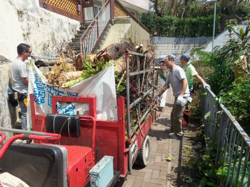
There’s also a paper on the damage caused by Mangkhut, including “There were more than 60,800 reports of fallen trees”: Assessment of the damages and direct economic loss in Hong Kong due to Super Typhoon Mangkhut in 2018.
Here’s a video I shot as Typhoon Mangkhut approached and hit Cheung Chau, along with the aftermath on Cheung Chau:
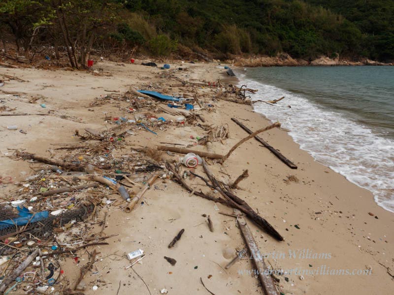
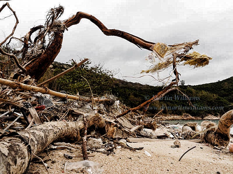
Below are some of my photos from Mangkhut, mainly of its aftermath on Cheung Chau, Middle Island [by Hong Kong Island; see also article I did for the Aberdeen Boat Club magazine: Super Typhoon Mangkhut Mauls Middle Island], and Tung Ping Chau. Notice, say, the size of the concrete blocks tossed around along the road to Cheung Chau helipad; it’s also notable that this happened at relatively low tide, so the surge could have been around a metre higher if it coincided with high tide.


Super Typhoon Saola, 1-2 September 2023: strongest winds in southern HK
Though Saola passed close to Hong Kong, its strongest winds were near the core, and it soon weakened, resulting in less impacts than might be expected for a powerful typhoon making essentially a direct hit on Hong Kong. Also relatively brief periods of the strongest winds. From a report by Hong Kong Observatory:
Many places of the territory were affected by storm force winds at night; whereas southern part of the territory and high ground were persistently battered by hurricane force winds. Saola came closest to Hong Kong at around 9 p.m. when its centre was located at about 40 km to the south-southeast of the Observatory Headquarters…
When Saola passed south of Hong Kong on the night of 1 September, radar imagery depicted that its circulation was rather compact, with the strongest winds concentrating at only about 10-15 kilometers away from the centre.
The storm to hurricane force winds of Saola impacted many places in Hong Kong on 1 – 2 September. Maximum hourly mean winds of 153, 133 and 130 km/h and gusts of 183, 189 and 176 km/h were recorded at Waglan Island, Ngong Ping and Cheung Chau Beach, respectively. During the passage of Saola, the overall wind strength in Hong Kong was similar to that of Hato in 2017, but relatively weaker than that of Mangkhut in 2018.
The storm surge induced by Saola resulted in flooding in some low-lying coastal areas of Hong Kong, including Sha Tin, Tai Po, and Tai O.
Super Typhoon Saola


Video I shot on Cheung Chau:
Typhoon Wipha, 19-20 July 2025: small storm, small impact
Though Wipha led to the T10 signal being issued, for hurricane force winds, it was a relatively small storm, and not too impactful across Hong Kong. Southernmost areas were more affected, including Cheung Chau:
As Wipha came quite close to Hong Kong on 20 July, many places were affected by storm to hurricane force winds during the day. The maximum 60-minute mean wind speeds recorded at Waglan Island and Cheung Chau were 131 km/h and 115 km/h respectively.
The Weather of July 2025
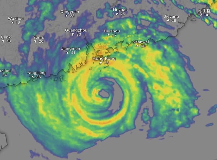
Super Typhoon Ragasa, September 2025 – strong winds and storm surge
Short video by me, of Ragasa impacting Cheung Chau:
Further Info on Hong Kong Typhoons and Tropical Storm Forecasts
For info on several of the major typhoons hitting HK prior to 2005 [when the paper was published], see “Typhoons affecting Hong Kong: case studies” (pdf file). Also see: Impact of historical storm surge in Hong Kong; A Review of Natural Disasters of the Past;
There are several good websites related to forecasting typhoons. The Hong Kong Observatory is an important site when a storm may impact Hong Kong (try real time satellite images and, if a storm is close, check out the radar images; along with storm tracks, and probability forecast maps). The Joint Typhoon Warning Center has info including forecast strengths and tracks that may differ somewhat from the Observatory’s forecasts, along with forecasters’ comments; it’s mainly for the Pacific rather than the South China Sea. CIMSS Tropical Cyclones is also worth checking, especially for several satellite images. The windy smartphone app and website have several forecast products from the ECMWF, GFS and ICON models. Earth Weather from the Hong Kong Observatory shows computer forecasts from ECMWF, the ECMWF AI model, and three other AI models including the Observatory’s Pangu.
Also, see a 2007 paper (pdf) – Recent decline in typhoon activity in the South China Sea. This revealed a significant decline in numbers of typhoons entering the South China Sea; during 1996-2005, typhoons forming over west Pacific showed more tendency to head for Japan and east China than during 1961-1995. The cause may be associated with change in ways tropical storms are steered, in turn perhaps linked to higher temperatures in the South China Sea. Mind you, since the paper was published there have been several storms in the area!
Weather including tropical cyclones
With Super Typhoons Near Hong Kong, Small Variations in Tracks Mean Huge Differences in Impacts
Occasionally, typhoons have caused immense damage and loss of life in Hong Kong; the worst effects…

Widespread Impacts of Super Typhoon Ragasa including Hong Kong: storm surges, fierce winds, tornado
On 18 September 2025, the system that became Super Typhoon Ragasa developed into a tropical depression;…
Super Typhoon Ragasa approaching Hong Kong updates
Even before it really formed, there were forecasts indicating Typhoon Ragasa – as it is now…

Rare November Tropical Cyclones Including Typhoons in Hong Kong
As I write on 13 November 2024, Tropical Cyclone Toraji is set to pass over Hong…

Typhoons and Rainstorms Past Help Hong Kong Forecasts Today
Wetter, Wilder Weather Events Loom with Warming World You may find yourself on a Hong Kong…

“Typhoon to Hong Kong Soon” Makes Great Clickbait
While Hong Kong is sometimes hit by typhoons, predicting them in advance is tricky. Yet this…

Lightning-packed Supercell over Cheung Chau, Hong Kong
Yesterday evening (30 April 2024), weather monitoring imagery showed an intense rainstorm/thunderstorm area – a “supercell”…

Tropical Cyclone Ma-on Headed for Hong Kong
25 August 2022 (evening) update: Ma-on took a track somewhat south and west of earlier forecasts;…

Severe Typhoon Mangkhut highlights perils of massive reclamation by Lantau
Typhoon Mangkhut helped show “storm surge” is a threat to modern cities, not just something for…

Typhoon Jebi a Warning for East Lantau Metropolis aka Lantau Tomorrow Vision
To anyone concerned about plans for Lantau Tomorrow Vision, the clobbering of Kansai by T Jebi…
Mad Lantau Metropolis Plans Should be Scuppered by Storm Surge Threat
A consideration of science suggests the reclamation plans, including for East Lantau Metropolis are foolhardy, even…
As Hong Kong Sizzles the World Keeps Warming
While climate change may have long seemed an issue for hardcore, tree-hugging environmentalists, concerns are spreading.
Typhoon Haiyan Lessons for Hong Kong
Typhoon Haiyan was among the strongest storms on record, and devastated a swathe of the Philippines.…

Forecasters Benefit from Flights into Typhoons
As well as computer models and weather station info, the Hong Kong Observatory is uses flights…
Hong Kong weather outlook warmer wetter wilder
With global warming only just getting started, according to scientists, it’s time for Hong Kong to…

Typhoon Vicente hurricane force winds blast Hong Kong
Severe Typhoon Vicente slammed Hong Kong on 23 and 24 July 2012, with hurricane force winds…

Severe Tropical Storm Pabuk
Severe Tropical Storm Pabuk looked set to have passed Hong Kong, barely causing an impact other…
HK Number 8 Signal
Hong Kong's Number 8 tropical cyclone warning can be controversial.

Hong Kong tropical cyclones
Hong Kong can be impacted by tropical cyclones including and typhoons. Happily, typhoons are scarce near…
Typhoon Update
Actualy the most recent Direct Hit by a typhoon happend 4/5 weeks ago It was not as seviere as Typhoon york.
But still reached Typhoon Signal 9 That one was called Nuri,
And yes it dose hep to open the windows a bit during a typhoon.
Although Iam not sure what would happen to tall buildings above 30-40 floors in hight if a repeate of the 1960’s strorm/Typhoon Hit Hong Kong
As I was not even born when that one hit HK,
Anyway enough about my youth,
I am intrested because I happen to live on the 37th Floor of a Blook of flats in Po lam
Annonomus
Nuri a direct hit
Aha, anonomous, thanks for pointing this out – I should do an update to the article
Nuri’s eye indeed passed right over HK, tho by then it was more a severe tropical storm. Still, powerful winds, and weird in the eye: I took some photos and video footage: Typhoon Nuri.
Tropical Cyclones Myths – Windows Open
Subject: C6) During a hurricane are you supposed to have the windows and doors on the storm side closed and the windows and doors on the lee side open? Contributed by Chris Landsea
No! All of the doors and windows should be closed (and shuttered) throughout the duration of the hurricane. The pressure differences between inside your house and outside in the storm do not build up enough to cause any damaging explosions. (No house is built airtight.) The winds in a hurricane are highly turbulent and an open window or door – even if in the lee side of the house – can be an open target to flying debris. All exterior windows should be boarded up with either wooden or metal shutters.